Opened 14 years ago
Closed 13 years ago
#2426 closed bug (fixed)
On-the-fly projection issues with large extents
| Reported by: | gislab | Owned by: | nobody |
|---|---|---|---|
| Priority: | major: does not work as expected | Milestone: | Version 1.7.0 |
| Component: | Projection Support | Version: | Trunk |
| Keywords: | Cc: | dr | |
| Must Fix for Release: | No | Platform: | All |
| Platform Version: | Awaiting user input: | no |
Description
When I'm trying to project the whole Russian Federation layer, there is some weird behaviour.
- Take sample from http://gis-lab.info/data/vmap0/bounds-correct.7z
- Add new projection (Albers based):
+proj=aea +lat_1=52 +lat_2=64 +lat_0=0 +lon_0=105 +x_0=18500000 +y_0=0 +ellps=krass +units=m +no_defs
- Load country boundary from sample
- Select created projection and make zoom to layer
Everything disappears
- Zoom out a little
Data shows up as expected.
Note: this projection works fine in Arcview, ArcGIS etc and used for the whole country indeed .
Attachments (1)
Change History (10)
comment:1 by , 14 years ago
by , 14 years ago
| Attachment: | Screenshot.png added |
|---|
follow-up: 3 comment:2 by , 14 years ago
Thanks for testing, please check out this video http://www.screencast.com/users/gislab/folders/Jing/media/43dc0347-d657-434d-9a03-e7072dd75f15
the point when layer appears is actually when zoom out with the mouse wheel
comment:3 by , 14 years ago
Replying to gislab:
Thanks for testing, please check out this video http://www.screencast.com/users/gislab/folders/Jing/media/43dc0347-d657-434d-9a03-e7072dd75f15
the point when layer appears is actually when zoom out with the mouse wheel
Confirmed.
comment:4 by , 14 years ago
| Platform: | Windows → All |
|---|
Well, you are right. I made a slightly different test:
The vector you posted is defined in wgs84 crs and I exported it with "ftools" (I misunderstood your steps) to the system you describe, so I had obviously no problems.
Now... your vector is geographically really wide(!), defined in a geographic crs, and what you do is to reproject it in a projected crs. Maybe the result cannot be the expected one, especially if/when the vector crosses/nears the 180◦ longitude line? Really not sure.
[See also paragraph 5.2.6 of the qgis 1.3 user manual if you want to avoid to see the features crossing the 180º lon line separated from the others]
Somehow related to #2349 ?
In any case if you need the vector in the projected crs you describe, and the project in the same crs, an easy workaround is to export it to this projection with ftools, instead of having qgis reproject it on the fly.
I'm not sure how arcview works, but I believe that gvsig (the only other gis program I can test now) works like it, but actually I can't understand its logic:
I created a view and defined its projection as the crs you describe, then added to the view your vector "bnd-political-boundary-a". The vector shows fine (and no zoom problems), the only "detail" is that is not reprojected. It shows as in a wgs84 qgis project, but in the properties the vector crs is the one of the view.
comment:5 by , 14 years ago
Thanks for testing it again, glad it was confirmed.
I'm aware of other ways of reprojecting it permanently, but I am still interested in having it fixed while using usual logic. Well, Russia is a big country and we do want to store our shape-files in lat/long. I hope someone will have a look at it.
comment:6 by , 14 years ago
| Milestone: | Version 1.5.0 → Version 1.6.0 |
|---|
comment:8 by , 13 years ago
Perhaps an issue of the global wrap around not handled correctly? See my comment in #3508
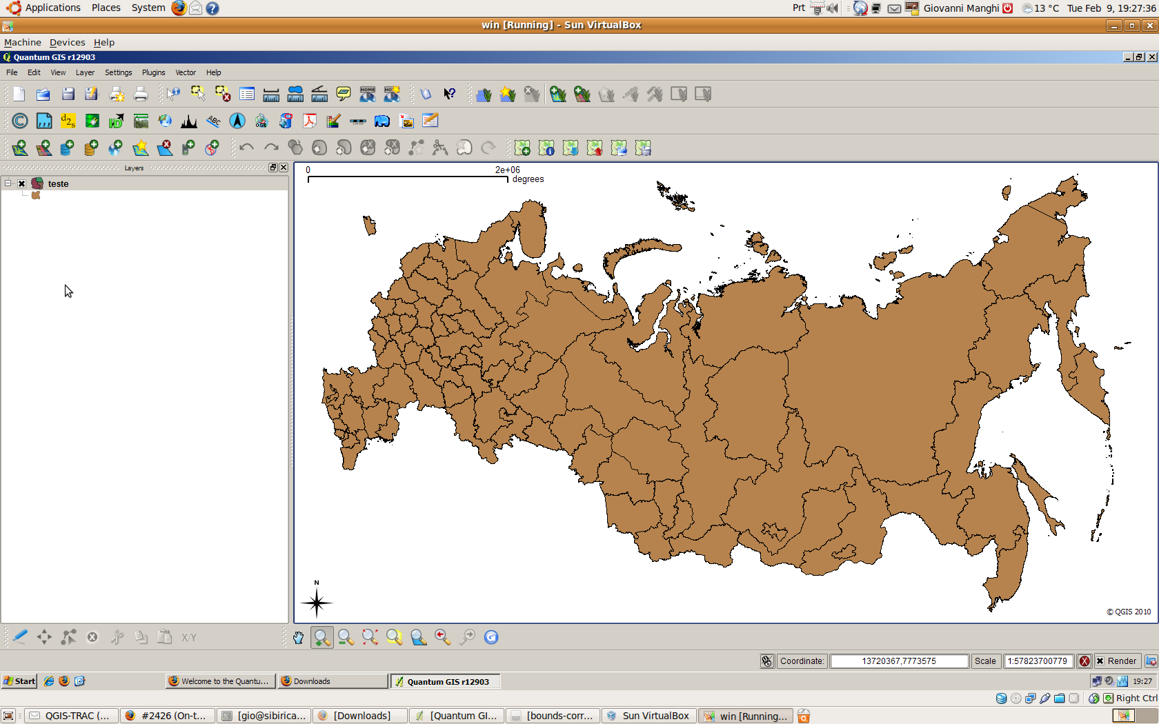
Hi, I just followed the steps and I cannot replicate the behaviour on both windows xp and linux using qgis trunk.
The vector seems correctly projected in the system you have posted (see attached image), and I cannot see any problem zooming in/out or to full extent.