#3017 closed bug (worksforme)
Save as shapefile in AGD84 CRS
| Reported by: | micha | Owned by: | jef |
|---|---|---|---|
| Priority: | major: does not work as expected | Milestone: | Version 1.6.0 |
| Component: | Vectors | Version: | 1.5.0 |
| Keywords: | CRS shapefile | Cc: | |
| Must Fix for Release: | No | Platform: | Debian |
| Platform Version: | Lenny | Awaiting user input: | no |
Description
A text file of locations in the AGD84 zone 51 CRS (S. Hemisphere, EPSG 20351) was imported with the delimited text plugin. The this layer was saved as a shapefile, choosing the AGD84 CRS. This resulted in a "Latitude or Longitude exceeds limits" error. The global CRS was EPSG:4326. Changing the global CRS to EPSG:20351 does solve the problem and allows saving as a shapefile with the correct CRS. But I think this shouldn't occur in any global CRS. (checked both on Linux and Windows)
Attachments (2)
Change History (6)
by , 14 years ago
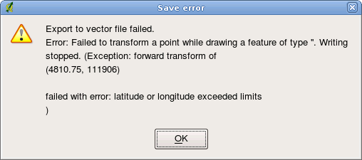
| Attachment: | CRS_error.png added |
|---|
follow-up: 2 comment:1 by , 14 years ago
| Resolution: | → worksforme |
|---|---|
| Status: | new → closed |
Replying to micha:
A text file of locations in the AGD84 zone 51 CRS (S. Hemisphere, EPSG 20351) was imported with the delimited text plugin. The this layer was saved as a shapefile, choosing the AGD84 CRS. This resulted in a "Latitude or Longitude exceeds limits" error. The global CRS was EPSG:4326. Changing the global CRS to EPSG:20351 does solve the problem and allows saving as a shapefile with the correct CRS. But I think this shouldn't occur in any global CRS. (checked both on Linux and Windows)
I can only reproduce the problem, when I don't actually specify the right CRS for the delimited text layer (ie. keep it WGS84). "Saving as" in AGD84 then means reprojecting from WGS84 to AGD84 and that leads to the PROJ exception as the coordinates are illegal for WGS84.
When setting the coordinate system of the delimited text layer to AGD84, saving as AGD84 works fine.
I don't think this is a bug.
follow-up: 3 comment:2 by , 14 years ago
Replying to jef:
Replying to micha:
A text file of locations in the AGD84 zone 51 CRS (S. Hemisphere, EPSG 20351) was imported with the delimited text plugin. The this layer was saved as a shapefile, choosing the AGD84 CRS. This resulted in a "Latitude or Longitude exceeds limits" error. The global CRS was EPSG:4326. Changing the global CRS to EPSG:20351 does solve the problem and allows saving as a shapefile with the correct CRS. But I think this shouldn't occur in any global CRS. (checked both on Linux and Windows)
I can only reproduce the problem, when I don't actually specify the right CRS for the delimited text layer (ie. keep it WGS84). "Saving as" in AGD84 then means reprojecting from WGS84 to AGD84 and that leads to the PROJ exception as the coordinates are illegal for WGS84.
When setting the coordinate system of the delimited text layer to AGD84, saving as AGD84 works fine.
I don't think this is a bug.
The problem, I think, is the default global CRS. If the user just leaves the default, then loads a csv file, QGIS *assumes* it is in WGS84, and there's no place to indicate otherwise. Then when he wants to export to shape with the correct CRS, it fails. Apparently this behavior of the default global CRS is not so obvious to users. Thanks, Micha
follow-up: 4 comment:3 by , 14 years ago
Replying to micha:
The problem, I think, is the default global CRS. If the user just leaves the default, then loads a csv file, QGIS *assumes* it is in WGS84, and there's no place to indicate otherwise.
Except in vector layer properties. There the CRS can be checked and changed.
comment:4 by , 14 years ago
Replying to jef:
Replying to micha:
The problem, I think, is the default global CRS. If the user just leaves the default, then loads a csv file, QGIS *assumes* it is in WGS84, and there's no place to indicate otherwise.
Except in vector layer properties. There the CRS can be checked and changed.
Oh right! Thanks for reminding me...
screen shot of error