Opened 15 years ago
Closed 13 years ago
#2227 closed bug (fixed)
GPS Tools: "Import other file" doesn't work
| Reported by: | dr | Owned by: | gjm |
|---|---|---|---|
| Priority: | major: does not work as expected | Milestone: | Version 1.7.0 |
| Component: | C++ Plugins | Version: | Trunk |
| Keywords: | GPS, GPX | Cc: | dr, gislab, alexbruy |
| Must Fix for Release: | No | Platform: | Windows |
| Platform Version: | Awaiting user input: | no |
Description
1) GPS Tools -> Import other file
2) Browse -> choose 'shapefile' format and open point shapefile
3) Set feature type to 'Waypoints'
4) Type layer name and GPX output file and press OK
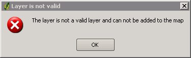
At result we have error message: "The layer is not a valid layer and can not be added to map"
Attachments (1)
Change History (15)
by , 15 years ago
| Attachment: | shp2gpx.jpg added |
|---|
comment:1 by , 15 years ago
| Component: | Python plugins and bindings → C++ Plugins |
|---|---|
| Owner: | changed from to |
| Platform: | Windows → All |
comment:2 by , 15 years ago
comment:3 by , 14 years ago
no, this tool still doesn't work. There is no error message now, but progress bar is endlessly running.
comment:4 by , 14 years ago
| Owner: | changed from to |
|---|---|
| Status: | new → assigned |
comment:5 by , 14 years ago
I can reproduce this problem if I don't select shapefile in the file selection dialog. If I do select shapefile, my test file converts and loads fine.
I'll have a look at making that need more obvious, and perhaps a little more automatic.
comment:6 by , 14 years ago
| Milestone: | Version 1.5.0 → Version 1.6.0 |
|---|
comment:7 by , 14 years ago
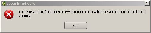
Tested with r15015 under Linux and all works fine. But on Windows with same revision and same data I get error
The layer D:/test.gpx?type=waypoint is not a valid layer and can not be added to map
comment:8 by , 13 years ago
issue is still present:
http://gis-lab.info/images/screenshots/20110417-120-11kb.jpg
follow-up: 11 comment:10 by , 13 years ago
| Platform: | All → Windows |
|---|---|
| Resolution: | fixed |
| Status: | closed → reopened |
If try to import any vector data into GPX QGIS throws an error. For example:
Could not import data from C:/personal/next/histmonumreg.geojson!

Input type 'copilot' not recognized
comment:11 by , 13 years ago
| Resolution: | → fixed |
|---|---|
| Status: | reopened → closed |
Replying to dr:
If try to import any vector data into GPX QGIS throws an error. For example:
Could not import data from C:/personal/next/histmonumreg.geojson!

Input type 'copilot' not recognized
You can only use the file types listed in the selection dialog - and it's important to choose the one that matches your selected file. Seems you left the file type at 'copilot'.
But gpsbabel (or just the plugin) doesn't support GeoJSON anyway.
follow-up: 14 comment:12 by , 13 years ago
| Resolution: | fixed |
|---|---|
| Status: | closed → reopened |
Just tried to import shapefile with GPS Tools. Other files tab, select point shapefile and Shapefile (*.*) from file type combo. After clicking Ok button I get error message
Could not import data from F:/samples/shape/poi-osm.shp!

Input type 'shape' not recognized
Windows XP, r15786. In Linux with same revision and same test data all works fine
comment:14 by , 13 years ago
| Resolution: | → fixed |
|---|---|
| Status: | reopened → closed |
Replying to alexbruy:
Just tried to import shapefile with GPS Tools. Other files tab, select point shapefile and Shapefile (*.*) from file type combo. After clicking Ok button I get error message
Could not import data from F:/samples/shape/poi-osm.shp!

Input type 'shape' not recognized
Windows XP, r15786. In Linux with same revision and same test data all works fine
your gpsbabel probably doesn't support shape.
this is probably related to #2203.
If fix for #2203 works (please test it, so we can eventually close the ticket) the probably the same fix can apply here.