Opened 15 years ago
Closed 15 years ago
#1802 closed bug (duplicate)
problem when using a geographic CRS after changing the central meridian
| Reported by: | lutra | Owned by: | nobody |
|---|---|---|---|
| Priority: | major: does not work as expected | Milestone: | Version 1.3.0 |
| Component: | Projection Support | Version: | Trunk |
| Keywords: | Cc: | pcav | |
| Must Fix for Release: | Yes | Platform: | All |
| Platform Version: | Awaiting user input: | no |
Description
Tested with both shapefiles and postgis.
How to reproduce the problem:
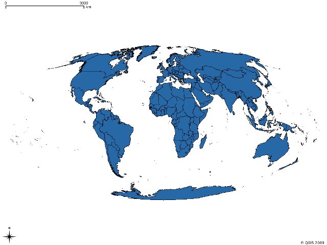
*) download this shapefile of the world borders http://thematicmapping.org/downloads/TM_WORLD_BORDERS-0.3.zip
*) add it to your project
*) add a custom CRS with the following definition (for example) "+proj=moll +lon_0=Central Meridian +x_0=False Easting +y_0=False Northing"
*) in the project properties choose the just created CRS and activate OTFR
*) the layer shows correctly
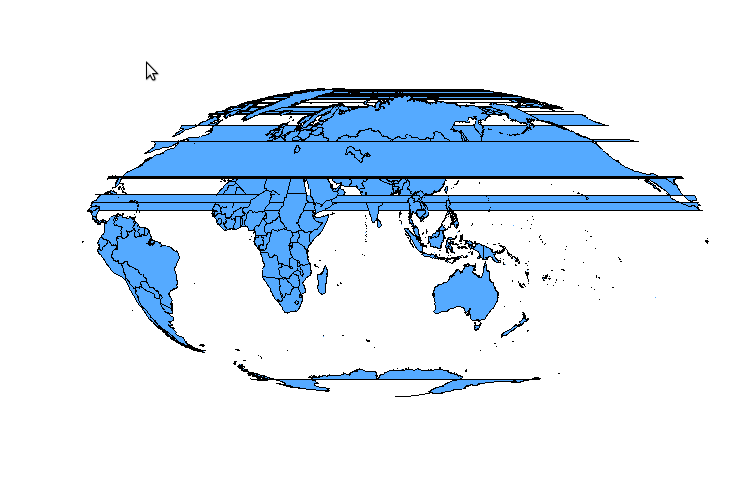
*) now go to the CRS management and change the central meridian "+proj=moll +lon_0=90 +x_0=False Easting +y_0=False Northing"
*) in the project properties change again to wgs84 and back again to the custom CRS, now the shape looks weird.
*) if you zoom in enough the problem disappear
Attachments (2)
Change History (3)
by , 15 years ago
by , 15 years ago
| Attachment: | Screenshot.png added |
|---|
comment:1 by , 15 years ago
| Resolution: | → duplicate |
|---|---|
| Status: | new → closed |
This is a duplicate of #597. As you can see the American continent wraps around, which means the polygons should really by split.
Basically, you can't set up your projections such that geometries must be split.