Opened 15 years ago
Closed 15 years ago
#1664 closed bug (fixed)
fTools geoprocessing changes field format
| Reported by: | gislab | Owned by: | cfarmer |
|---|---|---|---|
| Priority: | minor: annoyance | Milestone: | Version 1.2.0 |
| Component: | Python plugins and bindings | Version: | Trunk |
| Keywords: | fTools | Cc: | |
| Must Fix for Release: | No | Platform: | All |
| Platform Version: | 1.2 | Awaiting user input: | no |
Description
Tried Clipping with fTools, everything is fine, but fields of the output are changed to different length and number of decimals. This is small, but I guess it should better be kept as in source.
Change History (9)
comment:1 by , 15 years ago
| Component: | Plugins → Python |
|---|
comment:2 by , 15 years ago
| Keywords: | fTools added |
|---|---|
| Platform Version: | → 1.0.1 |
| Priority: | critical: causes crash or data corruption → minor: annoyance or enhancement |
comment:3 by , 15 years ago
comment:5 by , 15 years ago
| Owner: | changed from to |
|---|
I cannot replicate this, qith qgis 1.2 from trunk and the latest version of ftools. Tested both shapefiles and postgis layers.
Can you give a try with the latest version of the plugin and/or post the sample data that gave you problems?
follow-up: 8 comment:6 by , 15 years ago
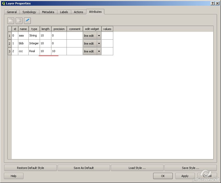
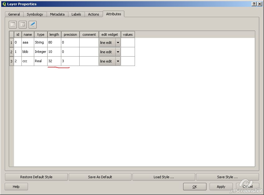
Still no luck. Tried clipping attached points with polygon. Note properties before and after. QGIS 1.2-trunk.
comment:7 by , 15 years ago
| Platform Version: | 1.0.1 → 1.2 |
|---|
attachements and screenshots of field structure, before and after http://gis-lab.info/other/ftools-clipping-bug.zip http://gis-lab.info/images/screenshots/20090711-n20-54kb.jpg http://gis-lab.info/images/screenshots/20090711-1l6-54kb.jpg
comment:8 by , 15 years ago
| Milestone: | → Version 1.2.0 |
|---|---|
| Platform: | Windows → All |
Replying to gislab:
Still no luck. Tried clipping attached points with polygon. Note properties before and after. QGIS 1.2-trunk.
Ok, now I see and I confirm. Probably my first test was made with layers that had already this 32/3 values for lenght/precision.
It's related to the QgsShapefileWriter issues. See #1681.