Opened 15 years ago
Closed 14 years ago
#1437 closed enhancement (wontfix)
improve dxf plugin
| Reported by: | gespiel | Owned by: | timlinux |
|---|---|---|---|
| Priority: | minor: annoyance | Milestone: | Version 1.0.3 |
| Component: | C++ Plugins | Version: | Trunk |
| Keywords: | Cc: | scala@… | |
| Must Fix for Release: | No | Platform: | Windows |
| Platform Version: | xp sp3 | Awaiting user input: | no |
Description
There is no connection between the technical platforms, producing dxf files and the gis-world. To combine this aereas, it is necessary to read dxf-files as native function in qis. (The way about grass plugins does not realy works.)
Attachments (2)
Change History (11)
comment:1 by , 15 years ago
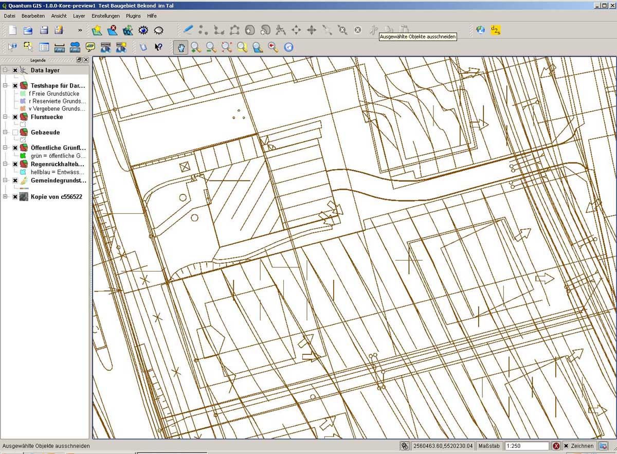
by , 15 years ago
| Attachment: | result_qgis_dxf2shp.jpg added |
|---|
by , 15 years ago
| Attachment: | native_dxf_in_fgis.jpg added |
|---|
comment:3 by , 15 years ago
In general, it is difficult to use dxf files in a GIS without conversion, because of the deeply different data model
comment:4 by , 15 years ago
| Cc: | added |
|---|
comment:5 by , 15 years ago
| Summary: | dxf-layer support as native function in qgis → improve dxf plugin |
|---|
comment:6 by , 15 years ago
comment:7 by , 15 years ago
Please note that in spite of the name, the suggested solution (opendwg) is non free, so probably cause of other hassles. Probably better to go on and improve the already working plugin, or port it/rewrite it to OGR
comment:8 by , 14 years ago
| Component: | Data Provider → C++ Plugins |
|---|---|
| Owner: | changed from to |
comment:9 by , 14 years ago
| Resolution: | → wontfix |
|---|---|
| Status: | new → closed |
DXF support has been recently added to GDAL/OGR. Please fill tickets there if not working properly
Note:
See TracTickets
for help on using tickets.
There is a core plugin that converts dxf to shape.