
| Version 31 (modified by , 3 years ago) ( diff ) |
|---|
Table of Contents
Marketing campaign
To better advertise the capabilities of GRASS GIS and its friendly community, we plan a marketing campaign. Some ideas are
- (ideally) monthly blog post on the main site, with social media advertisements
- ask students of our courses to fix bugs, add examples to manuals or write small tutorials as assignements that we could then show off with
- pick some works of the students and create webinars or live streams
- ... add more
Ideas
- "feature of the month" with screenshots (use manual pages and Wiki material)
- advertise the mailing lists: purpose and where to subscribe
- newcomer level technical articles about
- new forthcoming startup in GRASS GIS 8
- data import/registration
- from zero to hero
- the new startup GUI
- ...
- power user level technical articles about
- writing examples for manual pages
- translating messages in Transifex
- ...
- dev level technical articles about
- compiling the software
- work done on removing compiler warnings
- Python linting and formatting efforts
- C linting and formatting efforts
- ...
- edu related articles about
- tutorials
- curriculum (goal: enable academics to easier teach GRASS GIS)
- ...
- present new add-ons and examples of workflows using them
- Nice tweet about ongoing code development: https://gitmemory.com/OSGeo/grass
- Twitter: identify more hashtags to widen up the potential followers
- ...
Twitter posts
- See old posts here: https://twitter.com/GRASSGIS
Ideas for upcoming or recurrent posts
New ideas:
- Post PSC meeting minutes
- advertise translations in Transifex (what about https://weblate.osgeo.org/ ?)
- promote/recall folks about mailing lists and where to enroll and that they are friendly
- show the list of open PRs with important bug fixes and cool improvements and invite folks to test and review
- promote GRASS GIS related talks at FOSS4G 2021:
- State of GRASS GIS: The Dawn of a New Era: https://www.youtube.com/watch?v=wk3X_Vzp8zg
- A tool for machine learning based dasymetric mapping approaches in GRASS GIS: https://www.youtube.com/watch?v=te4-eWA7aTE
- Sentinel processing in GRASS GIS: A growing toolset for downloading, preprocessing and multitemporal analysis of Copernicus Sentinel data: https://www.youtube.com/watch?v=btk-S5jUAfk (#grassgis #satellite #ESA #Copernicus #Sentinel)
- I hated the way GRASS started so I changed it: https://www.youtube.com/watch?v=pF0hrebqdtA
- Cold war reconnaissance imagery reloaded: orthorectifying the 1960s in high resolution: https://www.youtube.com/watch?v=duoDyN-PDqg (#archeology #forestchange #coastlines #grassgis @MundialisInfo ...)
- News from actinia: https://www.youtube.com/watch?v=JopHVkK5Kfo (#cloud #hpc #grassgis @MundialisInfo ...)
- HERMOSA: Supporting the UN decade on ecosystem restoration utilizing geo- and earth observation technologies: https://www.youtube.com/watch?v=e6q8Fo9j3-E (#ecosystem #restoration #grassgis @MundialisInfo @UNEP ...)
- promote discussions in github: https://github.com/OSGeo/grass/discussions
- OpenCollective: Our new money sponsoring pool is now at https://opencollective.com/grass
- important: connect a goal with it
Tag cloud (collection, please expand):
- @grassgis @osgeo
- #gis #foss #foss4g #gischat
- #satellite #remotesensing #EO
- #opensource
- #mapping
- #community
- ...
Upcoming posts (may be recycled and posted again)
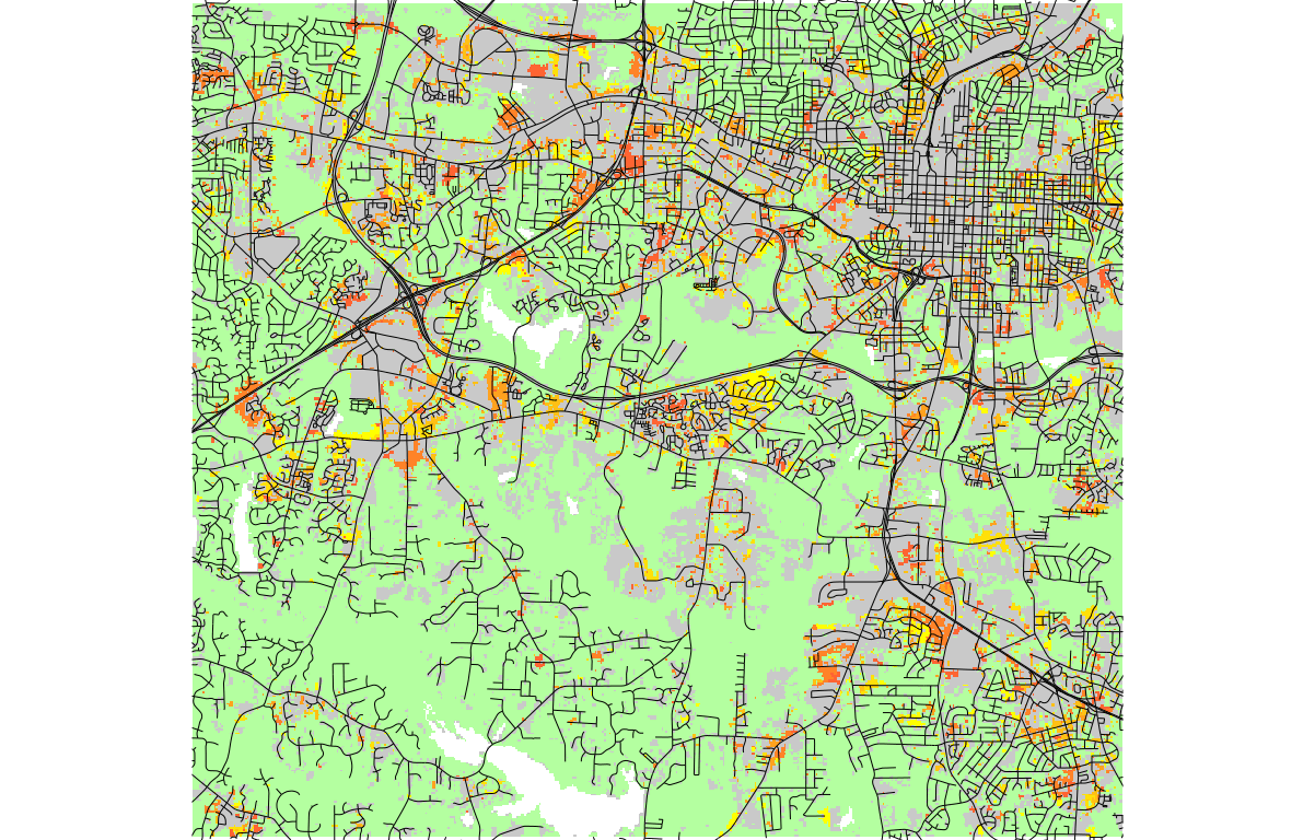
r.futures new validation modules (to be posted)
|
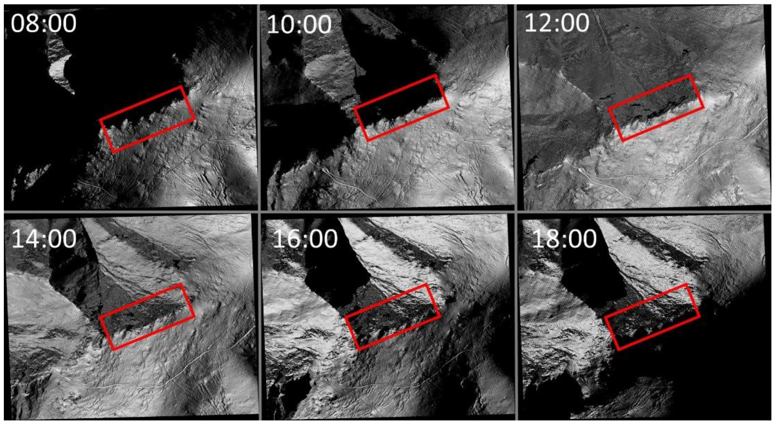
r.in.usgs enhancements (to be posted)
|
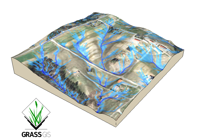
NCSU course (done)
|
General list of GRASS courses/materials by NCSU (done)
|
Invite folks to test release branch 8 and complete the wiki page (we did a similar one for GRASS 8 RC1)
|
GRASS GIS + UAV + SDM for Rare Plant Monitoring (done)
|
FOSS4G 2021 videos template post (done, but could be recycled in future FOSS4G)
|
Xmas (we didn't use this one)
|
End of year toast (done)
|
New Year (we didn't use this one)
|
New discussion forum in GitHub & mailing lists (done)
|
Student's projects/work in the context of GRASS mini grants
|