
| Version 30 (modified by , 6 years ago) ( diff ) |
|---|
List of new features in GRASS GIS 7.6 
NOTE: this page is a living document to keeping track of new features that come with GRASS GIS 7.6.0+
GRASS GIS 7.6 is actively developed and maintained with a first 7.6.0 stable release in January 2019. In total, it comes with more than XX fixes and improvements with respect to the previous stable releases 7.4.x. This page summarizes the manifold new features which have been added to GRASS 7.6.
Table of Contents
What's new in a nutshell 
After almost 1 year of development the new stable release GRASS GIS 7.6 is available. Efforts have concentrated on making the user experience even better, providing many new useful additional functionalities to modules and further improving the graphical user interface.
Releases 
- See list here:
- Release/7.6.0-News
(XXX 2019)(7.6.0 forthcoming)
- Release/7.6.0-News
- The release development was officially moved to a dedicated release branch on Aug 31, 2018 (r73210).
Graphical User Interface 
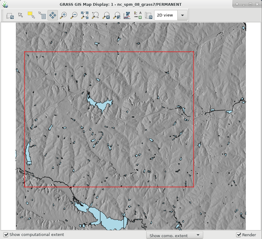
GRASS GIS 7.6 graphical user interface now displays the computational region extent by default in the Map Display window. This simple new feature allows to always visualize such an important basic concept in GRASS GIS and makes it a lot easier for newcomers. Moreover, a new widget has been implemented for commands including an SQL WHERE parameter to ease selection of features/data.
[screenshots here]
Many fixes were aimed to enhance compatibility with wxPython 4. The data catalog, the graphic modeler and the startup have also received many improvements in this new GRASS GIS release.
Modules (commands) 
A series of new modules has been added and many improved.
General modules 
- G7:g.region: new grow option to increase or decrease the region extent in all directions.
Raster modules 
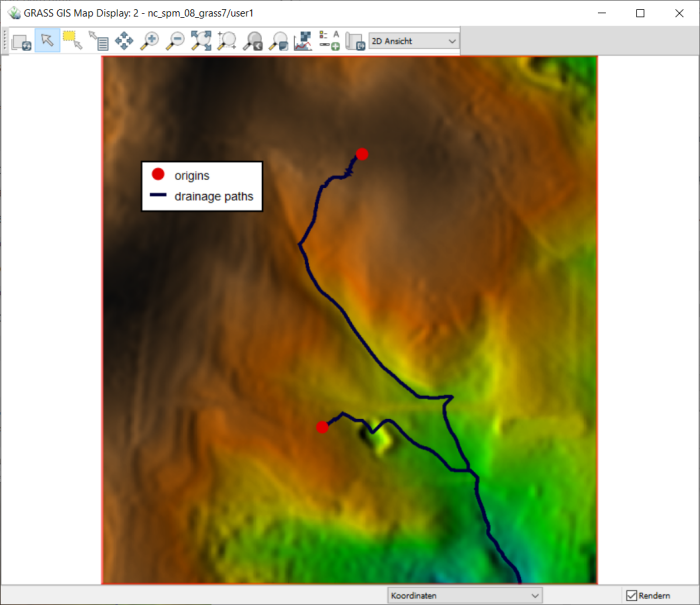
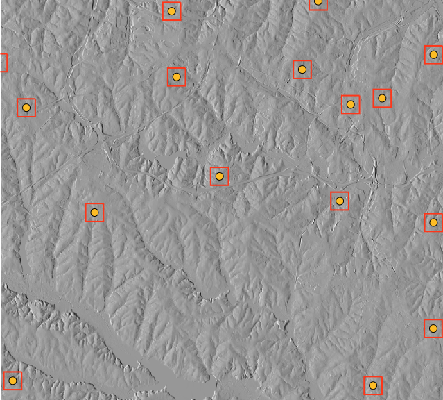
This new GRASS GIS release comes with 2 new dedicated raster modules. The first one, G7:r.path, can be used to trace paths from different starting points following input directions, such as the outputs of G7:r.cost, G7:r.walk or G7:r.watershed. The second, G7:r.buildvrt, provides the very useful functionality of creating virtual rasters (VRT) mosaics from a list of input raster maps. This allows processing big areas while avoiding the creation of physical maps, especially useful when space is limited.
[screenshots here]
Several other raster modules have been improved with new options, flags or parallelization support:
- G7:r.proj: new pipeline option for high-accuracy reprojection
- G7:r.info: recognize different types of raster maps: "raster" (GRASS native), "reclass" (reclassification of another raster map), "GDAL-link" (GRASS link to a GDAL raster band), "virtual" (virtual mosaic of raster maps)
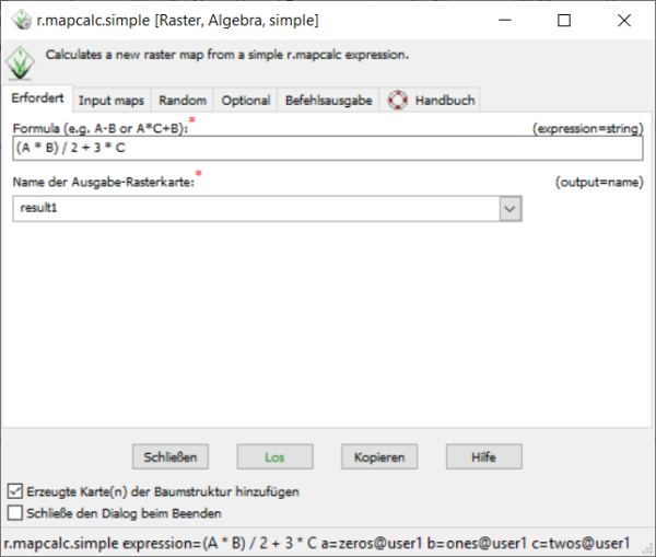
- G7:r.mapcalc: new functions floor(), ceil() (#769)
- ...
Vector modules 
The already impressive list of vector functions in GRASS GIS now includes two new modules that
Several other vector modules have been significantly improved with new options, flags, fixes and other enhancements:
- G7:v.proj: new pipeline option for high-accuracy reprojection
- G7:v.extract: it can now dissolve areas not only by category number, but also by attributes, at the same time preserving category values and attribute tables. This is an improvement over v.dissolve
- G7:v.in.ogr: now also converts OpenStreetMap line topology to GRASS topology, inserting nodes where appropriate (OSM vs GRASS topology)
- G7:v.what.rast: now supports to collect statistics from multiple input raster maps.
- ...
Imagery modules 
- ...
Temporal GIS modules 
- G7:t.rast.algebra: new suffix option for map names
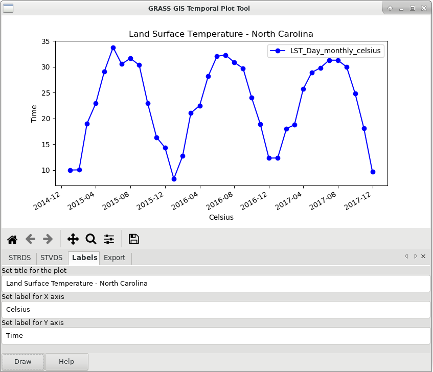
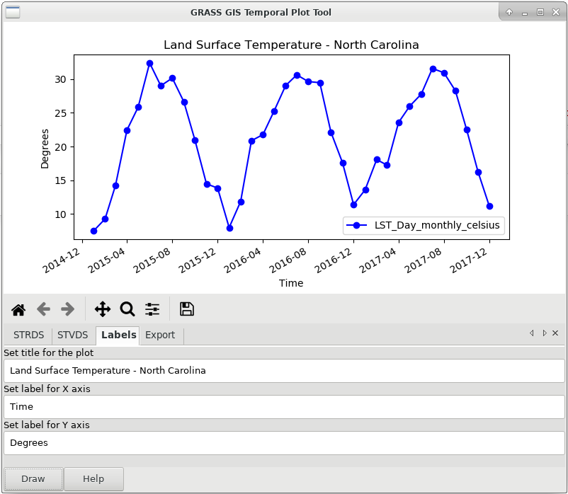
- G7:g.gui.tplot: now allows to set labels for title, x and y axes, and to export the plotted time series data in a CSV file
Scripting 
...
User Manuals - Documentation 
Translations 
Translations are managed in Transifex (please join and translate messages): https://www.transifex.com/grass-gis/grass7
User manual pages improvements 
More than 130 User Manual pages have received major or minor improvements.
GRASS 7 Library changes 
In the past year of development, there were several changes in different GRASS GIS libraries. The most relevant changes are described below:
- a new raster compression method has been added: ZSTD (ZSTD, see ZSTD on github). ZSTD is an improvement over ZLIB's deflate method, providing both faster and higher compression than ZLIB.
- a new raster map type has been added: GRASS virtual raster (VRT) which is a virtual mosaic of the list of input raster maps.
- support for PROJ 5: previously, reprojection from one CRS to another CRS used WGS84 as pivot datum: CRS1 -> WGS84 -> CRS2. This method provided reasonable results and allowed for reprojection on-the-fly. However, using a fixed pivot datum has been regarded as a suboptimal solution for coordinate reprojection, therefore a new mechanism has been introduced in PROJ 5, where custom pipelines for coordinate conversion and transformation can be defined. Together with the new PROJ 5+ API, this pipeline mechanism is now supported starting with proj-5.1.0. Custom coordinate conversion/transformation pipelines can now be defined for raster and vector reprojection.
- vector modules are now less "chatty" with regard to topology building: only problems are reported, standard topology building messages are only shown with --verbose. This should make it easier for users to spot problems.
- the segment library uses a new fast all-in-memory cache instead of a file-based cache if all data can be kept in memory
- ...
Source Code Portability 
- ...
- ...
GRASS GIS 7.6 Addons 
There are TODO twenty six 26 new addons that now enlarge the already impressive list of extensions available (see https://grass.osgeo.org/grass7/manuals/addons/).
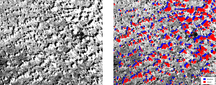
Among these new extensions there is a set of new addons to download, import and preprocess Sentinel-2 imagery: G7A:i.sentinel.download, G7A:i.sentinel.import, G7A:i.sentinel.preproc and G7A:i.sentinel.mask, additional imagery modules like, G7A:i.pysptools.unmix for extracting endmembers and spectral unmixing using pysptools or G7A:i.signature. to...
G7A:r.connectivity
G7A:v.rast.bufferstats
G7A:v.what.strds.timestamp
Migrating from GRASS GIS 6 to version 7.x 
If you are still using GRASS GIS 6, here details upgrade instructions for own scripts:
Attachments (10)
-
grass760_show_region.png
(580.1 KB
) - added by 6 years ago.
Show region extent in Map Display
-
grass760_r_path.png
(233.4 KB
) - added by 6 years ago.
r.path example
-
grass760_v_rast_bufferstats_01.png
(362.9 KB
) - added by 6 years ago.
example of v.rast.bufferstats addon 1
-
grass760_v_rast_bufferstats_02.png
(60.6 KB
) - added by 6 years ago.
example of v.rast.bufferstats addon 2
-
grass760_r_mapcalc_simple_01.png
(73.4 KB
) - added by 6 years ago.
r.mapcalc.simple example 1
-
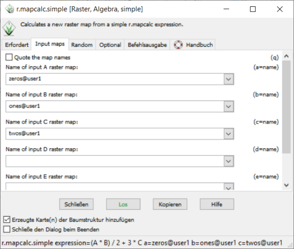
grass760_r_mapcalc_simple_02.png
(90.6 KB
) - added by 6 years ago.
r.mapcalc.simple example 2
-
grass760_g_gui_tplot_labels.png
(57.5 KB
) - added by 6 years ago.
New labels options in temporal plot tool
-
grass760_v_buffer_squared.png
(384.9 KB
) - added by 6 years ago.
example of squared buffers
-
grass760_i_sentinel_mask_clouds.png
(657.8 KB
) - added by 6 years ago.
example of cloud detection for sentinel 2 images (from manual of i.sentinel.mask)
-
grass760_temporal_plot_labels.png
(56.5 KB
) - added by 6 years ago.
updating temporal plot fig