
| Version 9 (modified by , 11 years ago) ( diff ) |
|---|
ossim-chipper
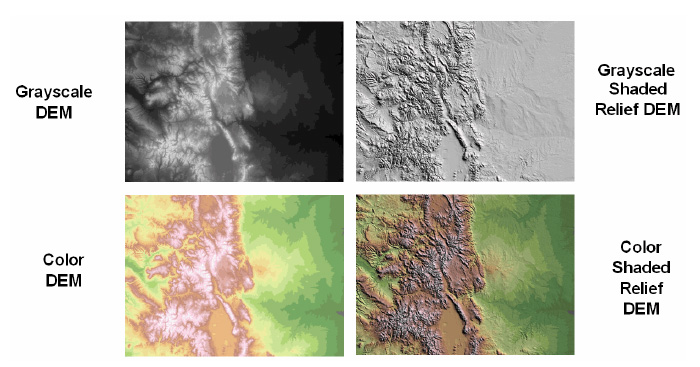
ossim-chipper is a command line application used to generate elevation products from raw dem, dted, and srtm data. This application supports 2 basic functions: hillshade and color-relief. From these 2 operations you can create the following products.

Color Relief
Color Relief is used to generate an RGB or ARGB representation of a dem. Different colors are used to represent elevation bands. Users will provide a template with corresponding colors values.
ossim-chipper --op color-relief --color-table template.kwl --srs EPSG:4326
input.src output.jpg
Command line without dot.src file with lots of options:
ossim-chipper -t 512 --resample-filter BILINEAR --op color-relief --color-table color-relief-lut1.kwl --output-radiometry U8 --writer-prop compression_quality=75 --writer-prop create_world_file=1 --writer-prop pixel_type=point --cut-bbox-ll 39.452331542969 -106.75654602051 40.507019042969 -105.43818664551 /data1/elevation/dted/level1/w107/n39.dt1 /data1/elevation/dted/level1/w107/n40.dt1 /data1/elevation/dted/level1/w106/n39.dt1 /data1/elevation/dted/level1/w106/n40.dt1 t1.tif
There is a color relief template on:
Hillshade
Hillshade is used to generate a shaded relief. It requires the following inputs:
- Sun Azimuth
- Sun Elevation
- Vertical Exaggeration
- Color (either RGB or Color Table)
Example:
ossim-chipper --op hillshade --azimuth 270 --elevation 45 --exaggeration 10
--color 222,229,188 --srs EPSG:4326 input.src output.jpg
Example with color table:
ossim-chipper --op hillshade --azimuth 270 --elevation 45 --exaggeration 10
--color-table template.kwl --srs EPSG:4326 input.src output.jpg
Example with color table without dot.src file:
ossim-chipper --op color-relief --azimuth 270 --elevation 45 --exaggeration 1.5 --color-table color-relief-lut.kwl --srs EPSG:4326 n37.dt1 t1.tif
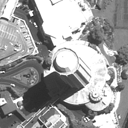
Chipping examples in image space:
Chip about latitude longitude point, 512x512 in image space, rotate "up is up", histogram stretch, scale to eight bit, outputting to a png file.
Note the up is up mode requires a sensor model that is affected by elavtion.
ossim-chipper --op chip -u --histogram-op auto-minmax --cut-center-llwh -42.883986392005788 147.331309643650911 512 512 --scale-to-8-bit -w ossim_png 5V090205P0001912264B220000100282M_001508507.ntf up-is-up.png

Additional Parameters
ossim-chipper shares many of the parameters used in orthoigen including:
- writer-props
- resample-type
- thumbnail
- srs
It accepts a comma delimited list of input files or a .src file. The output file extension is used to determine output format. As with orthoigen, users can specify a writer to use with a -w argument.
SRC File
The src file used by ossim-chipper is nearly identical to the one used by orthoigen. The primary difference between the 2 is the use of the dem keyword to distinguish elevation data from imagery data. Example:
image0.file: C:\my_image.ntf
image0.entry: 2
image0.ovr: D:\support_dir\images\my_image.ovr
image0.rgb: 3,2,1

dem0:file E:\N38W123.hgt
dem0.entry: 0
dem0.ovr: D:\support_dir\dems\N38W123.ovr

dem1:file Z:\N37W123.hgt
dem1.entry: 0
dem1.ovr: D:\support_dir\dems\N37W123.ovr
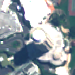
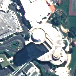
Pan Sharpened Multispectral (PSM):
Example command:
$ ossim-chipper --op psm -b 3,2,1 --histogram-op auto-minmax --cut-center-llwh -42.902358775406725 147.337399071900336 256 256 --resample-filter sinc --scale-to-8-bit -w ossim_png 5V090205M0001912264B220000100072M_001508507/Volume1/5V090205M0001912264B220000100072M_001508507.ntf 5V090205P0001912264B220000100282M_001508507/Volume1/5V090205P0001912264B220000100282M_001508507.ntf outputs/psm-output-1.png
Inputs/outputs:


Attachments (6)
- dem.jpg (100.1 KB ) - added by 11 years ago.
- up-is-up.png (177.8 KB ) - added by 11 years ago.
- ms-input-1.png (15.3 KB ) - added by 11 years ago.
- pan-input-1.png (40.2 KB ) - added by 11 years ago.
- ms-input-1.2.png (15.3 KB ) - added by 11 years ago.
- psm-output-1.png (112.0 KB ) - added by 11 years ago.
Download all attachments as: .zip
