
Opened 16 years ago
Closed 16 years ago
#682 closed enhancement (fixed)
Base Layers support
| Reported by: | MaksimS | Owned by: | ksgeograf |
|---|---|---|---|
| Priority: | medium | Milestone: | |
| Component: | Maestro | Version: | |
| Severity: | major | Keywords: | |
| Cc: | External ID: |
Description
Meastro API should support MG Base Layers, to be able to fully replicate Autodesk MapGuide Studio functionality. Base layers represent composite layer construct resulting in a raster map consumed by MG tiling service.
Attachments (2)
Change History (11)
comment:1 by , 16 years ago
| Component: | General → Maestro |
|---|---|
| Owner: | set to |
comment:2 by , 16 years ago
| Status: | new → assigned |
|---|---|
| Version: | 2.0.1 |
comment:3 by , 16 years ago
Yes, that explains why I had problems seeing a thing using HttpServerConnection.RenderRuntimeMap() (see ticket #675) since my initial map view includes base layers only.
comment:4 by , 16 years ago
Kenneth, is there any MaestroAPI news on RuntimeMap base layers support?
comment:5 by , 16 years ago
No, I have not looked at it yet. I looked at RuntimeMaps on the soon-to-be MGOS 2.1 beta, and there appears to be some trouble there, so I might look at it tonight together with the 2.1 Beta fixes.
by , 16 years ago
| Attachment: | OSGeo.MapGuide.MaestroAPI.dll added |
|---|
r3385 Release build of MaestroAPI
comment:6 by , 16 years ago
I have now uploaded a new version of MaestroAPI which inserts the base layers into the runtime map. I've had some trouble testing it, but it does appear to display base layers. Let me know if it works or fails for you.
by , 16 years ago
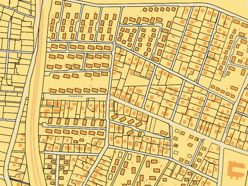
| Attachment: | 087e6e32-0000-1000-800b-00215a501f4d_en_7F0000010AF20AF10AF0.png added |
|---|
comment:8 by , 16 years ago
It's working now, thanks! Please find attached resulting MeastroAPI bitmap (returned via http): buildings and streets come from base layers, while parcels and street names were defined as dynamic layers. Image gets distorted a bit due to resizing, AGG renderer is not of much help here.
comment:9 by , 16 years ago
| Resolution: | → fixed |
|---|---|
| Status: | assigned → closed |
Very nice. I was unable to test it properly myself, so thanks for the feedback.
Just to specify, the Maestro API does support base layers in the MapDefinition, but not in the Maestro GUI, and not in the RuntimeMap generation. This ticket is to for fixing the RuntimeMap generation to support these.