| Version 2 (modified by , 3 years ago) ( diff ) |
|---|
Google Summer of Code 2022 =
Introduction
So you are interested in becoming a Google Summer of Code student. What should you do to improve your chances of being selected? We recommend reading
- OSGeo's GSoC Recommendations for Students
- We currently have one project in mind listed below, with a mentor ready to help - refer to Idea 1 below. We are open to other ideas.
- Join the PostGIS Developers list and describe your proposed project (or willingness to work on Idea 1 listed below). We will let you know if we think the project is worthwhile and doable within the allotted time you have.
- If you are looking for additional ideas, refer to our past GSOCS:
Improving your chances
For most projects involving PostGIS you will eventually need the following:
- Know how to install PostgreSQL
- Know how to install PostGIS in PostgreSQL
- Know how to compile PostgreSQL code
- Know how to compile PostGIS code and run tests
- Some basic knowledge of git — at least how to do a git clone, git push, git pull and pull requests
While you can learn to do these things and ask questions, we would prefer students to know these before starting on a PostGIS project.
Idea 1: Augment pgAdmin to support importing and exporting shapefiles
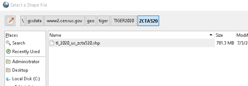
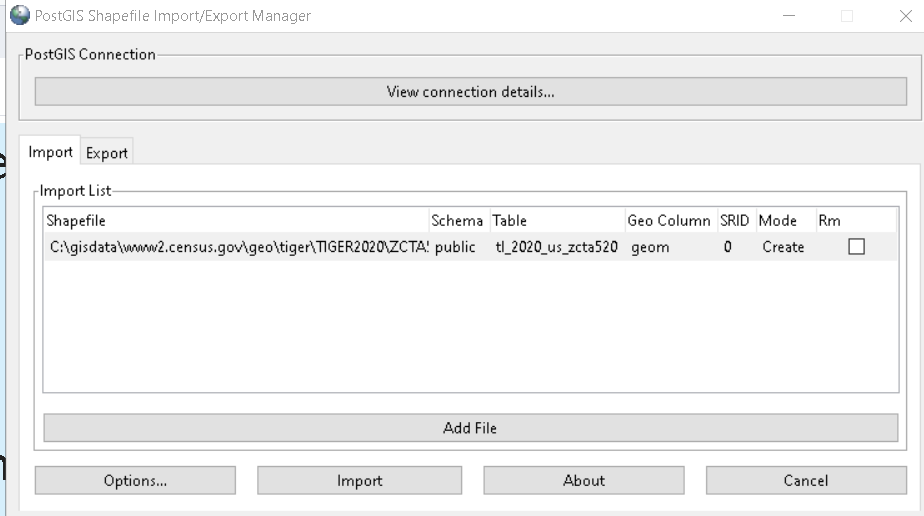
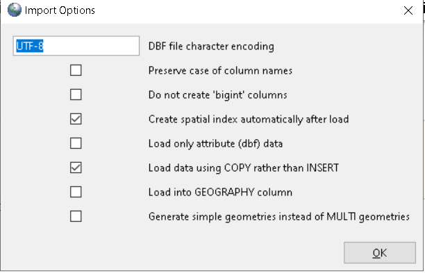
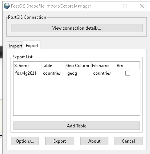
Expected outcome: There should be a menu option in the pgAdmin browser tree whenever you right-click a database, table, or schema that allows you to import or export shapefiles. The tool would use the shp2pgsql and pgsql2shp commandlines that are part of the PostGIS source code in much the same way the backup and restore data browse menu options built into pgAdmin utilizes pg_dump / pg_restore.
Skills required: python, html, css, and javascript, ability to compile PostgreSQL code, ability to compile PostGIS code, ability to compile pgAdmin
some familiarity with PostGIS, PostgreSQL, and pgAdmin is preferable
Mentors: Regina Obe
Difficulty: Medium
Student Test:
- git clone code from PostgreSQL and compile
- git clone PostGIS code from one of Git repos and compile
- git clone code from pgAdmin4 and compile
- Create a working PostgreSQL database with postgis extension installed and shp2pgsql/pgsql2shp installed on system you are running pgAdmin4 on.
- Setup a public fork of pgAdmin repo for your work (can be osgeo, gitlab, github, or any other repo you can make available for public review)
Since the above is all work in pgAdmin, installing PostGIS / postgis commandline tools from a repository is equally acceptable to doing (1,2)
Attachments (5)
- postgis-qui-import-1.png (23.3 KB ) - added by 3 years ago.
- postgis-qui-import-2.png (23.0 KB ) - added by 3 years ago.
- postgis-qui-import-3.png (28.0 KB ) - added by 3 years ago.
- postgis-qui-export-1.png (18.7 KB ) - added by 3 years ago.
- postgis-qui-export-2.png (18.7 KB ) - added by 3 years ago.
Download all attachments as: .zip