
ossim-chipper
ossim-chipper is a command line application used to generate image products from single or multiple image inputs. This includes chipping in image space, format conversions, ortho-rectification, elevation products from raw dem, dted, and srtm data.
Highlights:
- Input images can be in any format the ossim library can read.
- Output image can be in any format the ossim library can write.
- Outputs include:
- simple format conversion
- Chipping in image space, with various cut options, e.g. "cut center, lat, lon, with height, with rotation and scale option.
- Ortho-rectification of data with sensor models effected by elevation.
- Color Reliefs
- Hillshades
- Two Color Multiviews (2cmw)
- Pan Sharpened Multispectral.
- simple format conversion
- Ortho-rectification of data with a sensor model that is affected by elevation is automatic, provided your elevation set up is correct.
See elevation setup for more on that:http://trac.osgeo.org/ossim/wiki/ossimElevationSetup
Note:
Typical usage is to have pre-built overviews and histogram for input files. To build do:
ossim-preproc -o --ch <input-file(s)>
See ossim-preproc wiki documentation for more:http://trac.osgeo.org/ossim/wiki/ossim-preproc
Usage:
$ ossim-chipper
Usage: ossim-chipper [option]... [input-option]... <input-file(s)> <output-file>
Note at least one input is required either from one of the input options, e.g. --input-dem <my-dem.hgt> or adding to command line in front of the output file in which case the code will try to ascertain what type of input it is.

Available traces:
-T "ossimChipperUtil:debug"   - General debug trace to standard out.
-T "ossimChipperUtil:log"     - Writes a log file to output-file.log.
-T "ossimChipperUtil:options" - Writes the options to output-file-options.kwl.

Description:
ossim-chipper Utility application for generating elevation products from dem data.

Options:
  --2cmv-blue-output-source   <source>
                              Two color multi view source input for blue output.
                              Either, old, new, or mp(min pix).  Default=new.
  --2cmv-green-output-source  <source>
                              Two color multi view source input for green
                              output.  Either, old, new, or mp(min pix).
                              Default=new.
  --2cmv-new-input-band       <band>
                              Band to use for two color multi view new input.
  --2cmv-old-input-band       <band>
                              Band to use for two color multi view old input.
  --2cmv-red-output-source    <source>
                              Two color multi view source input for red output.
                              Either, old, new, or mp(min pix).  Default=old.
  --azimuth                   <azimuth>
                              hillshade option - Light source azimuth angle for
                              bump shade.
                              Range: 0 to 360, Default = 180.0
  --central-meridian          <central_meridian_in_decimal_degrees>
                              Note if set this will be used for the central
                              meridian of the projection.  This can be used to
                              lock the utm zone.
  --color                     <r> <g> <b>
                              hillshade option - Set the red, green and blue
                              color values to be used with hillshade.
                              This option can be used with or without an image
                              source for color.
                              Range 0 to 255, Defualt r=255, g=255, b=255
  --color-table               <color-table.kwl>
                              hillshade or color-relief option - Keyword list
                              containing color table for color-relief option.
  --cut-bbox-ll               <min_lat> <min_lon> <max_lat> <max_lon>
                              Specify a bounding box with the minimum
                              latitude/longitude and max latitude/longitude in
                              decimal degrees.
                              Note coordinates are edge to edge.
  --cut-bbox-llwh             <min_lat> <min_lon> <max_lat> <max_lon> <width>
                              <height>
                              Specify a bounding box with the minimum
                              latitude/longitude, max latitude/longitude in
                              decimal degrees and width/height in pixels.
                              Note coordinates are edge to edge.
  --cut-center-llr            <latitude> <longitude> <radius_in_meters>
                              Specify the center cut in latitude longitude space
                              with radius in meters.
  --cut-center-llwh           <latitude> <longitude> <width> <height>
                              Specify the center cut in latitude longitude space
                              with width and height in pixels.
  --degrees                   <dpp_xy> | <dpp_x> <dpp_y>
                              Specifies an override for degrees per pixel. Takes
                              either a single value applied equally to x and y
                              directions, or two values applied correspondingly
                              to x then y. This option takes precedence over the
                              "--meters" option.
  --disable-elev              Will disable the elevation
  --disable-notify            Takes an argument. Arguments are ALL, WARN,
                              NOTICE, INFO, FATAL, DEBUG.  If you want multiple
                              disables then just do multiple --disable-notify on
                              the command line.  All argument are case
                              insensitive.  Default is all are enabled.
  --disable-plugin            Will disable the plugin loader
  --elevation                 <elevation>
                              hillshade option - Light source elevation angle
                              for bumb shade.
                              Range: 0 to 90, Default = 45.0
  --exaggeration              <factor>
                              Multiplier for elevation values when computing
                              surface normals. Has the effect of lengthening
                              shadows for oblique lighting.
                              Range: .0001 to 50000, Default = 1.0
  --histogram-op              <operation>
                              Histogram operation to perform. Valid operations
                              are "auto-minmax", "std-stretch-1",
                              "std-stretch-2" and "std-stretch-3".
  --input-dem                 <dem> Input dem to process.
  --input-img                 <image> Input image to process.
  --input-src                 <file.src> Input source file list keyword list
                              with list of dems or images or both to process.
  --meters                    <meters>
                              Specifies an override for the meters per pixel
  --op                        <operation>
                              Operation to perform. Valid operations are "chip",
                              "color-relief", "hillshade", "psm"(pan sharpened
                              multispectral), "2cmv"(two color multi view) and
                              "ortho".
                              chip = input projection = output projection(image
                              space), single image operation only.
  --options-keyword-list      <options.kwl>  This can be all or part of the
                              application options.  To get a template you can
                              turn on trace to the ossimChipperUtil class by
                              adding "-T ossimChipperUtil" to your command.
  --origin-latitude           <latidude_in_decimal_degrees>
                              Note if set this will be used for the origin
                              latitude of the projection.  Setting this to
                              something other than 0.0 with a geographic
                              projection creates a scaled geographic projection.
  --ossim-logfile             takes a logfile as an argument.  All output
                              messages are redirected to the specified log file.
                              By default there is no log file and all messages
                              are enabled.
  --output-radiometry         <R>
                              Specifies the desired product's pixel radiometry
                              type. Possible values for <R> are: U8, U11, U16,
                              S16, F32. Note this overrides the deprecated
                              option "scale-to-8-bit".
  --projection                <output_projection> Valid projections: geo,
                              geo-scaled, input or utm
                              geo = Equidistant Cylindrical, origin latitude =
                              0.0
                              geo-scaled = Equidistant Cylindrical, origin
                              latitude = image center
                              input Use first images projection. Must be a map
                              projecion.
                              utm = Universal Tranverse Mercator
                              If input and multiple sources the projection of
                              the first image will be used.
                              If utm the zone will be set from the scene center
                              of first image.
                              NOTE: --srs takes precedence over this option.
  --reader-prop <string>      Adds a property to send to the reader. format is
                              name=value
  --resample-filter           <type>
                              Specify what resampler filter to use, e.g. nearest
                              neighbor, bilinear, cubic, sinc.
                              See ossim-info --resampler-filters
  --scale-to-8-bit            Scales the output to unsigned eight bits per band.
                              This option has been deprecated by the newer
                              "--output-radiometry" option.
  --snap-tie-to-origin        Snaps tie point to projection origin so that
                              (tie-origin)/gsd come out on an even integer
                              boundary.
  --srs                       <src_code>
                              Specify an output reference frame/projection.
                              Example: --srs EPSG:4326
  --three-band-out            Force three band output even if input is not.
  --writer-prop               <writer-property>
                              Passes a name=value pair to the writer for setting
                              it's property. Any number of these can appear on
                              the line.
  -K                          specify individual keywords to add to the
                              preferences keyword list: name=value
  -P                          specify a preference file to load
  -T                          specify the classes to trace, ex:
                              ossimInit|ossimImage.*
                              will trace ossimInit and all ossimImage classes
  -V or --version             Display version information.
  -b or --bands <n,n...>      Use the specified bands in given order: e.g.
                              "3,2,1" will select bands 3, 2 and 1 of the input
                              image.
                              Note: it is 1 based
  -e or --entry               <entry> For multi image handlers which entry do
                              you wish to extract. For list of entries use:
                              "ossim-info -i <your_image>"
  -h or --help                Display this help and exit.
  -n or --north-up            Rotates image North up. "chip" operation only.
  -r or --rotate              <degrees>
                              Rotate image by degrees. "chip" operation only.
  -t or --thumbnail           <max_dimension>
                              Specify a thumbnail resolution.
                              Scale will be adjusted so the maximum dimension =
                              argument given.
  -u or --up-is-up            Rotates image to up is up. "chip" operation only.
  -w or --writer              <writer>
                              Specifies the output writer.  Default uses output
                              file extension to determine writer. For valid
                              output writer types use: "ossim-info --writers"

NOTES:
1) Never use same base name in the same directory! Example is you have a Chicago.tif
   and you want a Chicago.jp2, output Chicago.jp2 to its own directory.

Example commands:

// Simple file conversion: Convert geotiff to a jp2 file.
ossim-chipper --op chip -w ossim_kakadu_jp2 Chicago.tif outputs/Chicago.jp2

// Basic orthorectification: Orthorectify a nitf with RPC model out to a geotiff.
ossim-chipper --op ortho 5V090205P0001912264B220000100282M_001508507.ntf outputs/ortho.tif

// A two color multi view with cut box.  First image is old, second image is new:
ossim-chipper --cut-bbox-ll 28.092885092033352 -80.664539599998633 28.109128691071547 -80.626914963229325 --op 2cmv oldMLB.tif newMLB.tif outputs/2cmv-test1.tif

// Ortho about point, 512x512, with histogram stretch, and 3,2,1 band order:
ossim-chipper --op ortho -b 3,2,1 --histogram-op auto-minmax --cut-center-llwh -42.819784401784275 147.265811350983 512 512 5V090205M0001912264B220000100072M_001508507.ntf orth.tif

// Chip, in image space, about point, 512x512, with histogram stretch, and 3,2,1 band order:
ossim-chipper --op chip -b 3,2,1 --histogram-op auto-minmax --cut-center-llwh -42.819784401784275 147.265811350983 512 512 5V090205M0001912264B220000100072M_001508507.ntf chip.tif

// Chip in image space, rotate "up is up"(-u option) about point, 512x512 with histogram stretch and 3,2,1 band order:
ossim-chipper --op chip -u -b 3,2,1 --histogram-op auto-minmax --cut-center-llwh -42.819784401784275 147.265811350983 512 512 5V090205M0001912264B220000100072M_001508507.ntf up-is-up-chip.tif

// Chip in image space, rotate 39 degrees (-r option) about point, 1024x1024, scaled to eight bit:
ossim-chipper --op chip -r 39 --histogram-op auto-minmax --cut-center-llwh -42.883809539602893 147.331984112985765 1024 1024 --scale-to-8-bit 5V090205P0001912264B220000100282M_001508507.ntf outputs/r39.png

// Above command where all options are in a keyword list:
ossim-chipper --options-keyword-list r39-options.kwl

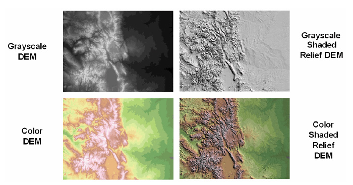
Color Relief
Color Relief is used to generate an RGB or ARGB representation of a dem. Different colors are used to represent elevation bands. Users will provide a template with corresponding colors values.
ossim-chipper --op color-relief --color-table template.kwl --srs EPSG:4326
input.src output.jpg
Command line without dot.src file with lots of options:
ossim-chipper -t 512 --resample-filter BILINEAR --op color-relief --color-table color-relief-lut1.kwl --output-radiometry U8 --writer-prop compression_quality=75 --writer-prop create_world_file=1 --writer-prop pixel_type=point --cut-bbox-ll 39.452331542969 -106.75654602051 40.507019042969 -105.43818664551 /data1/elevation/dted/level1/w107/n39.dt1 /data1/elevation/dted/level1/w107/n40.dt1 /data1/elevation/dted/level1/w106/n39.dt1 /data1/elevation/dted/level1/w106/n40.dt1 t1.tif
There is a color relief template on:
Hillshade
Hillshade is used to generate a shaded relief. It requires the following inputs:
- Sun Azimuth
- Sun Elevation
- Vertical Exaggeration
- Color (either RGB or Color Table)
Example:
ossim-chipper --op hillshade --azimuth 270 --elevation 45 --exaggeration 10
--color 222,229,188 --srs EPSG:4326 input.src output.jpg
Example with color table:
ossim-chipper --op hillshade --azimuth 270 --elevation 45 --exaggeration 10
--color-table template.kwl --srs EPSG:4326 input.src output.jpg
Example with color table without dot.src file:
ossim-chipper --op color-relief --azimuth 270 --elevation 45 --exaggeration 1.5 --color-table color-relief-lut.kwl --srs EPSG:4326 n37.dt1 t1.tif
Chipping examples in image space:
Chip about latitude longitude point, 512x512 in image space, rotate "up is up", histogram stretch, scale to eight bit, outputting to a png file.
Note the up is up mode requires a sensor model that is affected by elavtion.
ossim-chipper --op chip -u --histogram-op auto-minmax --cut-center-llwh -42.883986392005788 147.331309643650911 512 512 --scale-to-8-bit -w ossim_png 5V090205P0001912264B220000100282M_001508507.ntf up-is-up.png

Additional Parameters
ossim-chipper shares many of the parameters used in orthoigen including:
- writer-props
- resample-type
- thumbnail
- srs
It accepts a comma delimited list of input files or a .src file. The output file extension is used to determine output format. As with orthoigen, users can specify a writer to use with a -w argument.
SRC File
The src file used by ossim-chipper is nearly identical to the one used by orthoigen. The primary difference between the 2 is the use of the dem keyword to distinguish elevation data from imagery data. Example:
image0.file: C:\my_image.ntf
image0.entry: 2
image0.ovr: D:\support_dir\images\my_image.ovr
image0.rgb: 3,2,1

dem0:file E:\N38W123.hgt
dem0.entry: 0
dem0.ovr: D:\support_dir\dems\N38W123.ovr

dem1:file Z:\N37W123.hgt
dem1.entry: 0
dem1.ovr: D:\support_dir\dems\N37W123.ovr
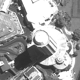
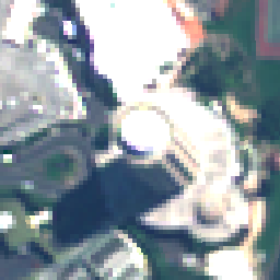
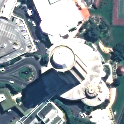
Pan Sharpened Multispectral (PSM):
Example command:
$ ossim-chipper --op psm -b 3,2,1 --histogram-op auto-minmax --cut-center-llwh -42.902358775406725 147.337399071900336 256 256 --resample-filter sinc --scale-to-8-bit -w ossim_png 5V090205M0001912264B220000100072M_001508507/Volume1/5V090205M0001912264B220000100072M_001508507.ntf 5V090205P0001912264B220000100282M_001508507/Volume1/5V090205P0001912264B220000100282M_001508507.ntf outputs/psm-output-1.png
Inputs/outputs:


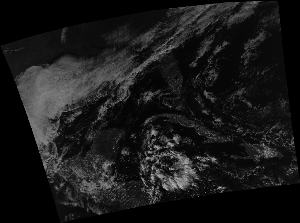
NPP VIIRS SVDNB ortho
Reprojected radiance layer to thumbnail, max dimension 1024 to eight bit png:
ossim-chipper -w ossim_png -t 1024 --op ortho --output-radiometry U8 GDNBO-SVDNB_npp_d20131210_t1840144_e1845548_b10987_c20131211154952933454_noaa_ops.h5 outputs/GDNBO-SVDNB_npp-ortho_test1.png
http://download.osgeo.org/ossim/thumbnails/GDNBO-SVDNB_npp-ortho_test1.png
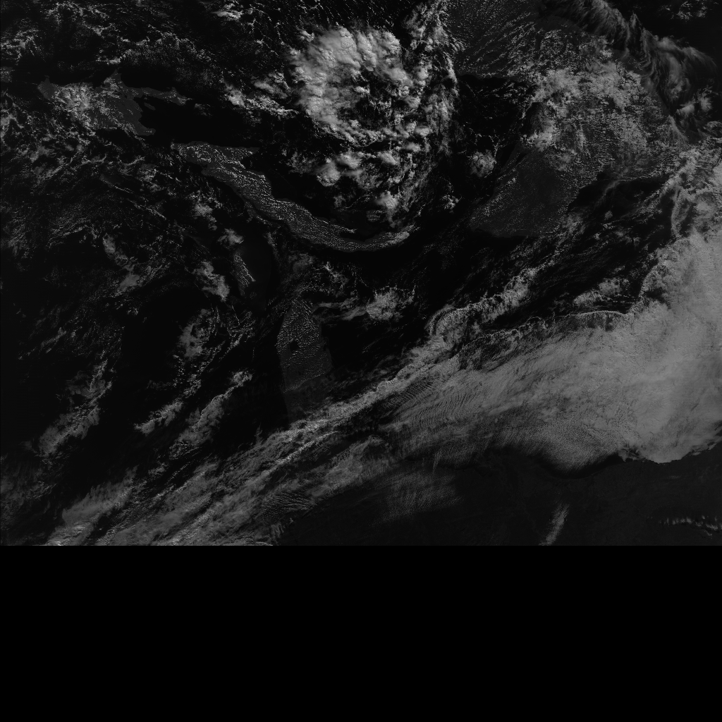
NPP VIIRS SVDNB raw thumbnail
Output raw (no reproject) radiance layer to thumbnail, max dimension 1024 to eight bit png:
ossim-chipper -w ossim_png -t 1024 --op chip --output-radiometry U8 GDNBO-SVDNB_npp_d20131210_t1840144_e1845548_b10987_c20131211154952933454_noaa_ops.h5 outputs/GDNBO-SVDNB_npp-chip_test1.png
http://download.osgeo.org/ossim/thumbnails/GDNBO-SVDNB_npp-chip_test1.png
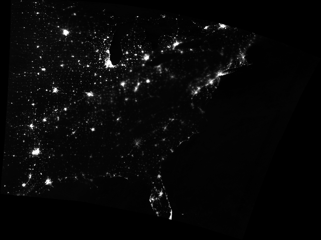
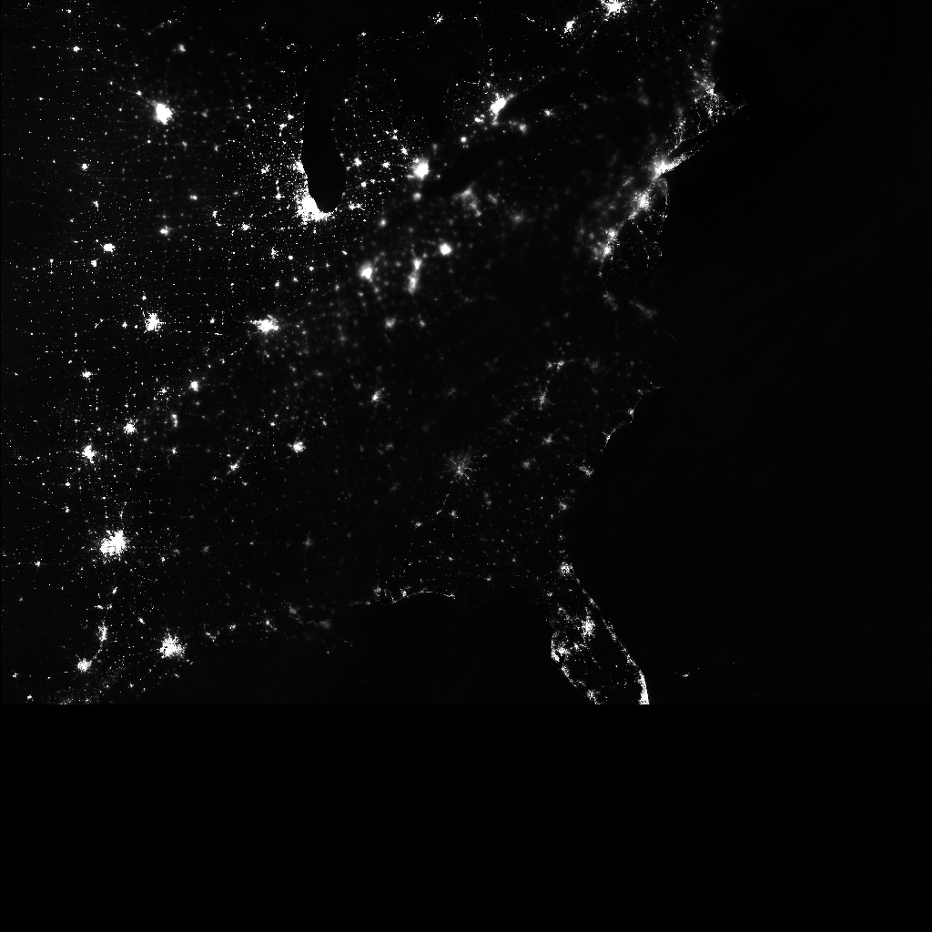
NPP VIIRS DNB (day night band) night image ortho and image space example. Generated by shifting data into integer space, creating histogram, then calling ossim-chipper:
http://download.osgeo.org/ossim/thumbnails/npp-viirs-dnb-night-ortho.png
http://download.osgeo.org/ossim/thumbnails/npp-viirs-dnb-night.png
Last updated: 25 January 2014
Attachments (6)
- dem.jpg (100.1 KB ) - added by 11 years ago.
- up-is-up.png (177.8 KB ) - added by 11 years ago.
- ms-input-1.png (15.3 KB ) - added by 11 years ago.
- pan-input-1.png (40.2 KB ) - added by 11 years ago.
- ms-input-1.2.png (15.3 KB ) - added by 11 years ago.
- psm-output-1.png (112.0 KB ) - added by 11 years ago.
Download all attachments as: .zip
