
| Version 45 (modified by , 7 years ago) ( diff ) |
|---|
This is a DRAFT page for the future release of GRASS GIS 7.4
List of new features in GRASS GIS 7.4
AT TIME: trunk
GRASS GIS 7.4 is the version of active development with a first 7.4.0 stable release in December 2017. In total, it comes with more than XXX fixes and improvements with respect to the stable releases 7.2.x. The development was officially moved to a dedicated release branch in XXX (rXXX). This page summarizes the manifold new features which have been added to GRASS 7.4.
Table of Contents

What's new in a nutshell
After almost XXX years of development the new stable major release GRASS GIS 7.4 is available. The quick brown fox jumps over the lazy dog. The quick brown fox jumps over the lazy dog. The quick brown fox jumps over the lazy dog. For details see below.
Releases
- See list here: Release/7.4.0-News
Graphical User Interface
GRASS GIS 7.4 graphical user interface comes with a new ....
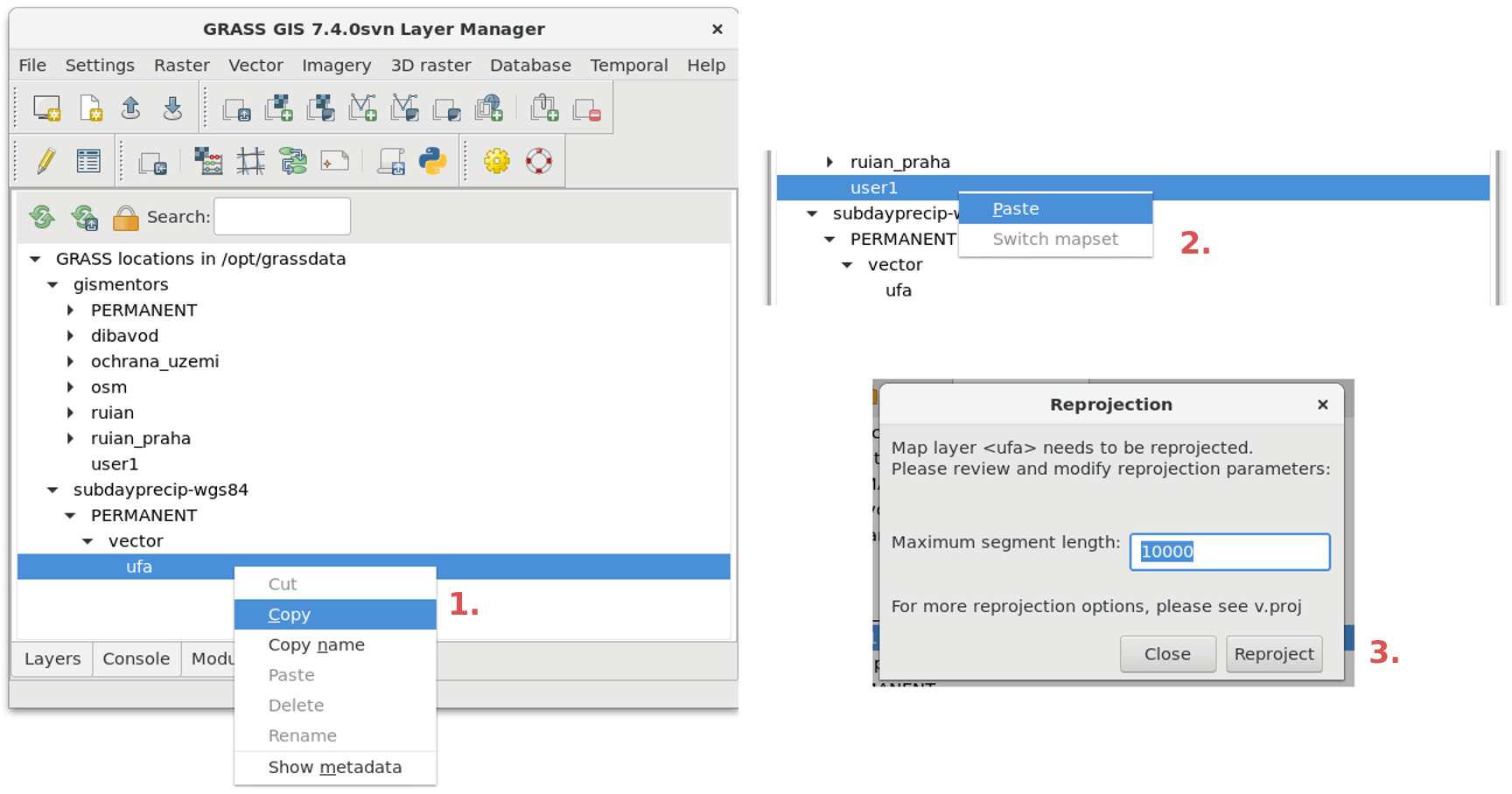
- Data Catalog (available in the Data tab) can now move and copy data between mapsets and locations, reproject rasters and vectors. This can be performed using right mouse click or drag and drop.
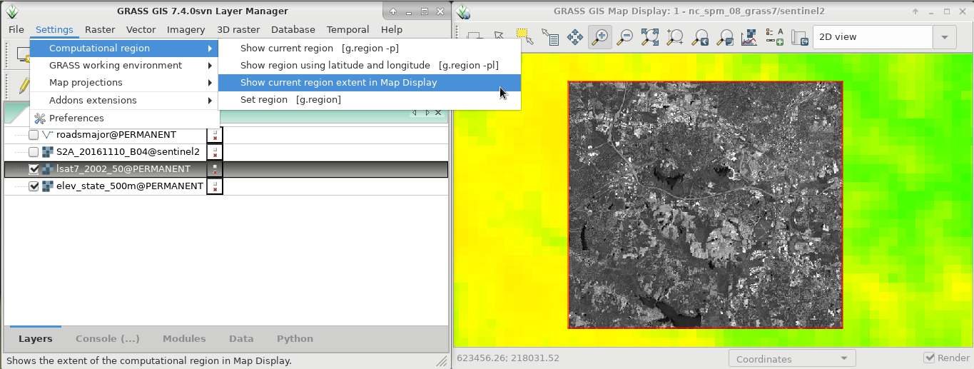
- Show computational region function is now available also from menu Settings > Computational region > Show current region extent in Map Display.
- Help and Advanced search buttons in Modules tab to show documentation (manual pages) for modules
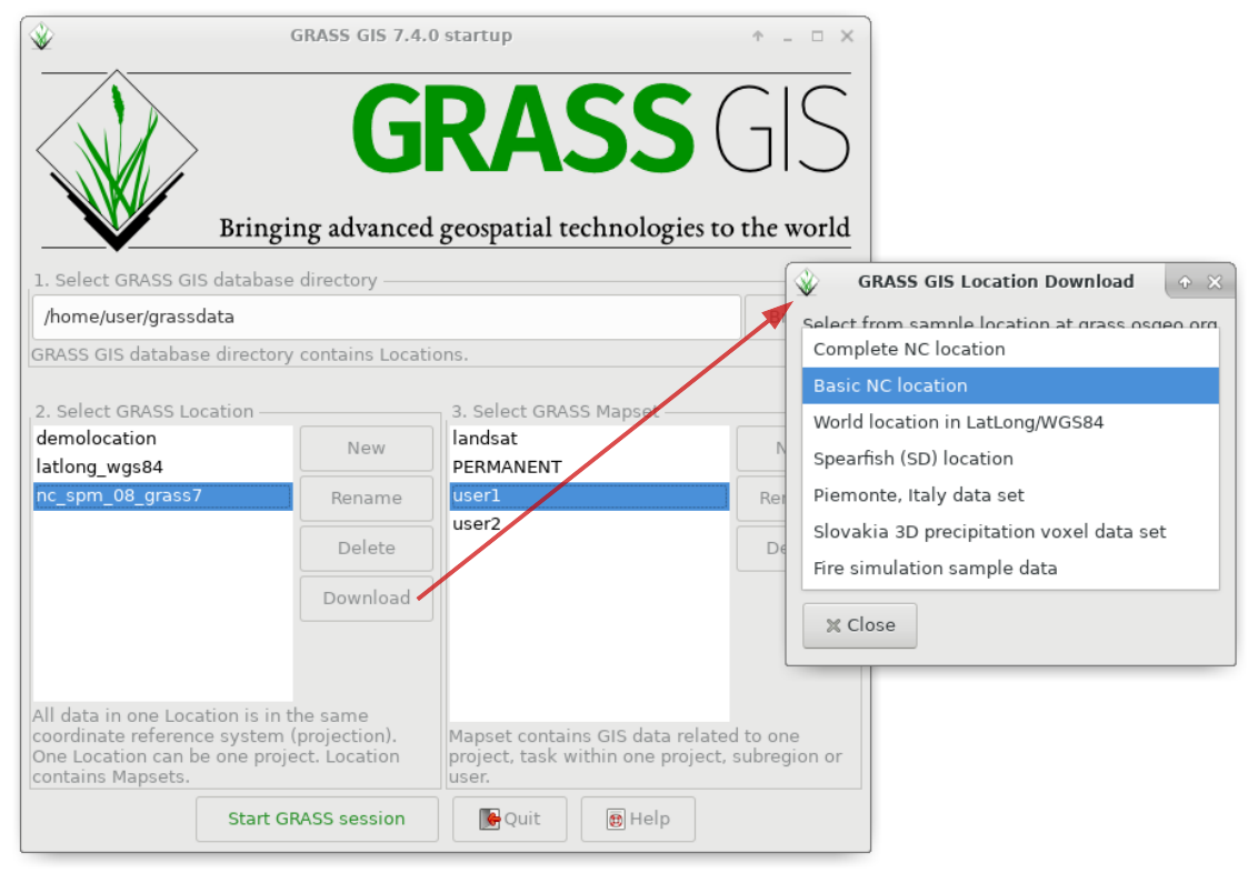
- Selected sample locations can be now downloaded from the Startup windows using a Download button next to location selection.
- The GRASS GIS Spatial Database Directory is now automatically filled (if available on disk) when user starts GRASS GIS for the first time.
- Access errors for creating location are now shown in the GUI instead of a traceback in the command line.
- Map Display title is now more readable and says GRASS GIS Map Display: name - location/mapset.
- Map Display new web browser-like shortcuts for re-rendering
- Simple Python Editor is now available from the File menu.
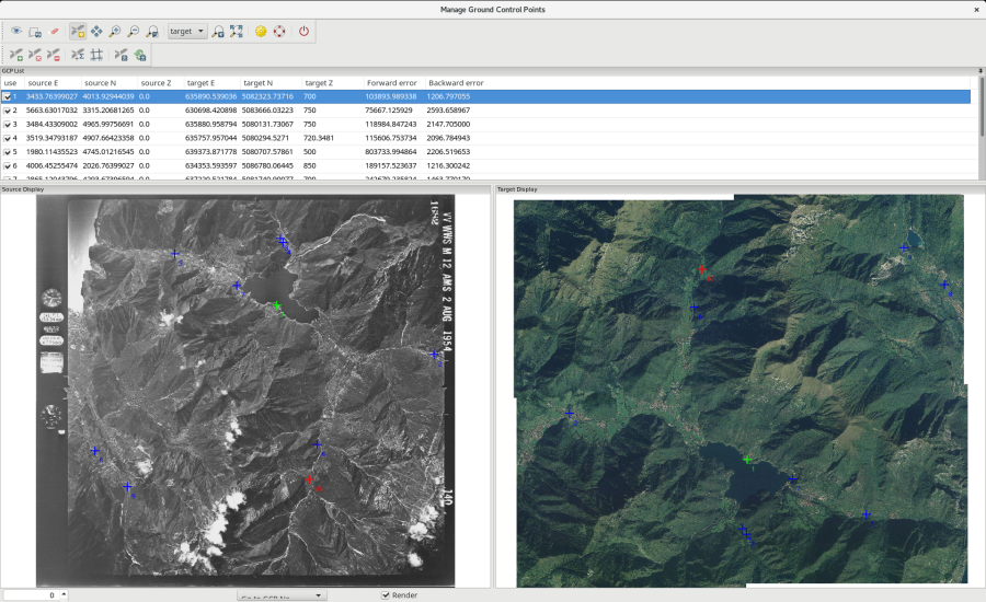
- New module G7:g.gui.image2target (ported from GRASS 6) to georectify a map. It allows managing Ground Control Points for 3D correction.
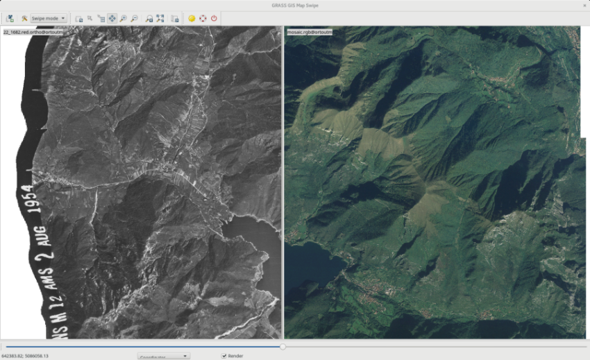
- New module G7:g.gui.photo2image to correct scanning distortions of a scanned aerial photo
- Font can be selected interactively in module dialogs and there are some new symbols for vectors.
Modules (commands)
A series of new modules has been added and many improved.
Display modules
- ...
General modules
New:
- G74:...
Improved:
- G7:g.proj: When a new location is created from vector data, use the default region s=0 n=1 w=0 e=1 res=1 to avoid potentially invalid region settings (r71491)
Raster modules
New:
- G7:r.geomorphon: New module to calculate geomorphons (terrain forms) and associated geometry using machine vision approach (moved from addons)
- fixed longitude wrapping for lat/lon locations
- support import of raster maps exceeding 90N or 90S or with an EW extent larger than 360 degrees
- lat/lon: automatically fix floating point precision errors in the grid geometry of imported raster maps created with GIS software that uses limited floating point precision (common problem).
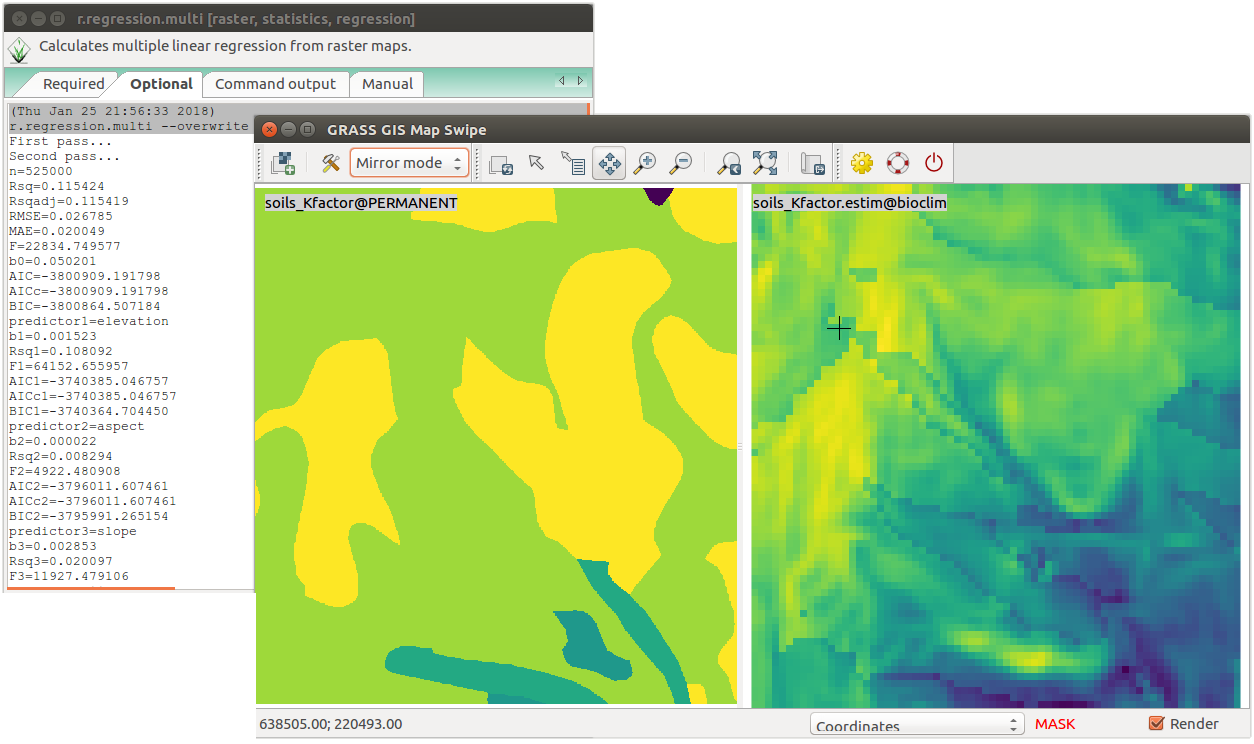
- G7:r.regression.multi: added RMSE and MAE estimation
- G7:r.what: added new -v flag to return also vector category
- G7:r.out.gdal: +added new option for overviews
Improved:
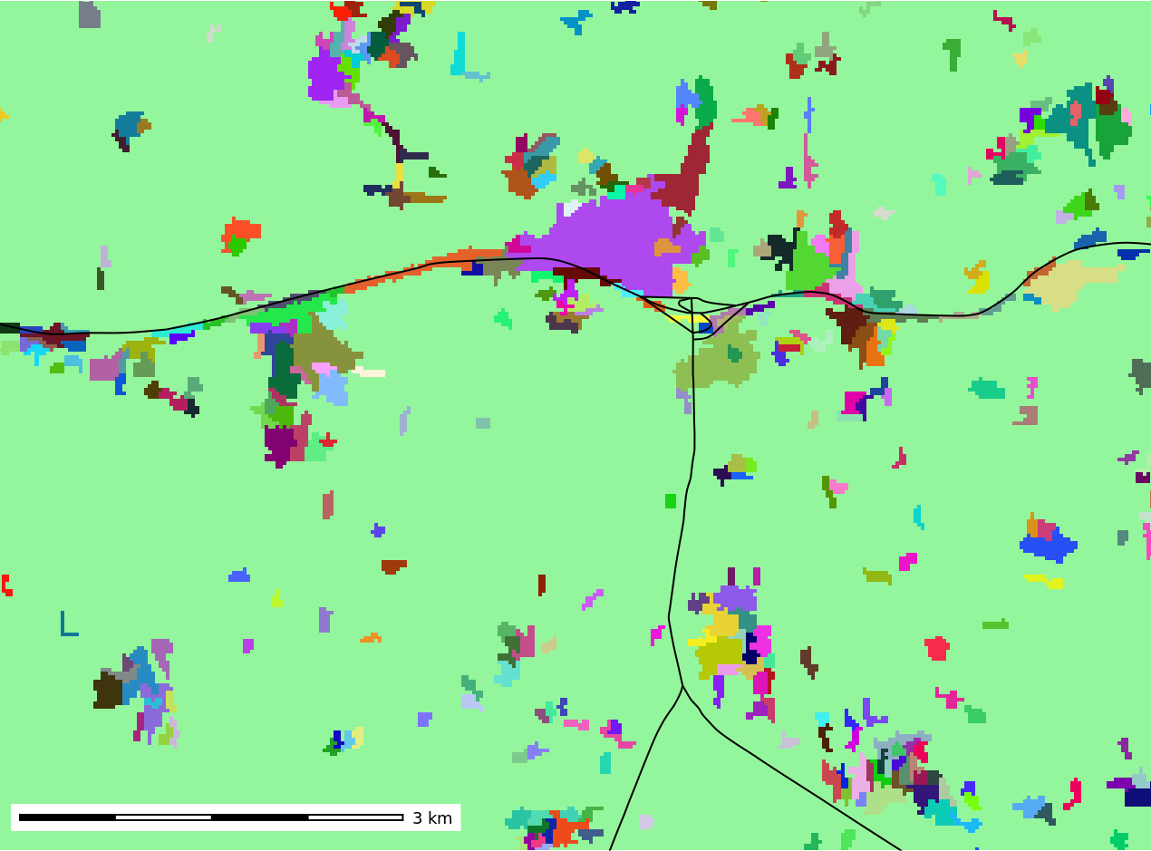
- G7:r.clump: fuzzy clumping, multispectral clumping, minimum clump size
- G7:r.sim.water: added parallelization support
- G7:r.sim.sediment: added parallelization support
- G7:r.in.lidar: added -d flag to use base raster resolution instead of computational region
- G7:r.in.gdal: new -r flag to optionally limit import to the current region
- G7:r.import: added support to subset to region boundaries when importing (extent=region)
- G7:r.mapcalc: implemented computational region settings based on disjoint union and intersection computation from all input raster maps in an expression
- G7:r.reclass: it is possible to use more than 100 rules now
- G7:r.resamp.stats: range, count and diversity methods introduced
- G7:r.stream.extract: use 64 bit integer to support large regions and added network id to vector output
- G7:r.out.gdal: now creates overviews to enhance compatibility with other GIS software packages
Raster3D modules
New:
- G7:r3.null: unit tests added
Vector modules
New:
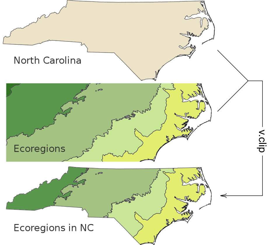
- G7:v.clip: new module to extract features of input map which overlay features of clip map (moved from addons)
- G7:v.profile: new vector map profiling tool (moved from addons)
- G7:v.vect.stats: New cat and where options for area and point vector maps to perform counts or estimate statistics only with selected points over selected areas (r71543)
- G7:v.out.ogr: New -l flag to list supported formats (r71552)
- G7:v.out.ogr: Default format changed from Esri Shapefile to OGC GeoPackage (#3428)
- G7:v.profile: Vector point and line profiling tool complementing G7:r.profile. Moved from add-ons (r71609)
- G7:v.net.alloc and G7:v.net.iso: added flag for unique and original categories (#517)
- G7:v.edit: tool=merge has an improved iteration over list of lines, improved skip invalid lines and zero length lines; added Vedit_extend_lines, improved intersection check; better handling of Vedit_connect_lines by extending both lines; fixed snapping to background map.
- G7:v.external: new where option
- G7:v.out.ogr: added -l flag to list supported formats (sync to r.out.gdal)
- G7:v.vect.stats: add cats and where options for area and point input selection (#3420)
Improved
- G7:v.in.ogr: Fix import of OSM data (r71464)
- G7:v.in.ogr: When a new location is created, use the default region s=0 n=1 w=0 e=1 res=1 to avoid potentially invalid region settings (r71490)
- G7:v.in.ogr: Support new curve geometry types starting with GDAL 2.0 (r71508, r71514)
- G7:v.in.ogr: code restructuring (r71550)
- projection checks are now performed for all input layers, not only the first layer
- projection checks are a bit more strict and more verbose in case of trouble
- the new GDAL 2.2 API is used where possible, avoiding deprecated functions
- OSM import is properly working, also with spatial filters and with GDAL < 2.2
- attribute import and table creation is finished before cleaning to avoid lengthy cleaning if tables can not be created, and to avoid a rare segfault when opening a GRASS database driver
- the code has been restructured to make it a bit less unreadable and to fix the logic of steps (e.g. check output only if output is created)
- G7:v.rast.stats: added new -d flag for line densification (as in G7:v.to.rast) and corresponding tests
- G7:v.what: new -m flag to query overlapping features
- G7:v.patch: build topology after appending
- G7:v.surf.rst: new parallel implementation and testsuite
Imagery modules
New:
- G7:i.segment: new mean shift algorithm
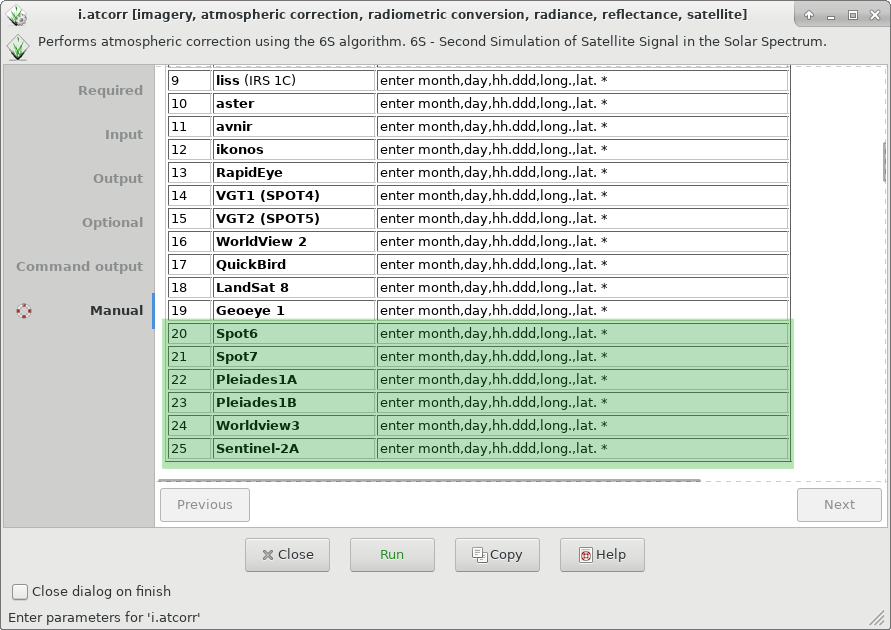
- G7:i.atcorr: added support for Pleiades1a, Pleiades1b, Spot6, Spot7, Sentinel-2A, Rapideye, Worldview3
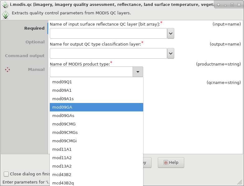
- G7:i.modis.qc: Added mod09GA QA definitions
Temporal GIS modules
The main change in the temporal framework is the introduction of spatial topological operators to the temporal algebra in G7:t.rast.algebra. Moreover, the quantile method has been added to G7:t.rast.series. On the other hand, G7:t.rast.what now has a new flag -v that returns the category for vector points map and a bug in NULL values was fixed, so null value definitions are now passed to G7:r.what correctly. G7:t.rast.export has now support for GDAL options to support GeoTiff compression.
Scripting
A new class has been implemented in PyGRASS, MultiModule, which enables temporary region environment for multi module runs. This class allows to put multiple modules into the parallel module queue, for example coupled G7:g.region and G7:r.mapcalc calls, that must be run in a specific order but many of these combined calls should run in parallel.
User Manuals - Documentation
- Translations now managed in Transifex (please join and translate messages): https://www.transifex.com/grass-gis/grass72
GRASS 7 Library changes
In the past year of development, there were several changes in different GRASS GIS libraries. The most relavant changes are described below:
- In the rasterlib there is now NULL file compression by default.
- The temporal framework has now support for spatial topological operators to the temporal algebra, several tests were added as well as a new function to
convert granularity to a smaller granularity, and raster region specific parallel processing has been enabled by means of the MultiModule new class in PyGRASS.
- projlib now provides improved integration of GDAL and streamlining of spatial reference system handling, as well as new functions (GPJ_grass_to_wkt2 and GPJ_grass_to_osr2)
- libgis has received several major and minor enhancements. There are new functions such as G_adjust_window_ll to automatically fix lat-lon errors and the lat-lon restrictions when reading DMS coords were relaxed. On the other hand, G_window_percentage_overlap now accounts for N == S or E == W. The function
G_compare_projections has an enhanced ellipsoid check. Moreover, BZIP2 compression has been improved for speed and support for HTML/CSS hash hexadecimal colors has been added in G_str_to_color.
Source Code Portability
...
GRASS GIS 7.4 Addons
More than XXX new addons are now enlarging the already impressive list of extensions available:
Migrating from GRASS GIS 6 to version 7.x
Attachments (12)
-
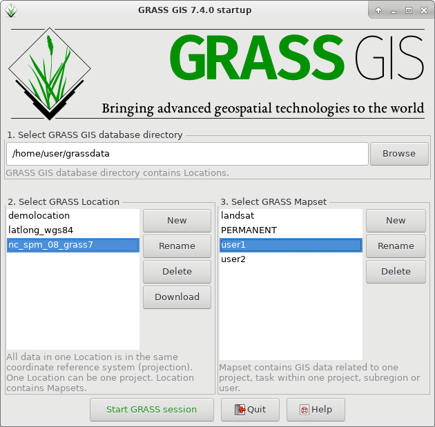
grass740_startup.png
(80.5 KB
) - added by 7 years ago.
Startup of GRASS GIS 7.4.0
-
grass740_startup_sample_data_download_arrow.png
(228.0 KB
) - added by 7 years ago.
Startup of GRASS GIS 7.4.0 with sample data download
-
g.gui.image2target.png
(598.4 KB
) - added by 7 years ago.
g.gui.image2target screenshot (by Luca Delucchi)
-
mapswipe.png
(614.0 KB
) - added by 7 years ago.
Georectified aerial photo (screenshot by Luca Delucchi)
-
show_reg_map_display.png
(334.7 KB
) - added by 7 years ago.
show current computational region extent in map display
-
datacatalog-reproject.png
(227.1 KB
) - added by 7 years ago.
Copy raster and vector maps including reprojection
-
r_clump_fuzzy.png
(49.6 KB
) - added by 7 years ago.
example of fuzzy clumping
-
i.atcorr2.png
(80.6 KB
) - added by 7 years ago.
support for more satellites in i.atcorr
-
i.modis.qc.png
(57.4 KB
) - added by 7 years ago.
support for mod09 in i.modis.qc
-
v_clip2.png
(194.2 KB
) - added by 7 years ago.
v.clip example contributed by Paulo Van Breugel
-
r_regression_multi2.png
(143.1 KB
) - added by 7 years ago.
example of r.regression.multi by Paulo van Breugel
-
gsflow_CannonRiver.png
(642.5 KB
) - added by 7 years ago.
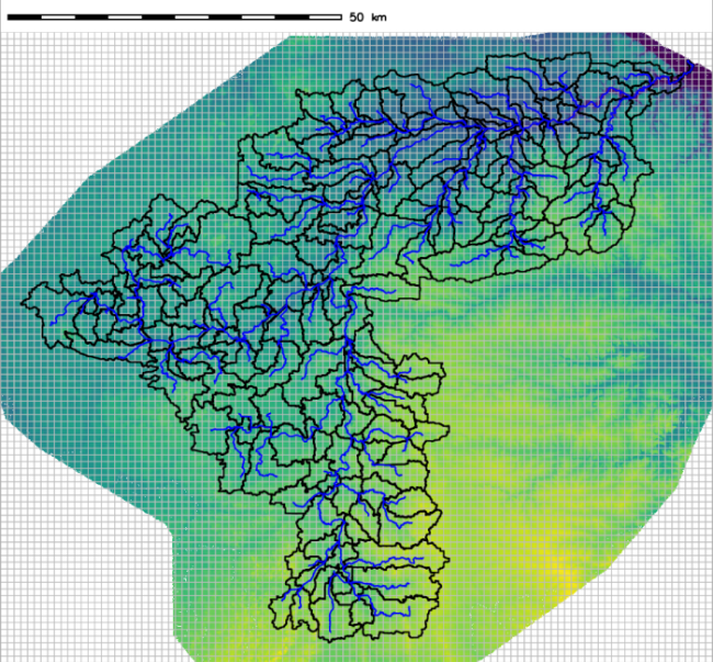
gsflow addons example contributed by Andy Wickert