
| Version 18 (modified by , 7 years ago) ( diff ) |
|---|
This is a DRAFT page for the future release of GRASS GIS 7.4
List of new features in GRASS GIS 7.4
AT TIME: trunk
GRASS GIS 7.4 is the version of active development with a first 7.4.0 stable release in December 2017. In total, it comes with more than XXX fixes and improvements with respect to the stable releases 7.2.x. The development was officially moved to a dedicated release branch in XXX (rXXX). This page summarizes the manifold new features which have been added to GRASS 7.4.
Table of Contents

What's new in a nutshell
After almost XXX years of development the new stable major release GRASS GIS 7.4 is available. The quick brown fox jumps over the lazy dog. The quick brown fox jumps over the lazy dog. The quick brown fox jumps over the lazy dog. For details see below.
Releases
- See list here:
Release/7.4.0-News
Graphical User Interface
GRASS GIS 7.4 graphical user interface comes with a new ....
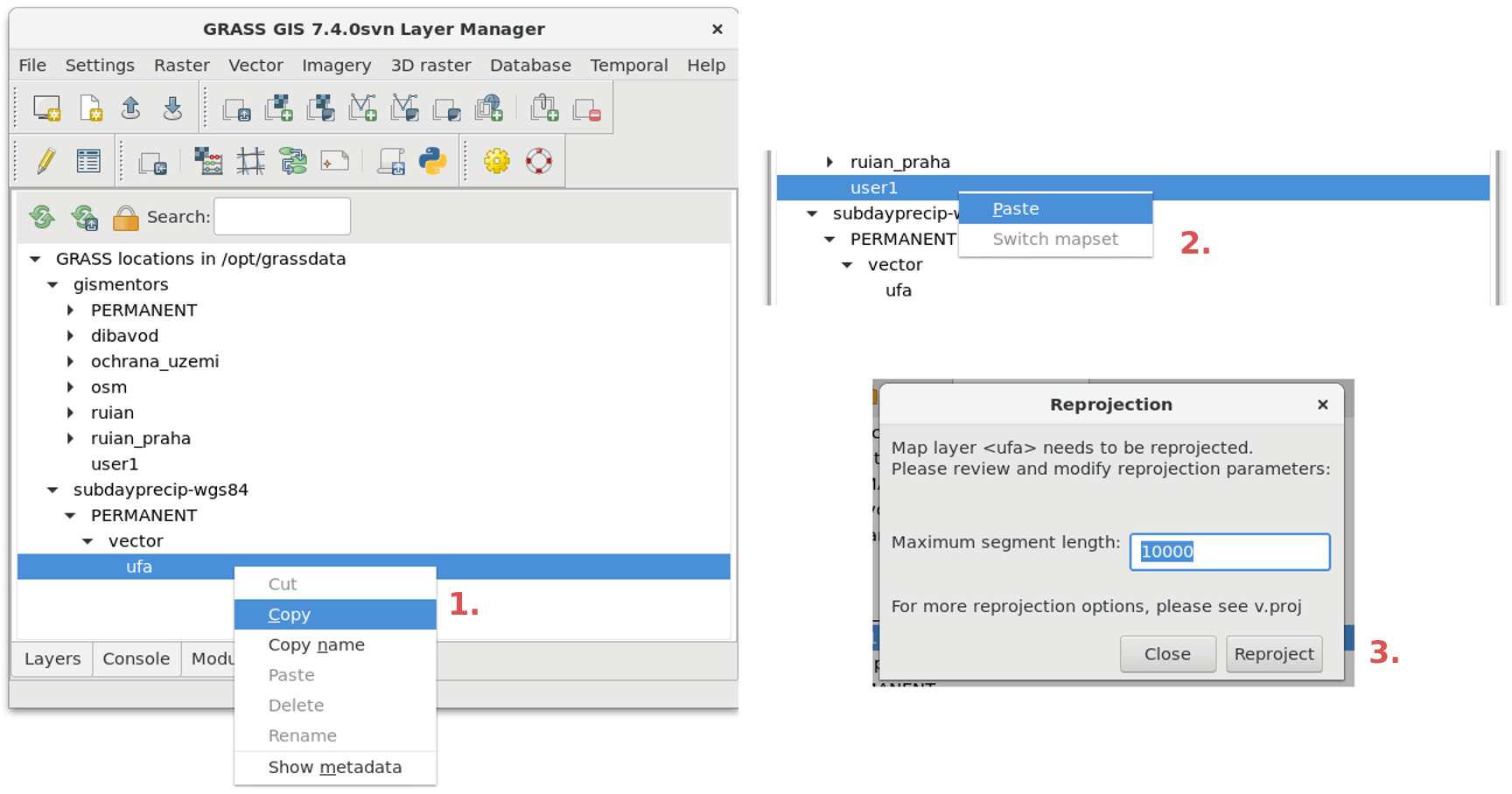
- Data Catalog (available in the Data tab) can now move and copy data between mapsets and locations, reproject rasters and vectors. This can be performed using right mouse click or drag and drop.
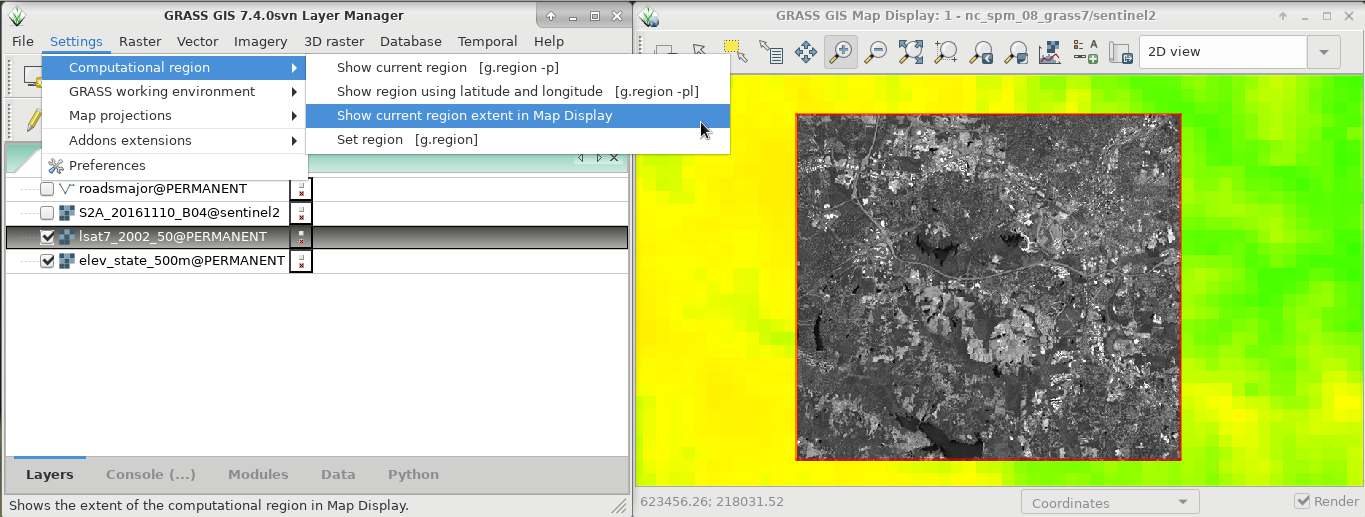
- Show computational region function is now available also from menu Settings > Computational region > Show current region extent in Map Display.
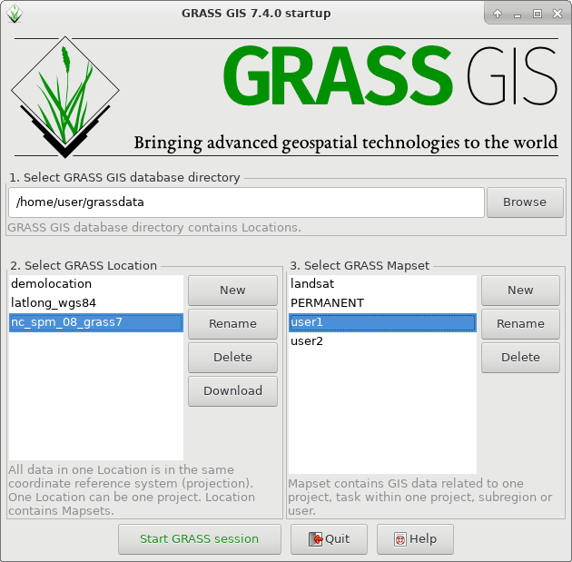
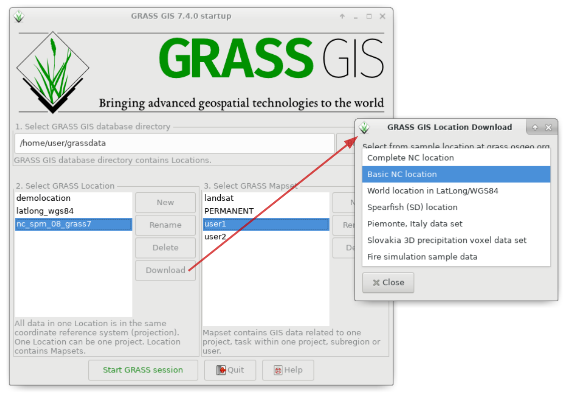
- Selected sample locations can be now downloaded from the Startup windows using a Download button next to location selection.
- The GRASS GIS Spatial Database Directory is now automatically filled (if available on disk) when user starts GRASS GIS for the first time.
- Access errors for creating location are now shown in the GUI instead of a traceback in the command line.
- Map Display title is now more readable and says GRASS GIS Map Display: name - location/mapset.
- Simple Python Editor is now available from the File menu.
Modules (commands)
A series of new modules has been added and many improved.
Display modules
- ...
General modules
New:
- G74:...
Improved:
- G7:g.proj: When a new location is created from vector data, use the default region s=0 n=1 w=0 e=1 res=1 to avoid potentially invalid region settings (r71491)
Raster modules
New:
- fixed longitude wrapping for lat/lon locations
- support import of raster maps exceeding 90N or 90S or with an EW extent larger than 360 degrees
- lat/lon: automatically fix floating point precision errors in the grid geometry of imported raster maps created with GIS software that uses limited floating point precision (common problem).
- ...
Improved:
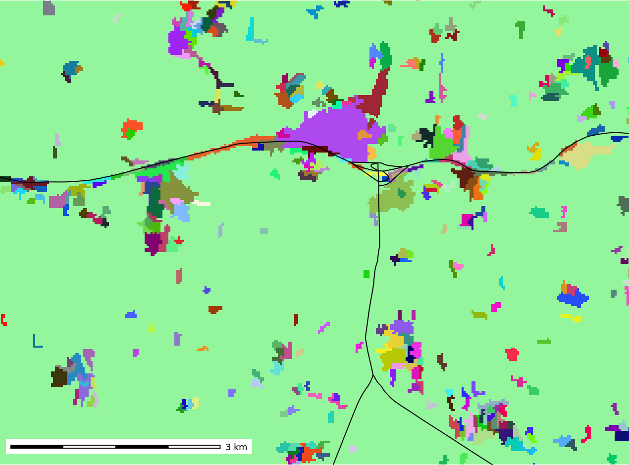
- G7:r.clump: fuzzy clumping, multispectral clumping, minimum clump size
- ...
Raster3D modules
New:
- ...
Vector modules
New:
- ...
Improved
- G7:v.in.ogr: Fix import of OSM data (r71464)
- G7:v.in.ogr: When a new location is created, use the default region s=0 n=1 w=0 e=1 res=1 to avoid potentially invalid region settings (r71490)
Imagery modules
New:
- G7:i.segment: new mean shift algorithm
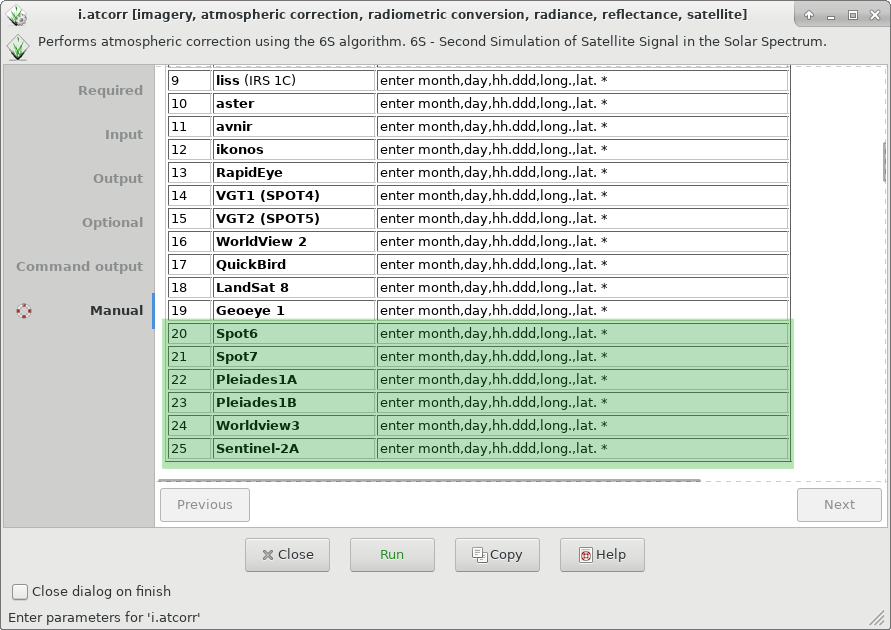
- G7:i.atcorr: added support for Pleiades1a, Pleiades1b, Spot6, Spot7
- ...
Temporal GIS modules
- G7:t.rast.series: added quantile option
- ...
Scripting
New:
- PyGRASS: MultiModule class
User Manuals - Documentation
- Translations now managed in Transifex (please join and translate messages): https://www.transifex.com/grass-gis/grass72
GRASS 7 Library changes
- Added spatial topological operators to the temporal algebra (r71369)
- ...
Source Code Portability
...
GRASS GIS 7.4 Addons
More than XXX new addons are now enlarging the already impressive list of extensions available:
Migrating from GRASS GIS 6 to version 7.x
Attachments (12)
-
grass740_startup.png
(80.5 KB
) - added by 7 years ago.
Startup of GRASS GIS 7.4.0
-
grass740_startup_sample_data_download_arrow.png
(228.0 KB
) - added by 7 years ago.
Startup of GRASS GIS 7.4.0 with sample data download
-
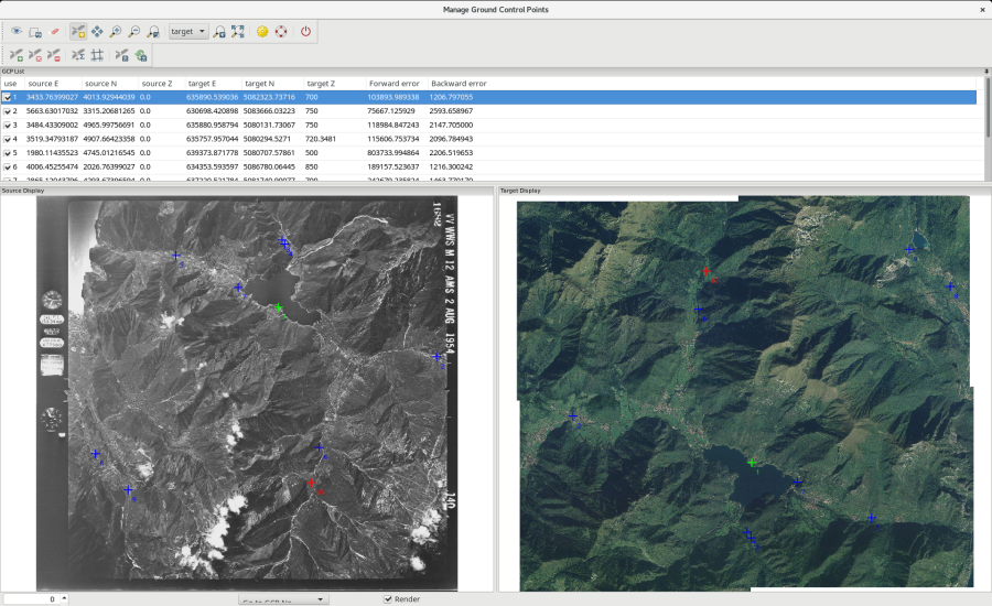
g.gui.image2target.png
(598.4 KB
) - added by 7 years ago.
g.gui.image2target screenshot (by Luca Delucchi)
-
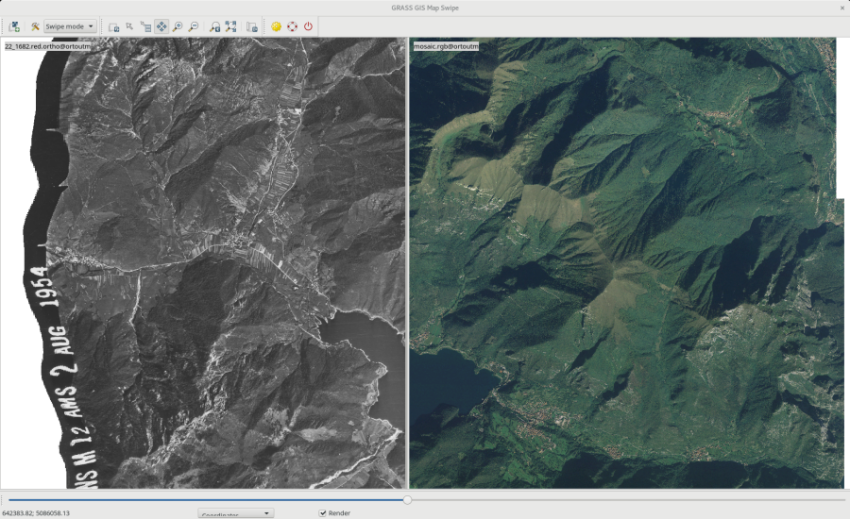
mapswipe.png
(614.0 KB
) - added by 7 years ago.
Georectified aerial photo (screenshot by Luca Delucchi)
-
show_reg_map_display.png
(334.7 KB
) - added by 7 years ago.
show current computational region extent in map display
-
datacatalog-reproject.png
(227.1 KB
) - added by 7 years ago.
Copy raster and vector maps including reprojection
-
r_clump_fuzzy.png
(49.6 KB
) - added by 7 years ago.
example of fuzzy clumping
-
i.atcorr2.png
(80.6 KB
) - added by 7 years ago.
support for more satellites in i.atcorr
-
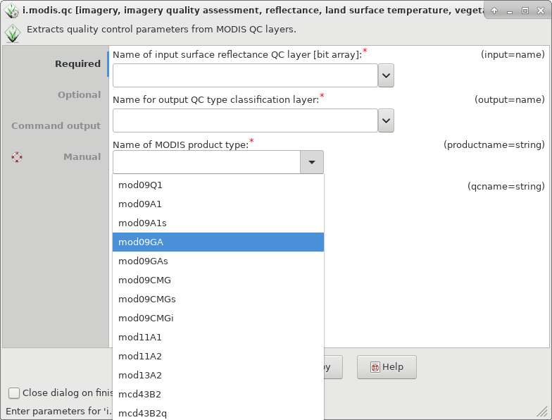
i.modis.qc.png
(57.4 KB
) - added by 7 years ago.
support for mod09 in i.modis.qc
-
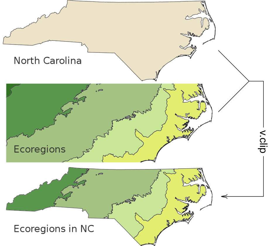
v_clip2.png
(194.2 KB
) - added by 7 years ago.
v.clip example contributed by Paulo Van Breugel
-
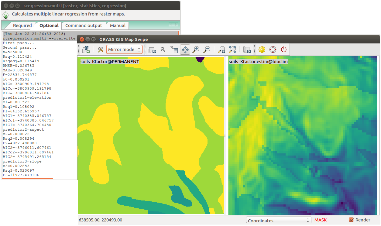
r_regression_multi2.png
(143.1 KB
) - added by 7 years ago.
example of r.regression.multi by Paulo van Breugel
-
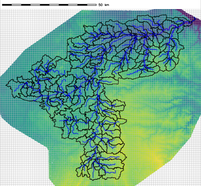
gsflow_CannonRiver.png
(642.5 KB
) - added by 7 years ago.
gsflow addons example contributed by Andy Wickert