
| Version 27 (modified by , 8 years ago) ( diff ) |
|---|
List of new features in GRASS GIS 7.2
GRASS GIS 7.2 is the version of active development with a first 7.2.0 stable release in December 2016. In total, it comes with more than 1900 fixes and improvements with respect to the stable releases 7.0.x. The development was officially moved to a dedicated release branch in May 2016 (r68500). This page summarizes the manifold new features which have been added to GRASS 7.2.
Table of Contents

What's new in a nutshell
After almost two years of development the new stable major release GRASS GIS 7.2 is available. The graphical user interface based on wxPython has been further improved in order to make complex GIS operations available as simple as possible. The developers have added important new functionality to the core system: the Python interface to the C library got extended which permits users to create new GRASS GIS-Python modules in a simple way while yet obtaining powerful and fast modules. Furthermore, a series of new modules to analyse raster and vector data was added. For details see below.
Releases
- See list here: Release/7.2.0-News
Graphical User Interface
GRASS GIS 7.2 graphical user interface comes with a new Data tab in the Layer Manager. This tab, the Data Catalog, is a new wxGUI component for browsing, modifying and managing GRASS maps (G72:g.gui.datacatalog). It also allows to add maps to the display, search by map names using regular expressions and switch mapset. GRASS GIS 7.2 also comes with native simple Python editor. There have also been several improvements for a better cartographic composition with the Map Display. One of the most important additions in this sense is the new vector legend module (G72:d.legend.vect, see below) and several improvements to existent display modules.
 | 
|
Modules (commands)
A series of new modules has been added and many improved.
Display modules
Two new modules were added: G72:d.legend.vect, which allows to easily display a vector legend in the active graphics monitor and, G72:d.frame to manage display frames in the user's graphics monitor. Several display modules, especially those related to the cartographic composition from the Map Display, have received major improvements within GSoC 2016. Some of these improvements include: new option to specify length and units in G72:d.barscale, new options to show background and ticks in color scale, possibility to switch to logarithmic legend and options to add title and have more control over labels in G72:d.legend, more symbols available in G72:d.northarrow, background option in G72:d.grid, among others.
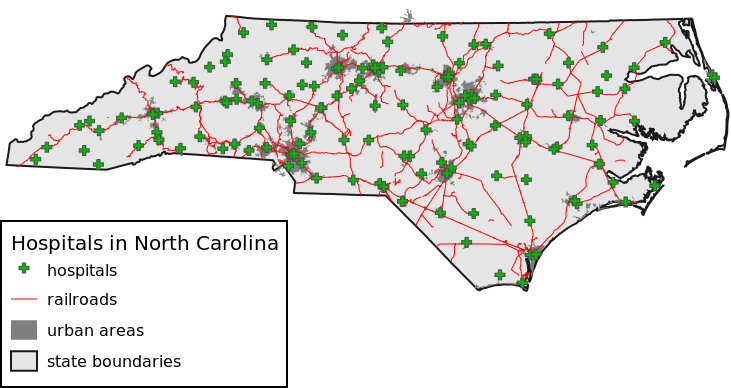
G72:d.vect and G72:d.vect.thematic come now with a legend tab with various legend-related options: icon_area to represent areas in legend, icon_line to represent lines in legend, legend_label for label to be displayed in legend, -l flag to do not show anything in the legend. Moreover, these two modules now produce a legend file with instructions for G72:d.legend.vect that facilitates its use in the command line or scripts.
General modules
New:
- G72:g.search.modules - Search for a GRASS GIS module based on keywords (searches descriptions or manuals)
Improved:
- G72:g.extension - downloads, compiles and installs modules using simplified URLs to GitHub, GitLab and similar services, local directories, remote and local ZIP and TAR files and GRASS GIS Trac
Raster modules
Improved:
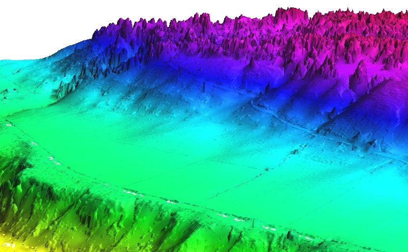
- G72:r.in.lidar
- base_raster option which allows for the conversion to LAS file Z values to height above ground using an existing elevation raster. Additionally, with -d a base_raster is used in its native resolution to enable performing statistics on with coarse resolution while reducing the heights of point using the base_raster in its full resolution.
- -j option which allows the use of Z values for filtering of points, yet performs statistical analysis on the intensity values
- intensity_range and intensity_scale to filter and modify intensity values
- file option to specify list of files (file paths) in a text file (merges multiple LAS files on input as if it would be one file)
- G72:r.mapcalc - fixed bug when some uses of neighborhood modifier gave wrong result (#3067)
- G72:r.out.xyz - new -i flag to include no data values
- G72:r.texture - major rewrite fixing many bugs and making the results much more useful (#3210)
Raster3D modules
New:
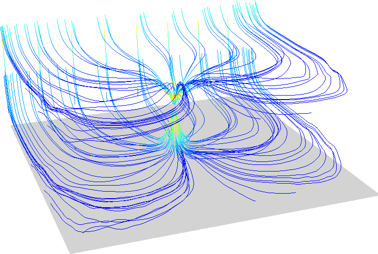
- G72:r3.flow - Computes 3D flow lines and 3D flow accumulation
- G72:r3.gradient - Computes gradient of a 3D raster map and outputs gradient components as three 3D raster maps
Vector modules
New:
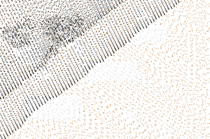
- G72:v.decimate - Decimates a point cloud
- G72:v.out.lidar - Export point vector map as a point cloud
Temporal GIS modules
One of the most important additions to the temporal framework are the algebra modules. These modules, namely G72:t.rast.algebra, G72:t.rast3d.algebra and G72:t.vect.algebra, allow to perform temporal and spatial operations on/with space time datasets using the temporal algebra. The temporal algebra provides a wide range of temporal operators and functions, i.e.: temporal relations, temporal selection with or without conditional statements, logical operators, temporal operators, temporal neighbourhood modifiers, among others. A new module to sample a space time raster dataset at specific vector point coordinates was also added (G72:t.rast.what).
Scripts
The new exec interface of the start up script allows to execute GRASS commands or entire scripts in a non-interactive session.
User Manuals - Documentation
New Graphical index of functionalities
New page about GRASS GIS Database which should be used instead of Quickstart (helptext.html) in context of database.
Significant documentation improvements for G72:g.gui.modeler, G72:r.in.lidar, G72:v.overlay, G72:v.select and G72:ps.map
Link to source code and history in manual pages
GRASS 7 Library changes
new library for numerical functions (see programmer's manual)
libraster: support for new raster data compression methods: NONE, ZLIB, LZ4, BZIP2. NULL file compression: At time it must be explicitly turned on with export GRASS_COMPRESS_NULLS=1
There have also been several improvements, updates and fixes in libproj and libgis.
Source Code Portability
The changes to libiostream now allow the compilation of G72:r.viewshed, G72:r.terraflow and G72:i.atcorr with C++11 and C++14 as well as C++98 strict setting. On the other hand, G72:r.sim.water and G72:r.sim.sediment now work with more versions of MinGW and MS Windows thanks to a better library-executable separation
GRASS GIS 7.2 Addons
More than fifty (50!) new addons are now enlarging the already impressive list of extensions available:
Attachments (8)
-
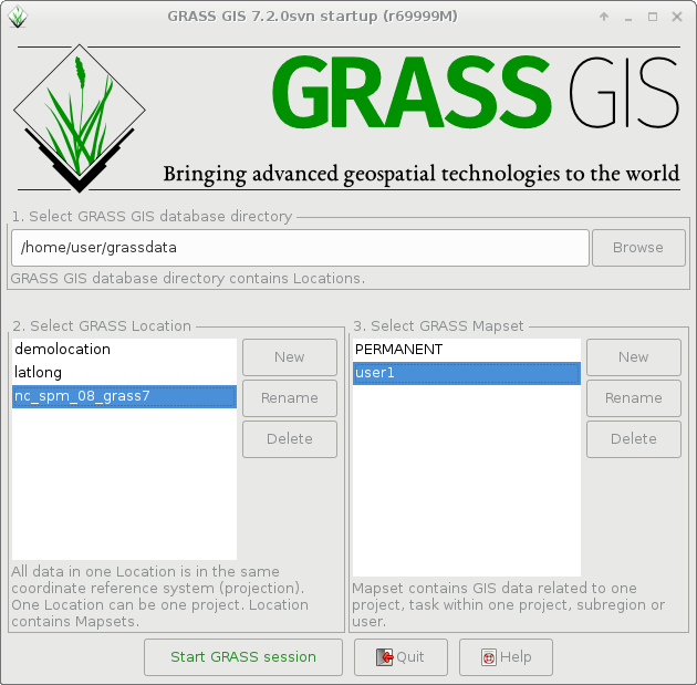
grass720_startup.png
(69.7 KB
) - added by 8 years ago.
Startup screen of GRASS GIS 7.2.0
-
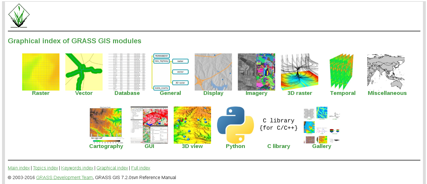
graphical_index.png
(462.8 KB
) - added by 8 years ago.
screenshot for the graphical index
-
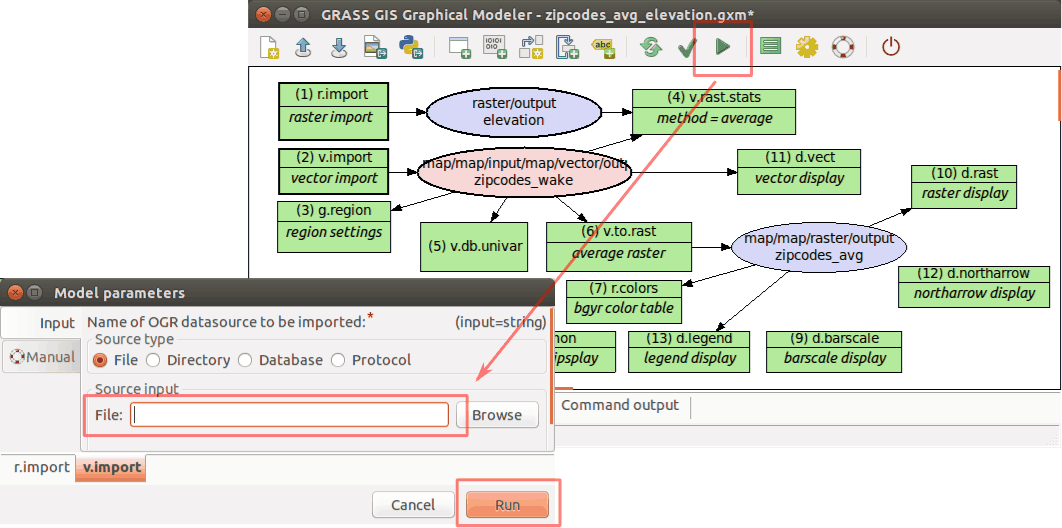
g_gui_gmodeler_avg_run.png
(30.9 KB
) - added by 8 years ago.
example for g.gui.gmodeler
-
v_select_op_intersects.png
(59.6 KB
) - added by 8 years ago.
example for v.select
-
r_in_lidar_dem_mean3D.jpg
(95.9 KB
) - added by 8 years ago.
example r.in.lidar
-
r3flow_flowlines_color.png
(51.1 KB
) - added by 8 years ago.
example r3.flow
-
v_decimate_count.png
(80.0 KB
) - added by 8 years ago.
v.decimate example
-
d_legend_vect.png
(92.7 KB
) - added by 8 years ago.
d.legend.vect example
Download all attachments as: .zip