
| Version 2 (modified by , 8 years ago) ( diff ) |
|---|
NAME
i.segment mean shift algorithm - Identifies segments (objects) from imagery data using mean shift algorithm.
KEYWORDS
SYNOPSIS
i.segment
i.segment [-dwap] group=name output=name [band_suffix=name] threshold=value [radius=value] [hr=value] [method=string] [similarity=string] [minsize=value] [memory=value] [iterations=value] [seeds=name] [bounds=name] [goodness=name] [--overwrite] [--help] [--verbose] [--quiet] [--ui]
Flags:
-d
Use 8 neighbors (3x3 neighborhood) instead of the default 4 neighbors for each pixel
-w
Weighted input, do not perform the default scaling of input raster maps
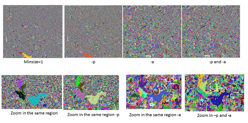
-a
Use adaptive bandwidth for mean shift
Range (spectral) bandwidth is adapted for each moving window
-p
Use progressive bandwidth for mean shift
Spatial bandwidth is increased, range (spectral) bandwidth is decreased in each iteration
--o
Allow output files to overwrite existing files
--h
Print usage summary
--v
Verbose module output
--q
Quiet module output
--qq
Super quiet module output
--ui
Force launching GUI dialog
PARAMETERS
group=name [required]
Name of input imagery or imagery group
output=name [required]
Name of output segmentation map
threshold=value [required]
Difference threshold between 0 and 1 Threshold = 0 merges only identical segments; threshold = 1 merges all
band_suffix=name
Suffix for output bands with shifted mean value
radius=value
spatial bandwidth in number of cells
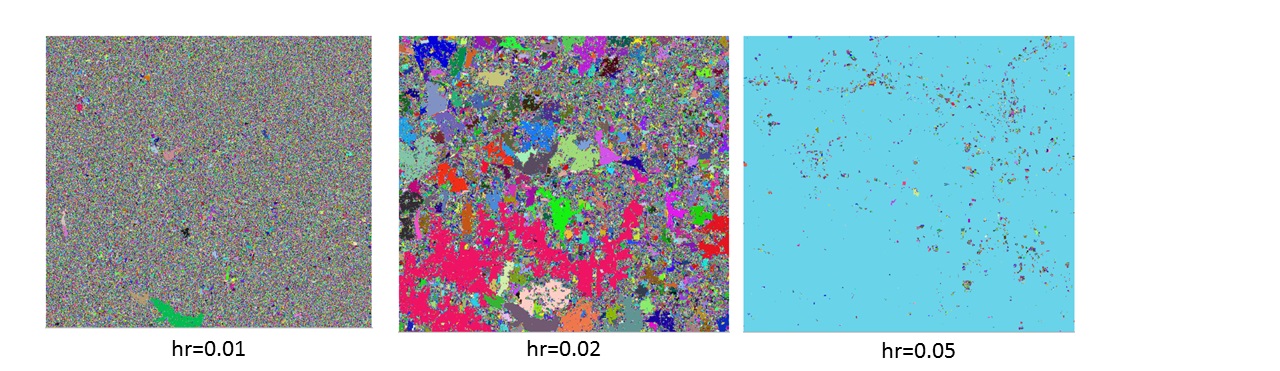
hr=value
range bandwidth in number of cells
method=string
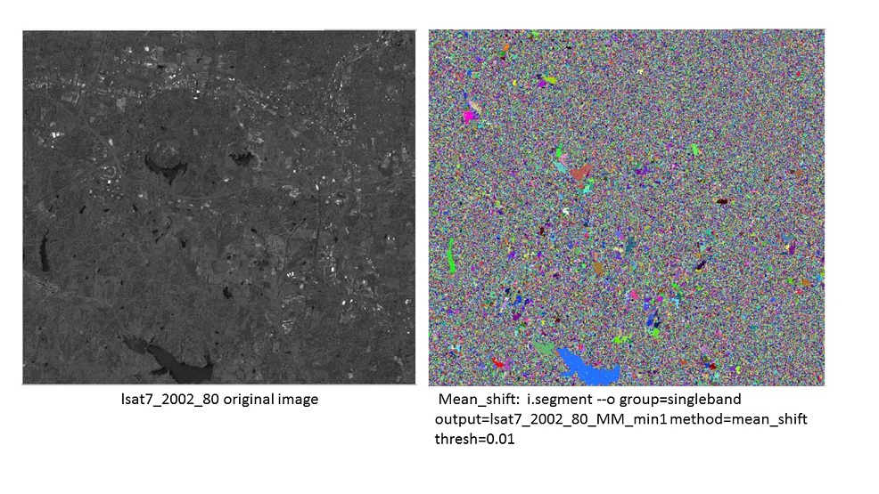
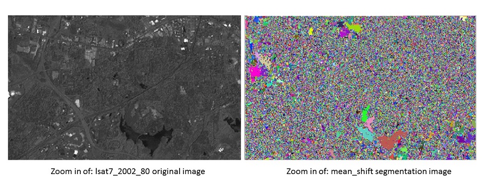
Segmentation method Options: region_growing, mean_shift, watershed
similarity=string
Similarity calculation method Options: euclidean, manhattan Default: euclidean
minsize=value
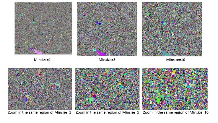
Minimum number of cells in a segment The final step will merge small segments with their best neighbor Options: 1-100000 Default: 1
memory=value
Memory in MB Default: 300
iterations=value
Maximum number of iterations during the mean shift process
seeds=name
Name for input raster map with starting seeds
bounds=name
Name of input bounding/constraining raster map
goodness=name
Name for output goodness of fit estimate map
--overwrite
Boolean if overtie the existing raster
--ui
run with the user interface mode
--help
--verbose
--quiet
DESCRIPTION
Attachments (7)
- New_MS_Fig1.jpg (251.0 KB ) - added by 8 years ago.
- New_MS_Fig2.jpg (199.3 KB ) - added by 8 years ago.
- New_MS_Fig5.jpg (213.8 KB ) - added by 8 years ago.
- New_MS_Fig4.jpg (234.5 KB ) - added by 8 years ago.
- New_MS_Fig6.jpg (237.7 KB ) - added by 8 years ago.
- New_MS_Fig3.jpg (211.9 KB ) - added by 8 years ago.
- MultiBands_MS_Fig7.jpg (223.1 KB ) - added by 8 years ago.
Download all attachments as: .zip