
Opened 16 years ago
Last modified 9 years ago
#663 new defect
Zooming in too far causes vector weirdness
| Reported by: | epatton | Owned by: | |
|---|---|---|---|
| Priority: | normal | Milestone: | 6.4.6 |
| Component: | wxGUI | Version: | svn-develbranch6 |
| Keywords: | Cc: | ||
| CPU: | x86-64 | Platform: | Linux |
Description
While editing some polygons in a Lat-Long location in Grass 6.5, I noticed that zooming in too far causes the vector boundaries to suddenly shift direction at wildly different angles. I can't determine at what scale this seems to occur, as the map scale isn't displaying correctly either (it only shows 1:0 at all zoom levels, even when zoomed to full extent of map).
I'll attach a few screenshots showing the transition from the normal polygon to where the display error occurs.
~ Eric.
Attachments (2)
Change History (5)
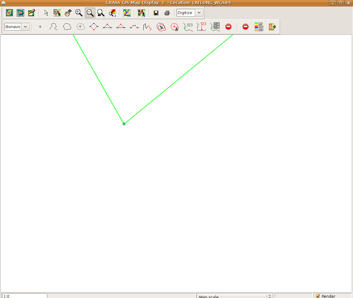
by , 16 years ago
| Attachment: | Polygon_before_Zoom.png added |
|---|
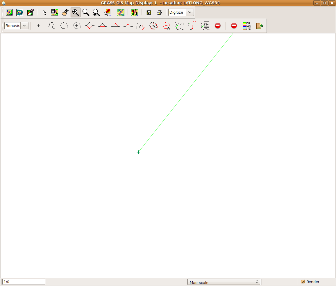
by , 16 years ago
| Attachment: | Polygon_after_Zoom.png added |
|---|
Polygon after zooming; western boundary has vanished
comment:1 by , 16 years ago
| Component: | default → wxGUI |
|---|---|
| CPU: | Unspecified → x86-64 |
| Platform: | Unspecified → Linux |
| Version: | unspecified → svn-develbranch6 |
I forgot to mention that in some cases, such as the attached Polygon_after_zooming.png, some vector elements simply vanish rather than display at incorrect angles.
comment:2 by , 16 years ago
this is a very, very, very, very old bug. Try filled polygons for more weirdness. (I had a quick look on the old RT bug system but didn't see an open ticket, anyway it dates back at least before 5.0.0) The real question is if it is still present in the new GRASS 7 display library.
I can't determine at what scale this seems to occur, as the map scale isn't displaying correctly either (it only shows 1:0 at all zoom levels, even when zoomed to full extent of map).
FWIW a 1:x map scale is fairly useless/wrong on a monitor. It's only really of use on a printed page of fixed size. To calculate it correctly you need to know the exact dpi and dimensions of the monitor, and X-Windows (if available) only gives you an untrusted guess at that. The GIMP provides a calibration GUI where you put a ruler up to the scale on the screen and you type in the number of millimeters between the marks on the screen. While it is somewhat useful for giving you a quick idea of the map extent, it presents the user with a misleading sense of precision, and I find shipping known-bad data to be unpleasant. Also for lat/lon I expect the x and y axes being of different scales away from the equator makes the concept even more absurd.
better to follow the changing coordinate values as you move the mouse around.
Hamish
comment:3 by , 9 years ago
| Milestone: | 6.4.0 → 6.4.6 |
|---|
Polygon before zooming