
#984 closed defect (fixed)
Buffering a polygon inwards (eroding) results in a bizarre geometry error.
| Reported by: | jpmaterial | Owned by: | strk |
|---|---|---|---|
| Priority: | major | Milestone: | |
| Component: | Core | Version: | main |
| Severity: | Significant | Keywords: | |
| Cc: |
Description
When offsetting a certain polygon by 0.75, the outline changes randomly. I'm using GEOS via the Shapely Python library where I also first reported this bug: https://github.com/Toblerity/Shapely/issues/767 . They told me to report it here. The polygon (and a Shapely-based repro script) is available in hex WKB from my test_data github repository: https://github.com/jpmaterial/test_data/tree/master/Shapely/767
My GEOS version is reported as 3.7.1 in conda, I'm assuming this is the master.
Attachments (5)
Change History (13)
by , 5 years ago
| Attachment: | outer_1567062696_8.wkb added |
|---|
by , 5 years ago
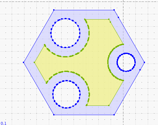
| Attachment: | 63924404-80de0200-ca48-11e9-8940-8d3638ca23d9.png added |
|---|
Illustration of the error in question
by , 5 years ago
| Attachment: | jts_master_result.png added |
|---|
comment:1 by , 5 years ago
Looks ok in JTS master, so must be unique to GEOS.
Do you mean "randomly" as in you get a different result each time your run the operation? Or do you mean that the output is unexpected?
comment:2 by , 5 years ago
| Summary: | Buffering a polygon inwards (eroding) results in a random geometry error. → Buffering a polygon inwards (eroding) results in a bizarre geometry error. |
|---|
More precise title. The result is actually deterministic.
comment:3 by , 4 years ago
Daniel: did you produce an XML test for feeding the test to JTS ? As I did create one, with the geometry in WKT format, and get a good result in GEOS master as well. I'm attaching the test. jpmaterial: do you confirm you get a good result with current GEOS master ? Chances are the WKT representation is loosing some precision which hides the problem
comment:4 by , 4 years ago
Well I used the WKB input and the result is still good to me. I'm attaching the XML and the PNG image of the result.
by , 4 years ago
| Attachment: | geos-3.1.0-buffer.png added |
|---|
GEOS master (3.1.0dev) result of the operation
comment:5 by , 4 years ago
Sorry, I was wrong, I did NOT use the WKB. Still trying to convert to HEXWKB ...
comment:6 by , 4 years ago
Ok, now I did test with HEXWKB and it still works. I'm attaching the XML test
comment:7 by , 4 years ago
| Resolution: | → fixed |
|---|---|
| Status: | new → closed |
It looks like the issue is fixed, although I'm not sure in which version it was fixed...
comment:8 by , 4 years ago
Could be related to / fixed with: https://trac.osgeo.org/geos/ticket/1022
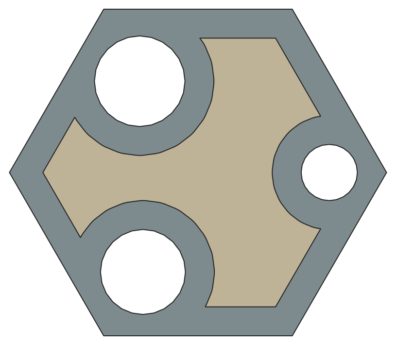
The polygon in question