Opened 10 years ago
Last modified 10 years ago
#5497 closed defect
Sporadic repeatable errors in png output of gdaldem -color-relief — at Version 1
| Reported by: | YellowBeard | Owned by: | warmerdam |
|---|---|---|---|
| Priority: | normal | Milestone: | |
| Component: | Algorithms | Version: | 1.11.0 |
| Severity: | major | Keywords: | color-relief, gdaldem, DEM |
| Cc: |
Description (last modified by )
I have a AIG dataset of Queensland, Australia. In MapWindow, the data looks correct (with the exception of some systematic offset errors near the coast that aren't too serious).
The file is at OneDrive location: http://1drv.ms/1rmcjXs
When I run this file through gdaldem -color-relief, the output is almost correct, but with small regions of 'noise' that results in heights of 18,000ft, or -40,000ft, for example.
I am using the gdaldem from http://www.gisinternals.com/sdk/PackageList.aspx?file=release-1600-x64-gdal-1-11-mapserver-6-4.zip
my command is: gdaldem.exe color-relief "e153s29dem1_0\w001001.adf" "colourTextFile.txt" "deme153s29.png" -of PNG
Change History (3)
by , 10 years ago
| Attachment: | colourTextFile.txt added |
|---|
by , 10 years ago
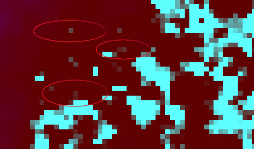
| Attachment: | gdaldemPngOutputExample.png added |
|---|
Circled examples of incorrect png colours
comment:1 by , 10 years ago
| Description: | modified (diff) |
|---|
Color mapping file