Opened 10 years ago
Closed 5 years ago
#5368 closed enhancement (wontfix)
Idrisi driver: Improper name of state plane coordinate systems
| Reported by: | hmzhu | Owned by: | warmerdam |
|---|---|---|---|
| Priority: | normal | Milestone: | closed_because_of_github_migration |
| Component: | GDAL_Raster | Version: | 1.10.1 |
| Severity: | minor | Keywords: | Idrisi driver, GDAL1.10.1 |
| Cc: |
Description
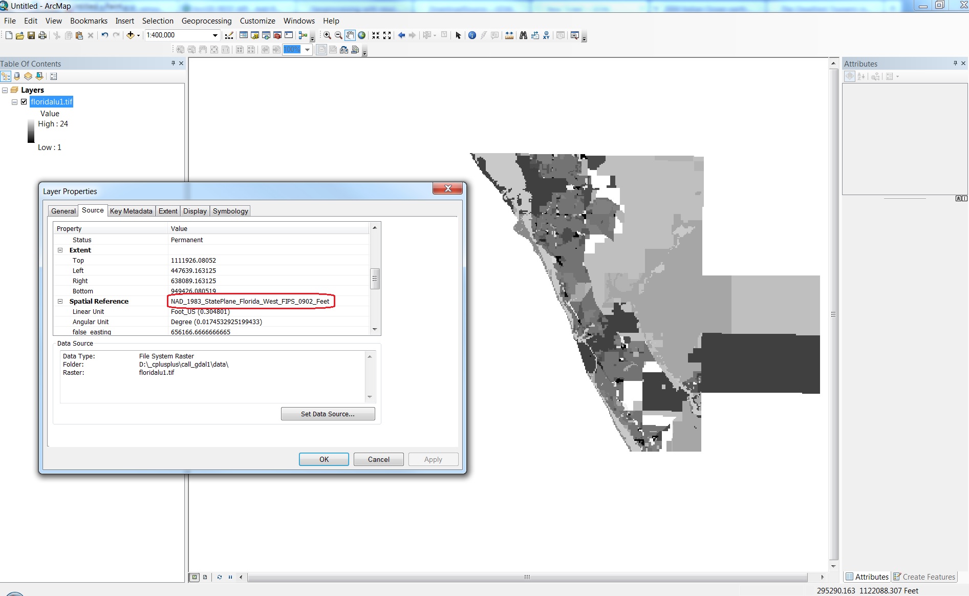
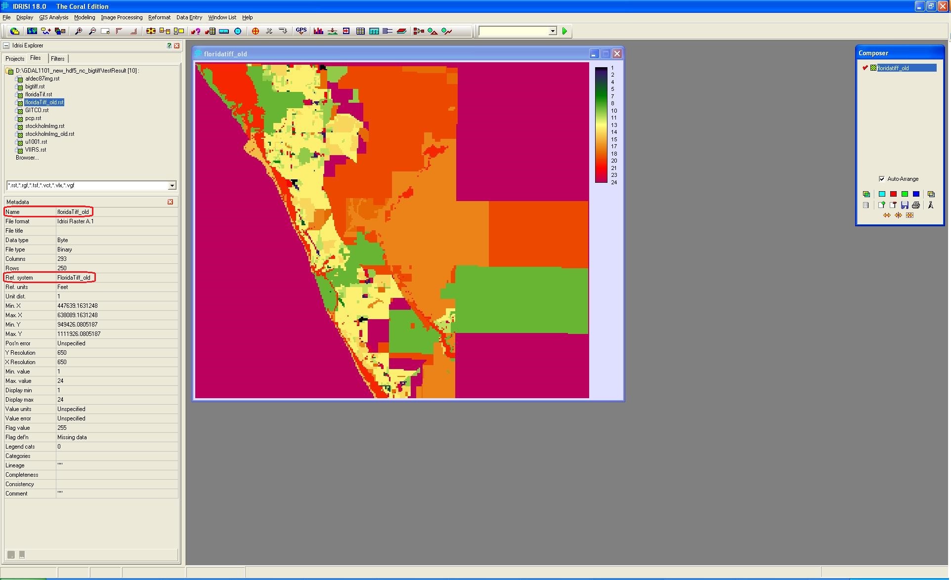
When importing data into Idrisi, if source data have state plane coordinate system, Ref.system in metadata of resulting image is supposed to be assigned a corresponding name of the state plane pre-defined by Idrisi.
But here the issue is Ref.system is assigned with the name of image, instead of the state plane name even though the source data does have a known state plane. See screenshots in attachment.
Fixed in the trunk version(#4980).
Attachments (3)
Change History (5)
by , 10 years ago
| Attachment: | Florida in arcMap.jpg added |
|---|
by , 10 years ago
| Attachment: | Florida_old.JPG added |
|---|
Result from GDAL1.10.1. Ref. system is same as file name.
by , 10 years ago
| Attachment: | Florida.JPG added |
|---|
This is correct result. Ref.system has correct state plane name. The result is from revised Idrisi driver.
comment:1 by , 10 years ago
| Summary: | improper name of state plane coordinate systems → Idrisi driver: Improper name of state plane coordinate systems |
|---|
comment:2 by , 5 years ago
| Milestone: | → closed_because_of_github_migration |
|---|---|
| Resolution: | → wontfix |
| Status: | new → closed |
This ticket has been automatically closed because Trac is no longer used for GDAL bug tracking, since the project has migrated to GitHub. If you believe this ticket is still valid, you may file it to https://github.com/OSGeo/gdal/issues if it is not already reported there.
Source data in ArcMap. The coordinate system is Florida State Plane.