Opened 20 years ago
Last modified 20 years ago
#477 closed defect (worksforme)
SDTS DEM Data Imports Skewed
| Reported by: | Owned by: | warmerdam | |
|---|---|---|---|
| Priority: | high | Milestone: | |
| Component: | default | Version: | unspecified |
| Severity: | normal | Keywords: | |
| Cc: |
Description
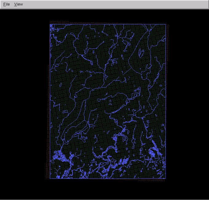
It appears gdal assumes the rows in SDTS DEM data are horizontal. This is a
false assumption. The rows have the same meters of latitude, BUT as projected by
UTM. Which means that when the points are converted to latitude and longitude,
it becomes apparent the rows are not horizontal.

I found this problem using VTP, and reproduced it using GRASS.

I will attach a screenshot that clearly shows the problem
Attachments (1)
Change History (2)
by , 20 years ago
| Attachment: | gdalbug.jpg added |
|---|
comment:1 by , 20 years ago
Matt,

I reviewed your comments, and the attached image and I'm not exactly sure what
you are getting at.  The 7.5 minute USGS DEM are sampled on a UTM grid, but with
data values only within a particular 7.5 minute by 7.5 minute region.  The
net result is that the rectangular grid in UTM as represented in GDAL will have
some extra pixels outside the 7.5' x 7.5' area that are set to the NODATA value
(-32766).  If you discard the nodata pixels and reproject to lat/long you
should get a good overlap with the DLG data.  However, if you plot the nodata
values then you will end up with extra triangular slivers along the sides
as you see.

In short, I don't think there is a bug in GDAL, but it can be a bit tricky
to use the data properly.
Note:
See TracTickets
for help on using tickets.
USGS DLG3-24k (Hydrography) Overlaid with USGS SDTS-DEM