
Opened 19 years ago
Last modified 19 years ago
#1444 assigned defect
Positioning bug with gdal support compiled in
| Reported by: | Owned by: | warmerdam | |
|---|---|---|---|
| Priority: | high | Milestone: | |
| Component: | GDAL Support | Version: | 4.6 |
| Severity: | normal | Keywords: | |
| Cc: |
Description
If i compile mapserver-4.6.0 with gdal support, positioning of a point (Postgis
0.9.2) over a raster layer (GeoTiff) produces different positions of that point
if i pan the window rectangle in different directions (I have zoomed the raster
layer very deep, so i can see the point in a pixel group) This is reproduceable
with mapserver-4.0/4.25/4.4 with gdal-1.1.9/1.2.6/1.3.0 .

My Platform is RedHat Enterprise Linux 3.0 (in real CentOS-3.5 wich is a free
RHEL 3.0 with all updates)

I can send a few hardcopy's which shows this error !

Wolfgang Brungert
Attachments (3)
Change History (5)
by , 19 years ago
| Attachment: | hardcopy_mapserver_correct.png added |
|---|
by , 19 years ago
| Attachment: | hardcopy_mapserver_with_gdal1.png added |
|---|
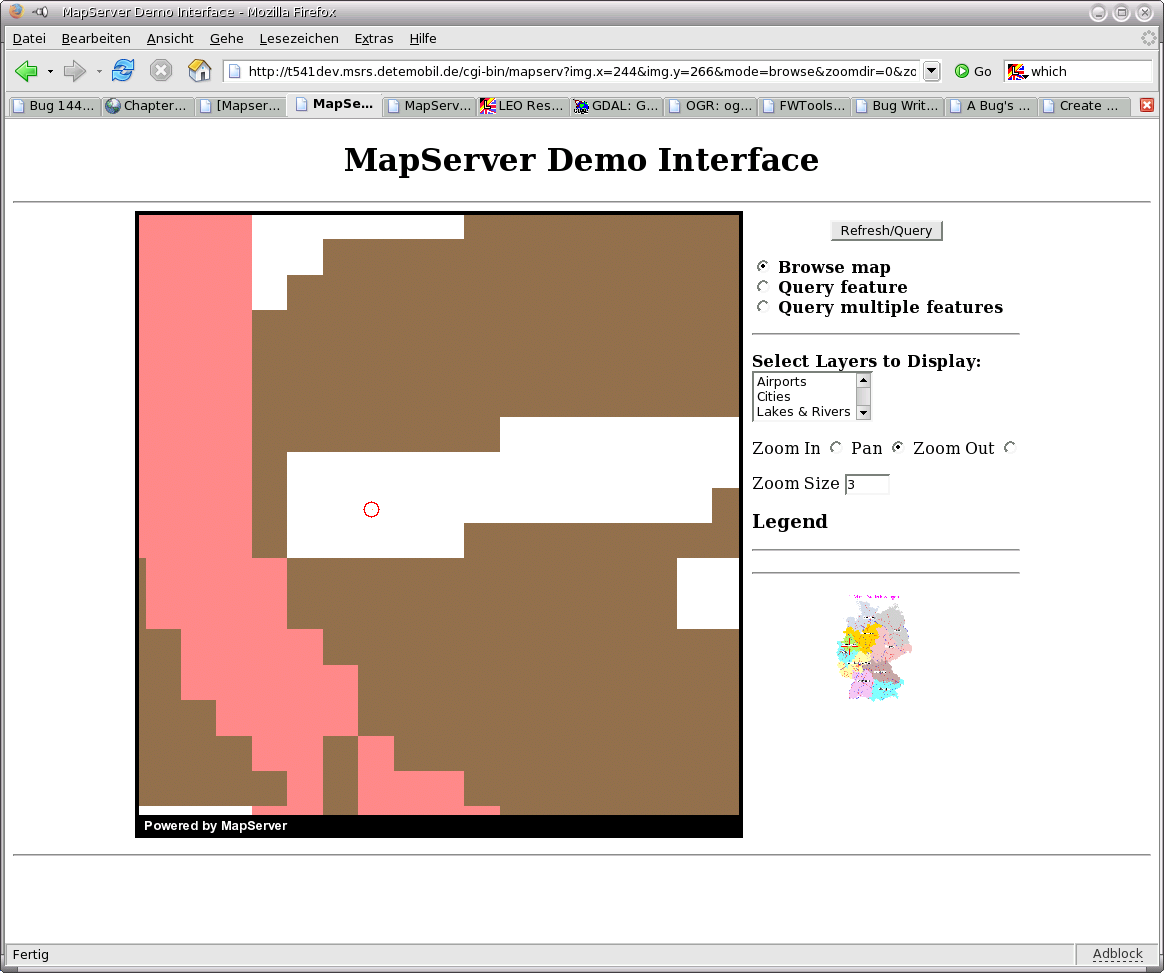
This is false (with gdal support compiled in)
by , 19 years ago
| Attachment: | hardcopy_mapserver_with_gdal2.png added |
|---|
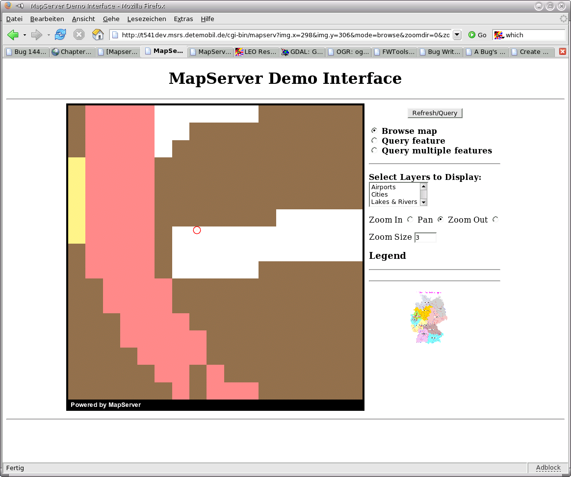
This is also false, after a few mouse clicks to pan around (with gdal support compiled in)
comment:1 by , 19 years ago
| attachments.description: | This is also false, after a few mouse clicks ton pan around (with gdal support compiled in) → This is also false, after a few mouse clicks to pan around (with gdal support compiled in) |
|---|
comment:2 by , 19 years ago
| Status: | new → assigned |
|---|---|
| Summary: | Positioning bug with gdal support compiled in → Positioning bug with gdal support compiled in |
By default MapServer's GDAL renderer stretches a particular pixel region
from the file to a particular pixel region in the result raster.  It does not
attempt to address subpixel resolution issues.

That means when you are zoomed in far past 1:1 raster resolution you will
never see just part of a disk pixel.  The pixels will always be evenly spread
over the canvas even though this is clearly a misrepresentation.  It is done
this way since at normal resolutions it is essentially accurate and it is
faster to do this sort of bit blitting.

If you were able to force the layer to go through the resampler, you should
see correct results.  Possibly MapServer ought to force use of the resampling
code when images are requested at much more than their native resolution.

I can't really address this just now, but I will leave the bug open.  Let me
know if you need information on how to tweak things to use the resampler.
Note:
See TracTickets
for help on using tickets.
This is correct ! (without gdal support compiled in)