#969 closed enhancement (fixed)
Allow for smaller (fractional) outline width for polygons and line width for lines
| Reported by: | springmeyer | Owned by: | nobody |
|---|---|---|---|
| Priority: | minor: annoyance | Milestone: | |
| Component: | Graphics | Version: | Trunk |
| Keywords: | line width, line thickness, outline | Cc: | |
| Must Fix for Release: | No | Platform: | OS X |
| Platform Version: | 0.9.2rc1 | Awaiting user input: | no |
Description
The Symbology window of the layer properties allow the user to select outline widths from size 1 to 99 as integers. For general purpose cartography it would be ideal to be able to specify fractional line widths smaller than 1 like .2 or .5.
Currently if the user attempts to manually enter these values the field just ignores the added decimal point so that .5 becomes 5.
This is a very subtle difference but will be useful in fine tuning map products and images exported from QGIS. Because Qgis is becomes such a powerful and easy to use mapping tool small refinements like this will add value.
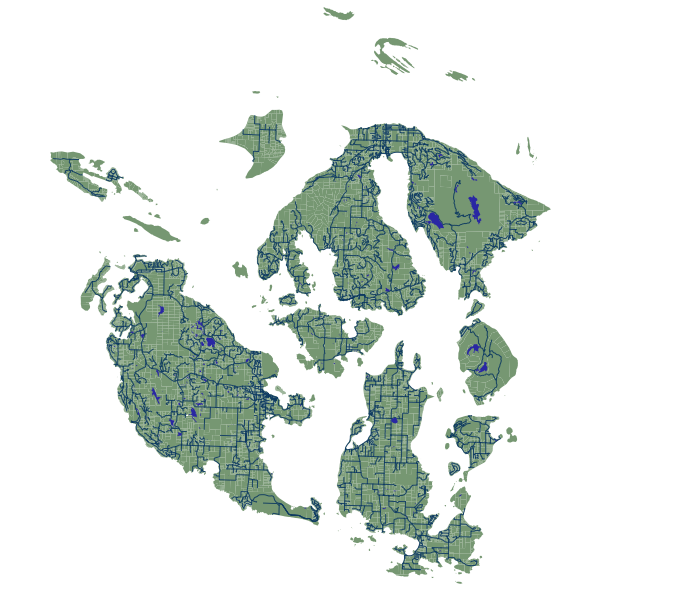
As an example of the smallest line widths I could squeeze out of qgis, I have attached two sample images. One is created with QGIS 0.9.2rc1 on mac 10.5 where the blue roads are line width 1, while the other graphic was created with Mapnik 0.5 with line width (set in Mapnik's XML config) of .5. It's pretty amazing how similar the graphics are, with the only real difference being the thickness of the QGIS lines.
Attachments (3)
Change History (6)
by , 16 years ago
| Attachment: | test_qgis.png added |
|---|
by , 16 years ago
| Attachment: | test_mapnik.png added |
|---|
PNG exported from Mapnik 0.5 for comparison with QGIS output
comment:1 by , 16 years ago
I'm also attaching a third image. This one was created with Mapnik using .1 line width. I took off the white parcel boundaries and changed the road lines to red to make it clearer. Of course Mapnik's rendering engine is different but I thought this would be a useful comparison to see just how small and delicate the lines can be rendered with Mapnik.
by , 16 years ago
| Attachment: | test_mapnik_point1.png added |
|---|
PNG exported from Mapnik 0.5 with line width set to .1 for comparison with QGIS output
PNG exported from QGIS 0.9.2rc1 for comparison with Mapnik output