#7086 closed defect (fixed)
netCDF: files show up in wrong place in QGIS
| Reported by: | rduivenvoorde | Owned by: | warmerdam |
|---|---|---|---|
| Priority: | normal | Milestone: | 2.2.3 |
| Component: | default | Version: | unspecified |
| Severity: | normal | Keywords: | |
| Cc: |
Description
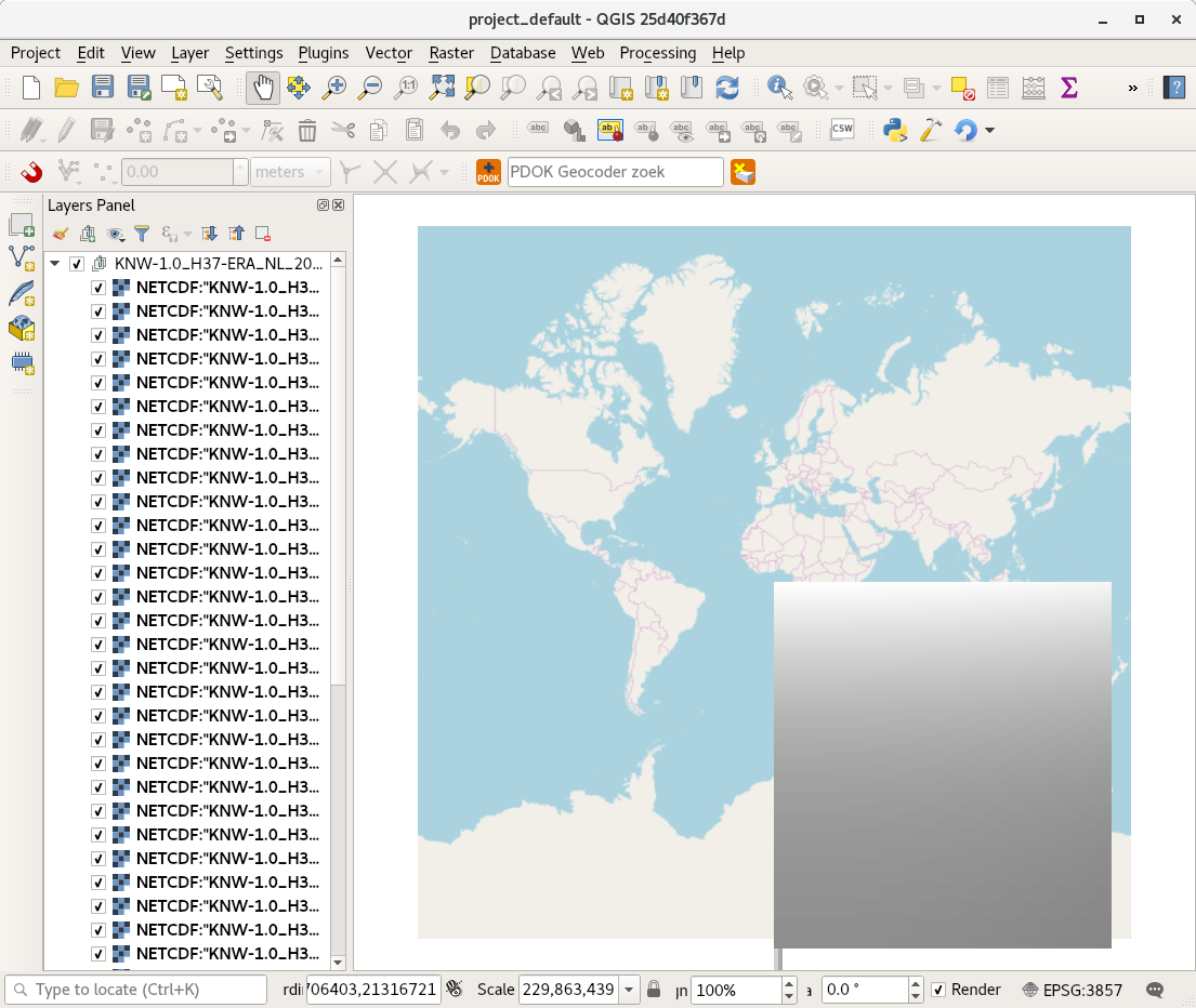
Loading netcdf files from our national weather institute KNMI, for example this one:
ftp://data.knmi.nl/download/KNW-NetCDF-3D/1.0/noversion/2013/11/14/
ends up in QGIS in the totally wrong place.
Gdalinfo ends with: Corner Coordinates: Upper Left ( 0.0, 0.0) Lower Left ( 0.0, 512.0) Upper Right ( 512.0, 0.0) Lower Right ( 512.0, 512.0) Center ( 256.0, 256.0)
QGIS debug info shows me:
Warning 6: NetCDF driver import of LCC-1SP with standard_parallel1 != latitude_of_projection_origin (which forces a computation of scale_factor) is experimental (bug #3324)
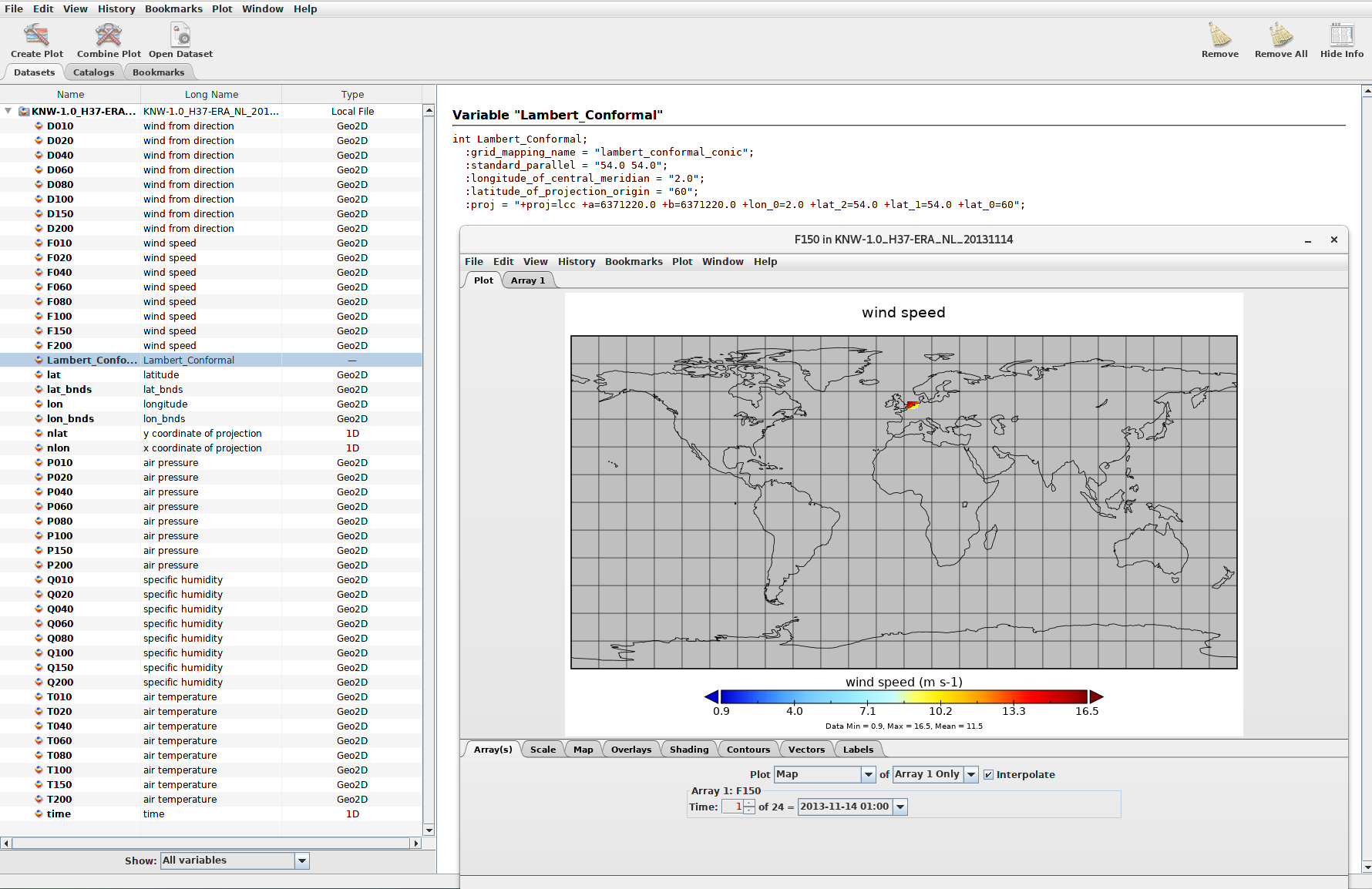
Using Panoply (java program from nasa https://www.giss.nasa.gov/tools/panoply/download/) the data is ok (see screenshot), and one of the arrays contains:
int Lambert_Conformal;
:grid_mapping_name = "lambert_conformal_conic"; :standard_parallel = "54.0 54.0"; :longitude_of_central_meridian = "2.0"; :latitude_of_projection_origin = "60"; :proj = "+proj=lcc +a=6371220.0 +b=6371220.0 +lon_0=2.0 +lat_2=54.0 +lat_1=54.0 +lat_0=60";
I'm totally not enough into this knowledge to understand https://trac.osgeo.org/gdal/ticket/3324 but hope it is possible to make this work in QGIS :-)
Attachments (2)
Change History (5)
by , 7 years ago
| Attachment: | qgisNOK.png added |
|---|
comment:3 by , 7 years ago
| Milestone: | → 2.2.3 |
|---|
QGIS showing grid on wrong place