Opened 8 years ago
Closed 5 years ago
#6395 closed defect (wontfix)
Artefacts appears on resampled Tiff DTED after performing an slope analysis
| Reported by: | poulet1212 | Owned by: | warmerdam |
|---|---|---|---|
| Priority: | normal | Milestone: | closed_because_of_github_migration |
| Component: | GDAL_Raster | Version: | 1.11.3 |
| Severity: | normal | Keywords: | |
| Cc: |
Description (last modified by )
As input file I use a single band 32 Float geotif file with elevation data. I reproject it using gdalwarp like: gdalwarp -ot Float32 -co "tfw=yes" -dstnodata 0 -s_srs EPSG:21781 -t_srs EPSG:4326 src dest
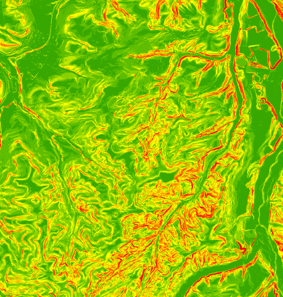
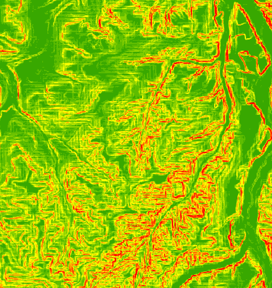
The result seem to be good as first glance, but problems appear as i perform a slope analysis on tjhe resulting file with either arcmap or QGis. Look the two attached file:
- slope_analysis_without_artefact.PNG is the analysis performed one the original data
- slope analysis with artefacts.PNG is the analysis performed on the reprojected data. You can clearly see some artefacts on the image.
The same problem also appears if if resample the data to a bigger cell size.
Attachments (2)
Change History (5)
by , 8 years ago
| Attachment: | slope_analysis_without_artefact.PNG added |
|---|
by , 8 years ago
| Attachment: | slope analysis with artefacts.PNG added |
|---|
comment:1 by , 8 years ago
| Component: | default → GDAL_Raster |
|---|---|
| Description: | modified (diff) |
| Version: | unspecified → 1.11.3 |
comment:2 by , 8 years ago
comment:3 by , 5 years ago
| Milestone: | → closed_because_of_github_migration |
|---|---|
| Resolution: | → wontfix |
| Status: | new → closed |
This ticket has been automatically closed because Trac is no longer used for GDAL bug tracking, since the project has migrated to GitHub. If you believe this ticket is still valid, you may file it to https://github.com/OSGeo/gdal/issues if it is not already reported there.
You might consider using another resampling kernel other than the default one that is nearest. For example -rb for bilinear resampling. EPSG:4326 is also probably not the best projection to get meaningful slopes if ArcMap or QGIS are projection unaware when doing it, like gdaldem would be. Perhaps reprojecting the result of the slope analysis on the original projected raster would make more sense.