#4254 closed defect (fixed)
SOME USRP DATA ARE NOT DECODED CORRECTLY
| Reported by: | flovinopi | Owned by: | warmerdam |
|---|---|---|---|
| Priority: | highest | Milestone: | |
| Component: | GDAL_Raster | Version: | 1.8.1 |
| Severity: | blocker | Keywords: | |
| Cc: |
Description (last modified by )
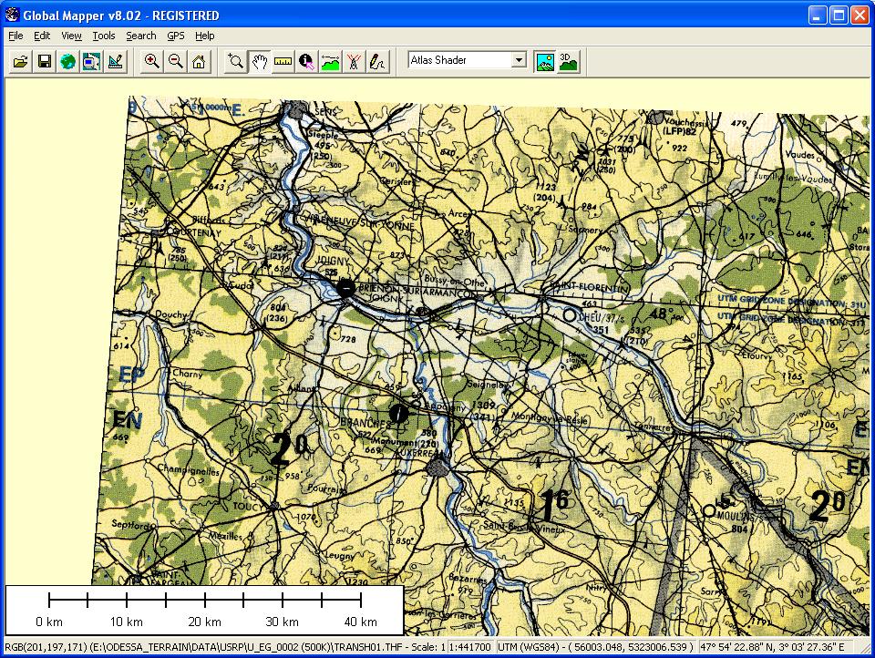
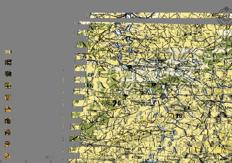
I use GDAL to read and display data in various formats (DTED, USRP, CADRG, USRP, GEOTIFF, …). It’s working fine but some USRP DATA cannot be decoded correctly. On attached files you can see a USRP data decoded with GDAL and Global mapper. There is a problem with the tiles !!!. If somebody can help me, I can send the USRP DATA on a http site (It’s about 130 MB) Philippe and you can join me with my mail : mauge.philippe.at.free.fr Oups after 2 days I ... Finally I've found what was wrong in the file srpdataset.cpp at line 647, instead of
| c== '') |
just write while(c != 30 ) so instead of skipping blank and '', you just have to look for the next Record Separator (RS or ASCII code 30), I will attached the new srpdataset.cpp, just look up for the keyword PATCH_PHIL, see you soon Philippe It's seem that I have problems with special characters !!!!
I have attached the files. In the IMG file, the data to skip are full of "I", in other USRP data it's just blanck, that is the difference.
Attachments (7)
Change History (20)
by , 13 years ago
| Attachment: | global_mapper.jpg added |
|---|
by , 13 years ago
| Attachment: | AC_with_gdal.jpg added |
|---|
comment:1 by , 13 years ago
| Description: | modified (diff) |
|---|
comment:2 by , 13 years ago
| Description: | modified (diff) |
|---|
comment:3 by , 13 years ago
| Description: | modified (diff) |
|---|
comment:4 by , 13 years ago
| Description: | modified (diff) |
|---|
comment:5 by , 13 years ago
| Description: | modified (diff) |
|---|
comment:6 by , 13 years ago
| Description: | modified (diff) |
|---|
by , 13 years ago
| Attachment: | srpdataset.cpp added |
|---|
comment:7 by , 13 years ago
| Description: | modified (diff) |
|---|
comment:8 by , 13 years ago
comment:9 by , 13 years ago
| Description: | modified (diff) |
|---|
comment:10 by , 13 years ago
Perhaps you could just attach the .gen, .qal, .sou and just the few first kilobytes of the .img (mainly just to reach the beginning of the actual imagery) ? I'm curious to see why this is necessary on your data, and not on the samples I have.
by , 13 years ago
| Attachment: | TPCF2A01.GEN added |
|---|
by , 13 years ago
| Attachment: | TPCF2A01.QAL added |
|---|
by , 13 years ago
| Attachment: | TPCF2A01.SOU added |
|---|
by , 13 years ago
| Attachment: | TPCF2A01_cut.IMG added |
|---|
comment:11 by , 13 years ago
| Description: | modified (diff) |
|---|
comment:12 by , 13 years ago
| Milestone: | → 1.8.2 |
|---|---|
| Resolution: | → fixed |
| Status: | new → closed |
I use GDAL to read and display data in various formats (DTED, USRP, CADRG, USRP, GEOTIFF, …). It’s working fine but some USRP DATA cannot be decoded correctly. On attached files you can see a USRP data decoded with GDAL and Global mapper. There is a problem with the tiles !!!. If somebody can help me, I can send the USRP DATA on a http site (It’s about 130 MB) Philippe and you can join me with my mail : mauge.philippe.at.free.fr Oups after 2 days I ... Finally I've found what was wrong in the file srpdataset.cpp at line 647, instead of
just write while(c != 30 ) so instead of skipping blank and '', you just have to look for the next Record Separator (RS or ASCII code 30), I will attached the new srpdataset.cpp, just look up for the keyword PATCH_PHIL, see you soon Philippe