Opened 14 years ago
Closed 14 years ago
#2047 closed bug (fixed)
Spatialite layers fail to render after performing identify
| Reported by: | timlinux | Owned by: | nobody |
|---|---|---|---|
| Priority: | major: does not work as expected | Milestone: | Version 1.4.0 |
| Component: | Data Provider | Version: | Trunk |
| Keywords: | Cc: | ||
| Must Fix for Release: | No | Platform: | Linux |
| Platform Version: | Awaiting user input: | no |
Description
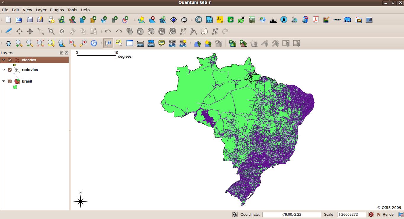
If I add three layers from my spatialite database and then try to identify a feature on one of them, the layer stops rendering and turning the layer on or off has no effect. See attached screenshot (note the cities layer is on but no point features are rendered.
Attachments (1)
Change History (9)
by , 14 years ago
| Attachment: | Screenshot.jpg added |
|---|
comment:1 by , 14 years ago
comment:2 by , 14 years ago
Hi,
I cannot confirm this bug on Ununtu 9.04 and qgis trunk compiled from source. Using the spatialite sample dataset.
comment:3 by , 14 years ago
| Priority: | critical: causes crash or data corruption → major: does not work as expected |
|---|
comment:5 by , 14 years ago
| Component: | Build/Install → Data Provider |
|---|
comment:6 by , 14 years ago
comment:8 by , 14 years ago
| Resolution: | → fixed |
|---|---|
| Status: | new → closed |
Hi Tim, the two (maybe) related tickets were closed. I'm still not able to replicate the problem. Please reopen if necessary.
Note:
See TracTickets
for help on using tickets.
Further clarification:
To replicate, try to identify a spatialite layer, then turn the layer off and then on again. It does not draw and it also fails to identify features properly.