| Version 2 (modified by , 13 years ago) ( diff ) |
|---|
Coverage Concepts and PostGIS
Introduction
This page attempts to provide a nontechnical introduction to basic coverage concepts and relate them to various tools and items provided by PostGIS. Nearly all users of PostGIS implicitly leverage coverage concepts, whether they realize it or not. Until the advent of PostGIS raster, vector coverages were the only possible use. Now, however, PostGIS contains the building blocks for raster coverages as well. There are similarities and differences between these two types of coverages; but in order to make sense of how they are related, the concepts cannot remain implicit.
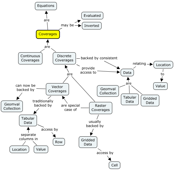
The following "concept map" gives an overview of this entire page. Starting in any box, you may read the text of the box, follow an outgoing arrow (reading the label on the way by), and read the contents of the second box. While this generally does not form complete sentences, it does provide a very visual summary of everything presented here.

Coverages are Equations
The most fundamental thing which is true of all coverages is that they act like equations. More precisely, they act like mathematical functions. They calculate, lookup, interpolate, or return one or more values given a location and/or a time. Like mathematical functions, they may be defined everywhere (for all values) or only in certain places (e.g., only over land). The area over which a coverage is defined is the domain of that coverage. The set of values a coverage may return is the range of that coverage. This terminology is borrowed from mathematical equations.
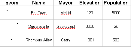
In general, the range of a coverage is not restricted to numbers. Given a location, for instance, a "nations" coverage may return a country name which contains that location. This is a common use. The range of a coverage is not necessarily restricted to "primitive" types either: it can even return another spatial type. This will become important later. The only constraint is that a coverage has the same range (or set of potential values from which an answer may be drawn) everywhere it is defined. If it returns a "County Name" and a "Population" in one place, it returns a "County Name" and a "Population" everywhere it is defined.
Finally, most (but not all) coverages may be inverted. Using the above example, users may ask for the set of all locations where "County Name" is "Mineral", or "Population" is 20000.
Querying a coverage for a set of values given a location is called evaluating the coverage. Querying for a (set of) location(s) given some criteria on the values is given the name evaluateInverse by ISO 19123. The specifics of how answers are generated for these queries depends on the type of coverage and how the "supporting data" are stored.
Continuous Coverages
Continuous coverages
Attachments (2)
- Cities.png (2.7 KB ) - added by 13 years ago.
- CoverageConcepts.png (68.4 KB ) - added by 13 years ago.
Download all attachments as: .zip