
Opened 18 years ago
Last modified 18 years ago
#1566 assigned defect
Rasters are resampled to bad colours when zooming out
| Reported by: | Owned by: | warmerdam | |
|---|---|---|---|
| Priority: | high | Milestone: | |
| Component: | MapServer CGI | Version: | 4.8 |
| Severity: | major | Keywords: | |
| Cc: |
Description
Here's a copy of the message posted to the user's list, with more information
below it:

~~~~~~~

I've just upgraded a site to MapServer 4.8beta2 from 4.4.1, using the
windows binary available at maptools.org/dl

I'm seeing an raster resampling problem.

When I zoom out, and a larger part of raster data sources are
resampled down to fit the map, it starts to resemble that old 256
colour limit in the mapserver 3.6 days with really wrong colours
overtaking the rasters ... and only affecting the raster layers, the
vector layers always draw fine.

I am using a 24bit output format.

The problem affects rasters layer by layer,  having multiple raster
layers turned on doesn't change how the individual rasters are
affected.

I didnt see this problem at all using MapServer 4.4.1.

I've looked at a few different raster layers, some are satellite
images, some are coloured geophysics images and all have the problem
in a similar fashion whether they are 24bit, 8bit (256 colour), or
8bit (120 colour).

The only difference is that the 120 colour raster, which had been down
sampled to display properly in mapserver 3.6, is not as badly
affected. In this case some of the colours end up resampled to match
my no-data offsite colour and just become transparent in the map, a
coincidence of where the offsite colour bin falls within this raster's
colour table I assume.

Is there a processing directive that will force resolution
downsampling without colour-matching the remaining pixels?

Here are examples of a good and bad map ... I've set the background
colour of the map to red to highlight the problem. The geophysics
layer really gets hacked up in the bad one, loosing a few colours.

Good map:
http://cariboo-gold.no-ip.info/IWA11342917155380.jpg

Bad map:
http://cariboo-gold.no-ip.info/IWA11342916912848.jpg

~~~~~~

More info:

I have found that the problem does not affect all rasters. They have come from
different sources however they have been handled in a similar manner with Corel
PhotoPaint10 for use with mapserver.  The problem is seen when using shp2img
4.8beta1 as well (from FWTools 1.0.0a8).

A simplified version of my mapfile can be downloaded here, it contains notes on
which raster layers work, and which dont, and two extents where the map is good
and bad:

http://cariboo-gold.no-ip.info/MS/mapserver/testIWA.map

The data for the layers in this mapfile can be downloaded by anonymous ftp here:

ftp://cariboo-gold.no-ip.info

Some of the data sources are quite large, upto 200mb ... you may want to
download welbarmag1.tif  and .tfw  first as this one is affected by the problem
and is only 13mb.

Thanks,
Ken Lord
Vancouver BC
Attachments (2)
Change History (13)
by , 18 years ago
Result of my test with shp2img on test.map on FWTools 1.0.0a7
comment:2 by , 18 years ago
That is strange about the map file link, The contents of my mapfile are shown
below.
Your result does appear to be fine. I used the same command when i tried it
with shp2img with FWTools 1.0.0a8.
If you visit cariboo-gold.no-ip.info and just zoom out a couple times, you will
see it happen there in the in the landsat image that loads from the start ...
brownish holes appear in the landsat, like the red holes in the example in the
previous posts.
The geophysics layer that you have tested is turned on by the first control
(Airbourne - Mag) in the 'Geophysics Layers' folder in the layer controls panel
(click the 'Layer Controls' on the top bar).
Here's my simplified map file:
####################
# The STATUS of the layers have been set to OFF, except for GPWELBARMAG, which
uses welbarmag1.tif and exhibits the problem.
###################
MAP
NAME IWA
STATUS ON
SIZE 550 550
#This extent is zoomed out enough to show the problem in the GPWELBARMAG layer.
EXTENT 580000 5865000 610000 5895000
#At this extent, the problem does not occur with the GPWELBARMAG layer.
#The LANDSAT7FC layer is affected at similar changes of scale.
#EXTENT 587000 5872000 603000 5888000
UNITS meters
SHAPEPATH "data/IWA/"
IMAGECOLOR 255 255 255 #0 0 0
IMAGETYPE jpeg
OUTPUTFORMAT
NAME jpeg
DRIVER "GD/JPEG"
MIMETYPE "image/jpeg"
IMAGEMODE RGB
EXTENSION "jpg"
FORMATOPTION "QUALITY=90"
END
FONTSET "fonts/fonts.txt"
SYMBOLSET "symbols/symbols.txt"
PROJECTION
"init=EPSG:26910"
END
TEMPLATEPATTERN "IWA"
WEB
#ERROR "../MS/mapserver/error.html"
EMPTY "../MS/mapserver/results/empty_results.html"
TEMPLATE void #"template.html"
HEADER "results/results_header.html"
MINSCALE 100
MAXSCALE 50000000
IMAGEPATH "C:/Inetpub/wwwroot/tmp/"
IMAGEURL "/tmp/"
LOG "C:/Inetpub/wwwroot/tmp/MS_LOG.txt"
METADATA
wms_title "Cariboo Gold Project"
wms_onlineresource "http://24.87.220.99/scripts/ms48b2/mapserv.exe?
map=c:/inetpub/wwwroot/ms/mapserver/testIWA.map&"
wms_srs "EPSG:26909 EPSG:26910 EPSG:26911 EPSG:4326 EPSG:4269 EPSG:3005"
END
END
SCALEBAR
IMAGECOLOR 255 255 255
LABEL
COLOR 0 0 0
SIZE medium
OUTLINECOLOR 255 255 255
END
SIZE 300 5
COLOR 255 255 255
BACKGROUNDCOLOR 0 0 0
OUTLINECOLOR 0 0 0
UNITS kilometers
INTERVALS 5
STATUS EMBED
TRANSPARENT ON
END
############
# This layer is NOT affected by the resampling problem
############
LAYER
NAME PROVINCE
STATUS OFF
TYPE RASTER
DATA "BC_DEM30B1.tif" #"Province1"
REQUIRES "![Global_LandSat7_WMS]"
OFFSITE 60 80 100
PROJECTION
"init=EPSG:26910"
END
METADATA
WMS_TITLE "580m Resolution Elevation DEM"
WMS_ABSTRACT "580m resolution DEM, BCGS datasource"
WMS_SRS "EPSG:26910"
END
END
############
# This layer is NOT affected by the resampling problem
############
LAYER
NAME Global_LandSat7_WMS
TYPE RASTER
STATUS OFF
CONNECTIONTYPE WMS
CONNECTION "http://wms.jpl.nasa.gov/wms.cgi?"
MAXSCALE 10000000
#MINSCALE 20000
METADATA
"wms_name" "global_mosaic"
"wms_srs" "EPSG:4326"
"wms_styles" "visual"
"wms_server_version" "1.1.1"
"wms_layers" "global_mosaic"
"wms_request" "GetMap"
"wms_format" "image/jpeg"
"wms_connectiontimeout" "30"
"wms_title" "global_mosaic_from_NASA_WMS"
END
END
############
# This layer IS affected by the resampling problem
############
LAYER
NAME LANDSAT7FC
TYPE RASTER
STATUS ON
DATA "LANDSAT7_15m_8bit_IWA.tif"
REQUIRES "![Global_LandSat7_WMS]"
OFFSITE 0 0 0
PROJECTION
"init=EPSG:26910"
END
METADATA
WMS_TITLE "LandSat7 15m Bands321"
WMS_ABSTRACT "LandSat7"
WMS_SRS "EPSG:26910"
END
END
############
# This layer is NOT affected by the resampling problem
############
LAYER
NAME ORTHO4
GROUP ORTHO
TYPE RASTER
STATUS OFF
DATA "iw4_8bit121.tif"
OFFSITE 255 255 255
PROJECTION
"init=EPSG:26910"
END
#MAXSCALE 3000
METADATA
WMS_TITLE "0.25m Orthophoto Mosaic. Flown by Eagle Mapping 2000, 4 of 6."
WMS_ABSTRACT "Ortho"
WMS_SRS "EPSG:26910"
END
END
############
# This layer IS affected by the resampling problem
############
LAYER
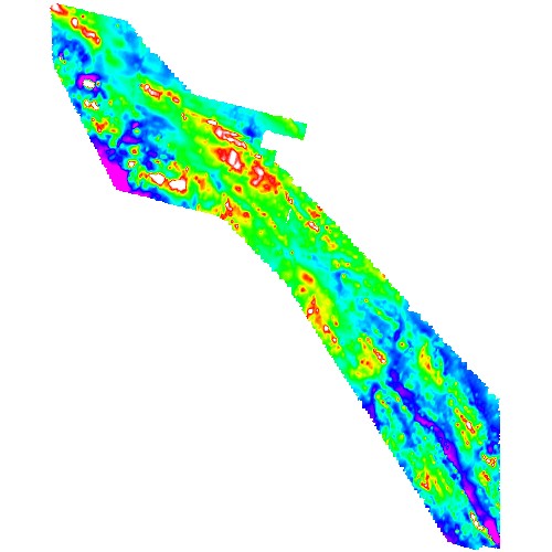
NAME GPWELBARMAG
TYPE RASTER
STATUS ON
DATA "WelbarMAG1.tif"
OFFSITE 0 0 0
PROJECTION
"init=EPSG:26910"
END
METADATA
WMS_TITLE "Regional - Airborne MAG"
WMS_ABSTRACT "No legend available, ~1995 Welbar Project, GoldCity
Industries"
WMS_SRS "EPSG:26910"
END
END
############
# This layer is NOT affected by the resampling problem
############
LAYER
NAME GPWELBARVD1
TYPE RASTER
STATUS OFF
DATA "WelbarVD1.tif"
OFFSITE 0 0 0
PROJECTION
"init=EPSG:26910"
END
METADATA
WMS_TITLE "Regional - Airborne VLF D1"
WMS_ABSTRACT "No legend available, ~1995 Welbar Project, GoldCity
Industries"
WMS_SRS "EPSG:26910"
END
END
############
# This layer is NOT affected by the resampling problem
############
LAYER
NAME GPWELBARVD2
TYPE RASTER
STATUS OFF
DATA "WelbarVLF2.tif"
OFFSITE 0 0 0
PROJECTION
"init=EPSG:26910"
END
METADATA
WMS_TITLE "Regional - Airborne VLF D2"
WMS_ABSTRACT "No legend available, ~1995 Welbar Project, GoldCity
Industries"
WMS_SRS "EPSG:26910"
END
END
END # Map File
comment:3 by , 18 years ago
Ken,

Can you boil things down to a minimum example demonstrating the problem?
comment:4 by , 18 years ago
OK, I'll try to make a simpler example at home tonight, for now try the
following link ... copy it into your browser if Bugzilla won't take you to it.
This example uses the same settings found in the map file posted above,
although in this case is the full map file for my website.

... It's set at a scale that shows the problem, zoom in once and you'll see a
good map.

http://cariboo-gold.no-ip.info/scripts/ms48b2/mapserv.exe?mode=browse&zoomdir=-
1&zoomsize=2&imgext=586844.825300+5873883.505170+602353.417828+5889392.097698&m
ap=c%3A%5CInetpub%5Cwwwroot%5CMS%5Cmapserver%
5CIWA.map&savequery=true&program=..%2F..%2Fscripts%2Fms48b2%
2Fmapserv.exe&map_web_template=IWA_html_template.html&map_web_imagepath=c%3A%
5CInetpub%5Cwwwroot%5Ctmp%5C&map_web_imageurl=%2Ftmp%
2F&elerank=au_rank&mapext=586844.825300+5873883.505170+602353.417828+5889392.09
7698&template=%5Btemplate%5D&INPUT_TYPE=&INPUT_COORD=&lastButtonSelected=%
5BlastButtonSelected%5D&layer=GPWELBARMAG&layer=LANDSAT7FC&img.x=243&img.y=267

Thanks,
Ken
comment:5 by , 18 years ago
Bugzilla is not so friendly to links ...

I've emailed the link directly to you.

Ken
comment:6 by , 18 years ago
Ken provides the following really long url to demonstrate
the problem:

http://cariboo-gold.no-ip.info/scripts/ms48b2/mapserv.exe?mode=browse&zoomdir=-1&zoomsize=2&imgext=586844.825300+5873883.505170+602353.417828+5889392.097698&map=c%3A%5CInetpub%5Cwwwroot%5CMS%5Cmapserver%5CIWA.map&savequery=true&program=..%2F..%2Fscripts%2Fms48b2%2Fmapserv.exe&map_web_template=IWA_html_template.html&map_web_imagepath=c%3A%5CInetpub%5Cwwwroot%5Ctmp%5C&map_web_imageurl=%2Ftmp%2F&elerank=au_rank&mapext=586844.825300+5873883.505170+602353.417828+5889392.097698&template=%5Btemplate%5D&INPUT_TYPE=&INPUT_COORD=&lastButtonSelected=%5BlastButtonSelected%5D&layer=GPWELBARMAG&layer=LANDSAT7FC&img.x=243&img.y=267

From this the problem would appear to be some error in offsite processing with
quite a few data values all getting treated as offsite (or at least transparent
after some fashion).
comment:7 by , 18 years ago
Ken,

I downloaded FWTools 1.0.0a8 and tested with it against roughly your map
with just the welbarmag1.tif data available and your url.  I have zipped
up the files I used (running test.bat) into a zip file.  The zip file has
everything *except* the welbarmag1.tif and welbarmag1.tfw files which are
pretty big.  note that this test did not include the LANDSAT data so debug
messages report it was not found.  Perhaps it is required to reproduce the
problem, but I'm leery to download the 200MB+ just for a quick test.

Could you grab the zip file, test at your end, and then modify that
configuration till it demonstrates the error?  If I need to download the
landsat data then I'll do so, though if you find the problem can be reproduced
with a reduced resolution version then that would be better.
by , 18 years ago
| Attachment: | frank_test.zip added |
|---|
Zip with the mapfile, and test script I (Frank) tested with.
comment:8 by , 18 years ago
Frank, I've used your test setup from the zip file, with both the landsat7fc
layer and the welbarmag1 layer, using FWTools 1.0.0a8 (downloaded and
installed on this machine today)

From my work computer it is working fine, there's no problem with the images.

Tonight I'll try it again on my computer at home.

I'm not sure why they would output differently, both working through the
FWTools shell, windows XP, same map file etc.

My home computer does have mapserver 4.4.1 as well as 4.8b2, but the dll's are
isolated in their own folders.
comment:9 by , 18 years ago
I tried the test setup on my home computer, where the problem is.  Using the
files in the test setup there is no problem, the images generate properly.

I can't see a difference between the test files and my main map file, or
anywhere else for that matter so I don't know why it is acting differently.
Running the test files with my main mapfile appears to be ok as well,  But,
the website still has the problem.

I've further isolated the older version of mapserver on my system, renaming
the folder.

I copied the layers blocks out of the test map file into my main mapfile ...
even though they appear identical ... and oddly it did make some difference,
you have to zoom out a bit more for the problem to happen.

So I'm pretty confused, and don't know where we can go from here with the bug.
comment:10 by , 18 years ago
Ken,

I'm not sure what to do either.  Till you can reduce this to a case
I can reproduce with mapserv.exe, there isn't much I can do.
comment:11 by , 18 years ago
Ok, Thanks very much for your efforts on this, If I can wrangle any more clues
out of my system, I'll post them.
Note:
See TracTickets
for help on using tickets.