
Opened 19 years ago
Closed 14 years ago
#1433 closed defect (worksforme)
tiled index files sometimes display blank layers
| Reported by: | Owned by: | warmerdam | |
|---|---|---|---|
| Priority: | high | Milestone: | |
| Component: | OGR Support | Version: | 4.6 |
| Severity: | normal | Keywords: | |
| Cc: |
Description (last modified by )
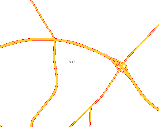
When using tiled index files with Mapinfo .TAB files as the vector data source,
data will sometimes be missing when the map extent crosses two or more tiles'
bounding boxes.  For instance, if the data is stored in a by-county basis,
displayig a map that straddles two county boundaries will display roads, water,
etc. in one county but not the other.  Panning the map so that its extent is
fully within the "empty" county will cause the roads and water to be
displayed.  This behavior was observed in CGI Mapserver version 4.4.1 and 4.6.
The tile index files were created using ogrtindex that is included in FWTools
version 0.9.8
Attachments (2)
Change History (14)
comment:2 by , 19 years ago
Get the file fdmaps.zip from:

ftp://192.70.205.30/pub/
username: ftpuser
password: fngsro

unzip it on your C: drive, it will creat the /fd_workspaces/ directory.

this URL shows the roads stopping at a county boundary:

http://localhost:8080/cgi-bin/mapserv.exe?
mode=map&map=/fd_workspaces/mapserver_demo_46.map&mapext=-
80.0594190150109+35.985454695987485+-80.01608164693057+36.02012459045174


this URL pans east from the above map, and the roads are showed correctly:

http://localhost:8080/cgi-bin/mapserv.exe?
mode=map&map=/fd_workspaces/mapserver_demo_46.map&mapext=-
80.02487848582449+35.985487037306946+-79.98154111774416+36.020156931771204

this URL zooms out from the original map, and the roads are shown correctly:

http://localhost:8080/cgi-bin/mapserv.exe?
mode=map&map=/fd_workspaces/mapserver_demo_46.map&mapext=-
80.06869857804348+35.979573367151794+-80.00369252592294+36.031578208848224
comment:3 by , 19 years ago
| Cc: | added; removed |
|---|---|
| Owner: | changed from to |
seizing this bug, and digging into it.
comment:4 by , 19 years ago
| Status: | new → assigned |
|---|
David,

I setup your example on Linux, adjusting the paths, fonts and symbols
accordingly and was unable to reproduce the problem you discuss with
the "CVS" version of MapServer and GDAL.

I also tried the test on win32 with FWTools0.9.8 (pre MapServer 4.6 release).

Could you indicate what version of GDAL you are using for MapServer?  Or
where you get your mapserver binaries so I can try and reproduce with them?
comment:5 by , 19 years ago
I got my windows binaries from the Hobu's Kitchen Sink site, I'm using the
standard build.  I found some gdal DLLs in my system32 directory, so I deleted
them and restarted my web server, but this did not help.
comment:6 by , 19 years ago
I have downloaded and tested with the "Standard Distribution" kitchen sink
build with "Standard Options".

I will attach the png file generated, for you to verify that this looks fine,
not broken as you were expecting.

The full tree I used to try and reproduce the problem is (temporarily) available
at:

  http://home.gdal.org/~warmerda/bug1433.zip

Unpack it under C:\ (NOTE!  It will dump in \FD_Workspace)

Go into the directory and run broken.bat to create broken_with_headers.png
which will include the mimetype header.  Remove the first two lines to
get a valid png file (ie. with emacs).  This zip includes the kitchen sink
executables I used.

At this point, since I can't seem to reproduce the error, there isn't anything
I can do.
by , 19 years ago
| Attachment: | bug1433.png added |
|---|
output of first case which is supposed to produce bug but does not
comment:7 by , 19 years ago
The output PNG in your zip file does not match the first test URL, but it does
match the second one.  The second and third URLs were examples showing the
roads displayed correctly, only the first one showed the error.
comment:8 by , 19 years ago
Doh!  Successfully reproduced now with CVS head of GDAL and MapServer.

I'm digging in deeper.
comment:9 by , 19 years ago
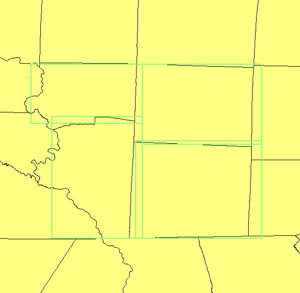
David,

The tileindex is in error, as shown by the view of the tileindex overlayed
on the county boundaries I will attach.

Could you give particulars of the ogrtindex command you used to generate
this tileindex? Was it done based on NCxxxxCB.TAB?
comment:10 by , 19 years ago
The county files were not indexed, only the roads.  The command I used:

C:\Program Files\FWTools0.9.8>ogrtindex -f "MapInfo File"
c:\fd_workspaces\roadbase\roads.tab c:\fd_workspaces\roadbase\roads\*.tab
comment:11 by , 19 years ago
The tileindex image makes it look like it's some kind of rounding or string
conversion problem on the longitudes, which are negative numbers.  Perhaps
using ceiling() and floor() is necessary?

I converted the TAB files to shapefiles using ogr2ogr, and then tileindexed the
roads.  The problem is NOT there when using shapefiles.
comment:12 by , 14 years ago
| Description: | modified (diff) |
|---|---|
| Resolution: | → worksforme |
| Status: | assigned → closed |
The data does not seem to be available any more and the problem does not seem to be with mapserver.
Closing.
Note:
See TracTickets
for help on using tickets.