
| Version 7 (modified by , 13 years ago) ( diff ) |
|---|
MapGuide RFC 110 - Profiling API enhancement
This page contains a change request (RFC) for the MapGuide Open Source project. More MapGuide RFCs can be found on the RFCs page.
Status
| RFC Template Version | (1.0) |
| Submission Date | February 23,2011 |
| Last Modified | Bruce Dechant, February 23,2011 |
| Author | Bruce Dechant |
| RFC Status | draft |
| Implementation Status | (pending) |
| Proposed Milestone | 2.3 |
| Assigned PSC guide(s) | Bruce Dechant |
| Voting History | |
| +1 | |
| +0 | |
| -0 | |
| -1 | |
| no vote |
Overview
This RFC adds some profiling APIs to MapGuide to help identify resources that need to be optimized and performance bottlenecks.
Motivation
Provide some profiling APIs that would generate an XML report that could be analyzed to help determine if any resources need to be optimized or if there are performance bottlenecks in the code that need to be looked at.
Proposed Solution
The following NEW APIs will be added to the offical API (PHP, Java and .Net):
MgByteReader* ProfileRenderMap(MgMap* map,
                               MgSelection* selection,
                               MgCoordinate* center,
                               double scale,
                               INT32 width,
                               INT32 height,
                               MgColor* backgroundColor,
                               CREFSTRING format,
                               bool bKeepSelection,
                               INT32 runs);
MgByteReader* ProfileRenderDynamicOverlay(MgMap* map,
                                          MgSelection* selection,
                                          MgRenderingOptions* options,
                                          INT32 runs);
MgByteReader* ProfileRenderMapLegend(MgMap* map,
                                     INT32 width,
                                     INT32 height,
                                     MgColor* backgroundColor,
                                     CREFSTRING format,
                                     INT32 runs);
MgByteReader* ProfileResource(MgResourceIdentifier* resource, INT32 runs)
Note: The results of the ProfileResource() API depends on the type of resource profiled.
The resource types supported by the ProfileResource() API are:
MapDefinition
LayerDefinition
FeatureSource
All of the above APIs will return an XML document that contains the profiling information gathered.
Information Gathered
The profiling information gathered will contain a collection of the items below depending on what is applicable.
MapDefinition:
Render Time
Initial scale ranges
Initial layers
Base layers
Coordinate System
Legend details
Data extents
LayerDefinition:
Render Time
Query Time
Number of Features
Feature Class
Properties
Data Extents
Filters
Scale Ranges
Theme Rules
Tooltip
URL
Watermark (If applicable)
FeatureSource:
Initial FDO Connection Time
Subsequent FDO Connection Time (Cache hits)
Initial DescribeSchema Time
Subsequent DescribeSchema Time (Cache hits)
Remaining cached FDO information
Joins
Calculations
Coordinate System of Data (Indicate if a CS transformation is needed. Only applies if we are profiling a map.)
XML Report / Schema
The generated XML report document will be defined by the following schema.
TBD XML document schema
Example of profiling a MapDefintion: (Work in progress)
Map Summary
  Layer(s) Summary
  Layer(s) Details
    Feature Source(s) Summary
    Feature Source(s) Details
Implications
None as these are new APIs.
Test Plan
Build/Run on Windows/Linux
Funding / Resources
Supplied by Autodesk
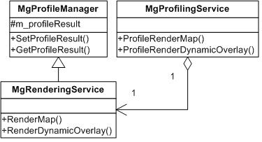
Attachments (2)
- Class Diagram.png (10.8 KB ) - added by 13 years ago.
-
ProfilingAPI_GUI_part1.patch
(88.0 KB
) - added by 13 years ago.
part of Profiling API UI
Download all attachments as: .zip