
| Version 9 (modified by , 8 years ago) ( diff ) |
|---|
GRASS GIS 7.2.0
Table of Contents
Binaries: http://grass.osgeo.org/download/software/#g72x
Releases
Stable Release
- tbd
Release Candidate 1 (RC1)
Release date: DD MMM 2016Announcement: https://grass.osgeo.org/news/XX/15/GRASS-GIS-7-2-0RC1-releasedChangelog: http://grass.osgeo.org/grass72/source/ChangeLog_7.2.0RC1.gzBinaries: http://grass.osgeo.org/download/software/#g72xSource code: http://grass.osgeo.org/grass72/source/grass-7.2.0RC1.tar.gz (md5sum)SVN Source Code Checkout 7.2.0RC1:svn checkout http://svn.osgeo.org/grass/grass/tags/release_YYYYMMDD_grass_7_2_4RC1
SVN Source Code
- Milestone: 7.2.0
- SVN Checkout latest 7.2 release branch (including yet unpublished bugfixes):
svn checkout http://svn.osgeo.org/grass/grass/branches/releasebranch_7_2
Overview of changes
A series of stability fixes, manual improvements and a few language translations have been added.
The GRASS GIS 7.2.0RC1 release provides more than XXX fixes and improvements with respect to GRASS GIS 7.2.0.
New modules
- G72:d.frame - Manages display frames on the user's graphics monitor.
- G72:r3.flow - Computes 3D flow lines and 3D flow accumulation.
- G72:r3.gradient - Computes gradient of a 3D raster map and outputs gradient components as three 3D raster maps.
- G72:t.rast.algebra - Apply temporal and spatial operations on space time raster datasets using temporal raster algebra.
- G72:t.rast3d.algebra - Apply temporal and spatial operations on space time 3D raster datasets using temporal 3D raster algebra.
- G72:t.rast.contour - Produces a space time vector dataset of specified contours from a space time raster dataset.
- G72:t.rast.to.vect - Converts a space time raster dataset into a space time vector dataset.
- G72:t.rast.what - Sample a space time raster dataset at specific vector point coordinates and write the output to stdout using different layouts.
- G72:t.vect.algebra - Apply temporal and spatial oeprations on space time vector datasets using temporal vector algebra.
- G72:v.decimate - Decimates a point cloud.
- G72:g.gui.datacatalog - The Data Catalog is a wxGUI component for browsing, modifying and managing GRASS maps.
- G72:d.legend.vect - Displays a vector legend in the active graphics frame.
Major module changes
- G72:r.in.lidar - base_raster option which allows for the conversion to LAS file Z values to height above ground using an existing elevation raster, -j option which allows the use of Z values for filtering of points, yet performs statistical analysis on the intensity values
- ...
Minor module changes
- ...
GUI changes
- ...
PyGRASS changes
- pygrass: ...
Library changes
- libraster: support for new raster data compression methods: NONE, ZLIB, LZ4, BZIP2. Overview:
- Raster map compression set by
export GRASS_COMPRESSOR=XXX, with XXX beNONE(uncompressed)RLE(generic Run-Length Encoding of single bytes)ZLIB(DEFLATE, good speed and compression)- with zlib compression levels (
export GRASS_ZLIB_LEVEL=X): -1..9 (-1 is default which is level 6) - Notes: ZLIB level = 0 tells ZLIB to copy the data as-is from source to destination. In case of CELL maps, the rasterlib itself will then still trim high zero bytes with trim_bytes() which can already reduce the data size considerably, but ZLIB will not compress the data.
- with zlib compression levels (
LZ4(fastest, low compression)BZIP2(slowest, high compression)
- NULL file compression: At time it must be explicitly turned on with
export GRASS_COMPRESS_NULLS=1
- Raster map compression set by
Map projection changes
- ...
Portability changes
- ...
MS Windows
- ...
Manual pages
Message translation updates
- ...
Closed tickets
Closed bugs since the last release
- #1096
- wxModeler: r.mapcalc action should allow to insert maps
- #1584
- error in r.walk help page
- #1672
- gcpmanager fails to list source mapsets if non-ascii characters in grass data dir path
- #2133
- g.parser does call the form.py with full path
- #2205
- Unicode unequal comparison in location wizard when title contains non-ascii letters
- #2239
- GRASS 7: v.to.rast -d produces empty raster when used on areas
- #2255
- g.mlist warnings for layers found in other mapsets
- #2261
- failed pygrass doctest
- #2298
- r.stream.order hack= generates order 1 single pixels
- #2304
- Problems with add category to all features workflow
- #2311
- PyGRASS points read from map are always 2D although they have z coordinate
- #2312
- browse button in import vector/raster wrapper for v.in.ogr and r.in.gdal crashes entire GUI
- #2318
- G7: t.* modules unclear -s flag
- #2327
- r.diversity = Illegal areas disposition
- #2339
- wxGUI.Nviz flickering
- #2343
- GRASS 7: "inf" values break insert statements in v.rast.stats
- #2357
- r3.info segfaults or reports incorrect values on Windows
- #2359
- r.stream.distance with a large map
- #2364
- Error in gunittest get_svn_info()
- #2365
- gunittest test local input file failure
- #2380
- d.legend "use" argument makes legend disappear
- #2381
- lighting/shading for vector objects backward in nviz
- #2385
- v.in.ogr doesn't use information from dblogin file about external PostgreSQL server
- #2410
- Python ScriptError
- #2416
- t.vect.export using no compression argument results in creation of an archive
- #2423
- r.series.interp missing in wxGUI menu
- #2439
- g.gui.iclass crashes
- #2442
- np.float128 does not always exist
- #2443
- r.in.srtm.region add-on updates for 7.1svn
- #2445
- r.mask -r removal not working in GRASS 7.1 svn r.62210
- #2472
- v.in.lidar gives negative point count on large las files
- #2479
- query raster/vector map(s) does not work with vector layers
- #2498
- yet another problem with GUI toolbox menu
- #2504
- Dotted line guiding digitization tool disappeared
- #2559
- g.gui.metadata not functioning
- #2574
- v.surf.icw - not working with the last version of grass7
- #2575
- i.segment threshold error message should be updated
- #2644
- osx - wxpython 3 64 bit - v.digit gui freeze when digitizing new vector
- #2645
- mac OSX - wxpython 3 (64 bit) profile surface map fails to start
- #2646
- mac OSX - wxpython 3 (64 bit) create histogram of raster map fails to start
- #2647
- mac OSX - wxpython 3 (64 bit) - ps.map fails to generate map preiew
- #2650
- v.in.ascii - dropdown menu - gui components doesn't get update
- #2671
- r.surf.idw won't make interpolation
- #2677
- mapswipe add raster map doesn't work with wxPython 3
- #2680
- d.mon: input file has incorrect dimensions
- #2687
- r.info picks map from current Mapset instead of PERMANENT
- #2691
- Rendering failed: Error reading PPM file
- #2694
- rendering command layer and adding 3d raster layer broken
- #2697
- data catalog does not show all raster layers, while showing some non-existing
- #2712
- WARNING: Unable to rename null file
- #2713
- GUI hangs when adding vector map from cli
- #2731
- t.rast.aggregate: ValueError: too many values to unpack
- #2741
- d.to.rast fails
- #2743
- v.net.steiner core dump
- #2746
- g.gui.vdigit fails to start with "PyAssertionError: C++ assertion "GetEventHandler() == this" failed at ../src/common/wincmn.cpp(478) in ~wxWindowBase(): any pushed event handlers must have been removed"
- #2758
- i.gensigset error G_calloc: unable to allocate 115671215 * 8 bytes of memory at lib/imagery/sigset.c:24
- #2765
- added "_1" to attribute table's name when working with v.overlay
- #2771
- r.in.lidar gives error for multiple pass processing
- #2778
- v.rast.stats: ERROR: Input window changed while maps are open for read.
- #2794
- Manual: Overly long description lines
- #2813
- wxplot tools fails with wxPython 3
- #2843
- g.gui fails to import set_gui_path
- #2869
- Default locale not found
- #2871
- lib/iostream/mm.cpp:Fails to build with GCC 6: declaration of ... has a different exception specifier
- #2879
- grass.script.array cannot read raster on Windows
- #2888
- r.external wizzard shows "projection match: no" although location was created by one of the dataset
- #2899
- d.histogram launched from map display toolbar doesn't work
- #2920
- "query raster/vector map(s)" tool does not work for raster maps
- #2928
- query tool does not work in wx display
- #2932
- z values read instead of intensity in r.in.lidar
- #2943
- Absolute path in TGIS connection can make db inaccessible in a (mixed) multi-user environment
- #2945
- MD5sum for WinGRASS-7.1.svn-r67975-87-Setup-x86_64.exe does not match md5sum file
- #2960
- db.login port parameter
- #2985
- Patch for spelling errors
- #2997
- python editor refuses to run script with UI after closing GUI dialog
- #3000
- i.gensig overwrites signature file without warning
- #3010
- PyGRASS fails to write vector map with attributes
- #3011
- OSGeo4W-winGRASS71 r68376: starting wxgui fails
- #3020
- Make N with arrow optional in d.barscale styles
- #3022
- d.polar ends with ValueError: could not convert string to float: dimensions:
- #3035
- r.support sets wrong map title
- #3044
- d.northarrow: transparent color does not work
- #3058
- unexpected behavior/error message in r.diversity?
- #3094
- wxGUI: error when profiling a raster map
- #3098
- problems with legend with categorical data and smooth gradient option
- #3106
- Transparent legend background does not work with categorical legend
- #3118
- Some modules fail to compile
- #3121
- d.barscale and northarrow positioning problem when off-screen rendering
- #3123
- d.legend.vect: wrong handling of spaces in legend_label
- #3126
- d.vect: Accents in legend_label cause encoding error
- #3131
- d.legend.vect workspace file flag problem
- #3132
- d.mon + d.vect: ERROR: Option <map> does not accept multiple answers
- #3152
- g.gui.animation issues with stvds and list of vector maps
- #3158
- r.watershed: PredictorSetup:Horizontal differencing "Predictor" not supported with 64-bit samples
- #3161
- different results by v.in.ogr --ui and vector import wizzard (data shift)
- #3168
- Behavior of t.register when r.timestamp was used
- #3172
- v.what: does not take into account layer information
- #3175
- g.gui.tplot AttributeError: 'module' object has no attribute 'EVT_COMBOBOX_CLOSEUP'
- #3181
- i.segment watershed method available but not implemented
- #3184
- v.vect.stats: errors in counts and statistics
- #3185
- Maps display differently 7.0.x vs 7.2.svn and 7.3.svn
- #3196
- workspace - layers are in inverted order after loading saved workspace file
- #3201
- wxGUI nviz: resolution settings widget broken in wxPython 3
- #3207
- Create histogram of raster map fails
- #3208
- Create bivariare scatterplot of raster maps fails
- #3212
- r.in.wms crashes if server does not exist
- #3213
- v.net.iso - Segmentation fault
- #3214
- t.rast.mapcalc: TypeError: object of type 'NoneType' has no len()
Closed wishes since the last release
- #947
- g.version: new flag for citation info
- #1113
- layertree to be compatible with DataCatalog
- #1203
- explain command mapping to wxGUI menus
- #1592
- GRASSCatalog
- #2293
- MapSwipe query maps
- #2326
- Command functions in grass.script.core miss a correct error reporting
- #2331
- parallelize r.horizon
- #2332
- change r.horizon output names from "angle index" to "angle"
- #2349
- CELL raster format: make ZLIB level 3 standard compression instead of RLE
- #2353
- v.univar says type not supported instead of column does not exist
- #2355
- g.mlist add parameter to check region
- #2408
- Force reading of VAR and GISRC files in libgis
- #2458
- testsuite: cosmetics for percentage output
- #2484
- store map elements in workspace file
- #2486
- add parameter for transformation of input data to v.in.ogr/r.in.gdal
- #2507
- r.in.gdal accepts multiple bands in band option
- #2535
- Enhancement request - i.segment handle large images above 2 billion pixels
- #2563
- r.grow.distance: define max distance
- #2579
- Specify command to be exectued as parameter of grass command
- #2592
- r.mapcalc: add -l flag
- #2611
- add stream power index to GRASS GIS
- #2632
- option in context menu to export vector attribute table
- #2638
- r.to.vect: ignore Null cells
- #2651
- Increase maximum number of vector points available
- #2663
- Add test for r.watershed module
- #2668
- "Browse" button v.external
- #2714
- wish: logarithmic legend for raster maps
- #2716
- availability of r.in.lidar and v.in.lidar without compiling
- #2721
- t.rast.what: allow stdin and add to GRASS 7.0
- #2864
- Add link to source code in the documentation pages.
- #2866
- Let r.import specify "title"
- #2937
- First r.grow.distance test
- #2965
- r.neighbors explain count in manual
- #3013
- support background and border for d.legend
- #3014
- Add ticks to continuous raster legend
- #3015
- Add legend title
- #3016
- Add option to set scalebar length
- #3018
- Specify custom label for d.northarrow
- #3019
- Add other existing symbols to d.northarrow
- #3026
- correction and enhancement of r.in.lidar description
- #3031
- Rotate symbol for north arrow in d.northarrow
- #3032
- Add images to the d.northarrow manual page
- #3043
- Change default color table
- #3056
- ]PATCH] r.patch: disable creation of support files
- #3078
- ps.map unicode support
- #3107
- d.correlate: add plotting of axes
- #3130
- r.out.gdal: add alpha channel support
Closed tasks since the last release
Attachments (5)
-
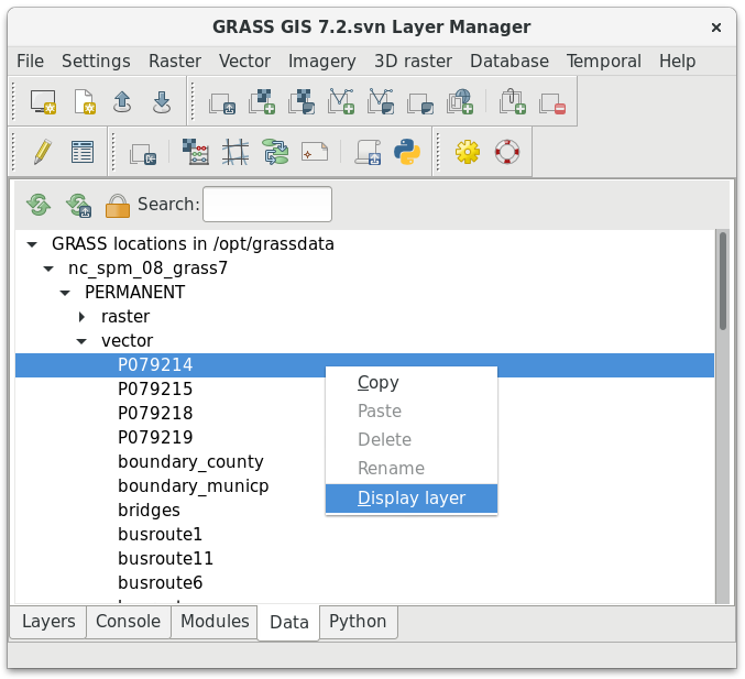
grass72-datacatalog.png
(58.2 KB
) - added by 8 years ago.
GRASS 7.2 Data Catalog
-
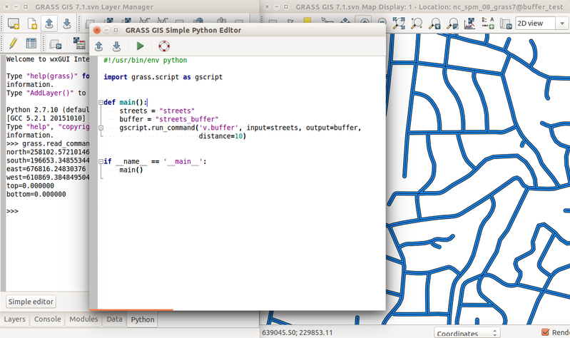
simple_python_editor_v_buffer.png
(234.7 KB
) - added by 7 years ago.
Simple Python editor in GRASS GIS wxGUI with v.buffer example
-
Screenshot_2016-11-16_23-18-08.png
(199.7 KB
) - added by 7 years ago.
screenshot for 72
-
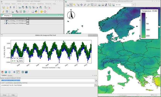
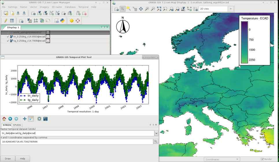
g_gui_tplot_screenshot.png
(315.1 KB
) - added by 7 years ago.
slightly bigger file
-
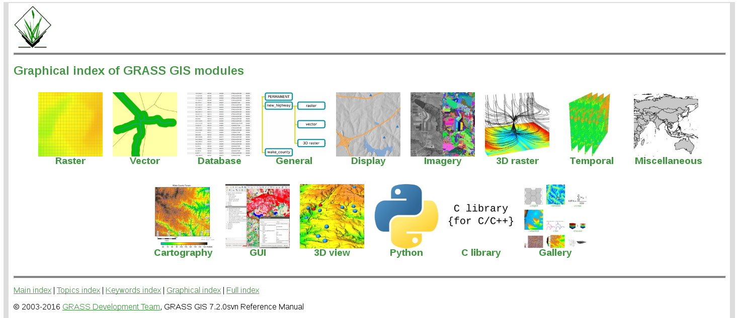
graphical_index.png
(462.8 KB
) - added by 7 years ago.
Graphical Index
Download all attachments as: .zip
Note:
See TracWiki
for help on using the wiki.