
| Version 54 (modified by , 13 years ago) ( diff ) |
|---|
List of new features in GRASS 7
Table of Contents
Graphical User Interface
- wxGUI improved (see here)
- Advanced GRASS command console
- Graphical modeler
- Improved wxNviz
- wxWidgets version of ximgview
- Tcl/Tk stuff dropped in favour of wxPython
Display modules
- old display architecture removed including related modules
- new display architecture based on CAIRO and wxPython
- ximgview: new
General modules
- g.cairocomp: new
- g.ppmtopng: new
- g.region: new flag to export region bounding box in WMS style
Image processing
- i.albedo: new
- i.biomass: new
- i.cca: supports now much more raster maps for canonical analyses (multi-spectral (8) -> hyper-spectral (thousands)), converted from Fortran style to C-style
- i.eb.eta: new
- i.eb.evapfr: new
- i.eb.h_SEBAL01: new
- i.eb.soilheatflux: new
- i.emissivity: new
- i.evapo.time_integration: new
- i.latlong: new
- i.modis.qc: new
- i.sunhours: new
- i.vi: new
- i.landsat.toar: new (from addons)
- i.landsat.acca: new (from addons)
Raster modules
- r.colors.out: new
- r.external.out: new
- r.cost faster by orders of magnitude (10x - 100x)
- r.neighbours: added new option to process only marked cells (i.e: selective elevation map improvement)
- r.walk faster by orders of magnitude (10x - 1000x)
- r.mapcalc: use pthreads for parsing
- r.resamp.filter: new - resamples raster map layers using an analytic kernel
- r.solute.transport: new; New module to compute the solute transport of groundwater in porous media using an implicit finite volume approach
- r.statistics2: new
- r.statistics3: new
- r.uslek: new
- r.usler: new
- r.watershed improved from G6.3 to G6.4 to G6.5 to G7: faster, less memory, floating point DEM support, MFD, clean stream extraction from MFD, segmented mode in G7 faster than in G6 by orders of magnitude.
- r.gwflow/r3.gwflow: Groundwater flow module update
- Large File Support (LFS) globally enabled
- r.pack, r.unpack: new
- r.in.lidar: new
Vector modules
- v.krige: new
- v.net.distance: new
- v.net.bridge: new
- v.net.spanningtree: new
- v.net.flow: new
- v.net.connectivity: new
- v.net.timetable: new
- v.net.components: new
- v.net.allpairs: new
- v.net.centrality: new
- v.in.ogr faster for polygon-import, cleaner output.
- v.out.ogr: reversed functionality of -c flag to preserve island by default.
- Large File Support (LFS) globally enabled
- v.in.lidar: new
3D raster modules
- r3.colors: new
Scripts
- All Bash scripts converted to Python
- Initialization scripts also based on Python
Libccmath
- new library for numerical functions
Libdbmi
- SQLite is now default database driver
- Added support for OFTDate, OFTTime, OFTDateTime
Libgis
- WPS support implemented in parser (c, c++, python, shell)
- Libraster separated out into own library
- Store metadata in $HOME/.grass7 directory
Libgmath
- Implementation of blas level 1,2 and 3 functions which are in use by all gmath solver, the gpde library and many modules.
- ATLAS wrapper for blas level 1 functions (level 2, and 3 are work in progress)
Libosgf
- WIP in OGSF - feature styling rewrite that will allow to assign custom (e.g. attribute based) style to points AND lines in NVIZ (might be extended to polys and any 3D vectors too).
Libraster
- Libraster separated out from libgis, refactored
Libvector
- Large File Support (LFS) added
- New spatial index, and spatial index kept in file: faster queries (>10x for large vectors), less memory for opening an existing vector
- Cleaning function 'break polygons' faster, less memory
- Cleaning function 'snap lines' faster and modifications are minimized: a vertex is snapped to the closest anchor vertex, not to the first anchor vertex found which might not be the closest anchor vertex.
- Simple Features API/OGR read/write support (ongoing)
Documentation
- Use Python to generate HTML docs
API
- Programmer's manual cleanup: http://grass.osgeo.org/programming7
- Improved Python API
- read/write GRASS rasters to/from NumPy
- libgis supports the automatic generation of a WPS 1.0.0 process description XML document for each module (c, c++, python, shell)
Portability
- All shell scripts have been rewritten in Python
- MS-Windows portability improved, new spawn functions (backported to 6.5 and 6.4), global LFS available by default
- MacOSX portability improved
Removed modules
Some modules present in GRASS 6 have been removed due to architecture changes or replacements:
- d.ask, d.colors, d.extend, d.extract, d.frame, d.mapgraph, d.measure, d.menu, d.mon, d.save, d.what.rast, d.what.vect, d.zoom (old display architecture decommissioned)
- d.histogram: integrated in wxGUI
- g.ask: use g.findfile
- g.setproj: use Location Wizard or 'g.proj -c'
- i.points: new graphical version in wxGUI
- i.class, i.ortho.photo, i.vpoints (need to be ported; old display architecture decommissioned)
- raster:
- r.average, r.median, r.sum merged into r.statistics, r.statistics2, r.statistics3
- r.bilinear merged into r.resamp.interp
- r.digit (needs to be ported; old display architecture decommissioned)
- r.le.patch, r.le.pixel, r.le.setup, r.le.trace: replaced by r.li.*
- r.terraflow.short (FP version is sufficient)
- v.digit (new wxPython digitizer)
Renamed options
- d.rast
- catlist and vallist options merged into new values option
- overlay flag inverted to new opaque flag
- r.fill.dir
- input -> elevation
- elevation -> depressionless
- r.basins.fill
- c_map -> cnetwork
- t_map -> tnetwork
- result -> output
- r.flow
- elevin -> elevation
- aspin -> aspect
- barin -> barrier
- flout -> flowline
- lgout -> flowpath
- dsout -> density
- r.li.*
- map -> input
- r.out.tiff
- -t flag -> -w
- r.topmodel
- belevation -> basin_elevation
- r.uslek
- usle_k -> output
- r.water.outlet
- drainage -> input
- basin -> output
- r.sim.sediment
- elevin -> elevation
- dxin -> dx
- dyin -> dy
- detin -> det
- tranin -> tran
- tauin -> tau
- manin -> man
- maninval -> man_value
- r.sim.water
- elevin -> elevation
- dxin -> dx
- dyin -> dy
- rain_val -> rain_value
- infil -> infil
- infil_val -> infil_value
- manin -> man
- manin_val -> man_value
- r.colors.stddev
- input -> map
- i.atcorr
- iimg -> input
- iscl -> range
- ialt -> elevation
- ivis -> visibility
- icnd -> parameters
- oimg -> output
- oscl -> rescale
- input -> map
- input -> map
- v.in.wfs
- wfs -> url
- input -> map
- v.rast.stats
- colprefix -> column_prefix
- input -> map
- g.region
- n -> north
- s -> south
- e -> east
- w -> west
- t -> top
- b -> bottom
- g.pnmcomp
- background -> bgcolor
- d.erase
- color -> bgcolor
- background -> bgcolor
- i.spectral
- raster -> input
- coord -> east_north
- background -> bgcolor
Attachments (10)
-
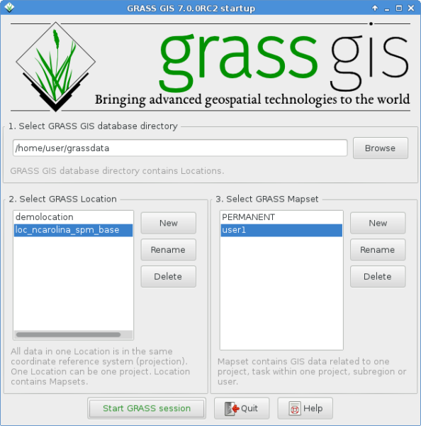
grass700RC2_startup.png
(89.6 KB
) - added by 9 years ago.
GRASS GIS 7.0.0 startup screen
-
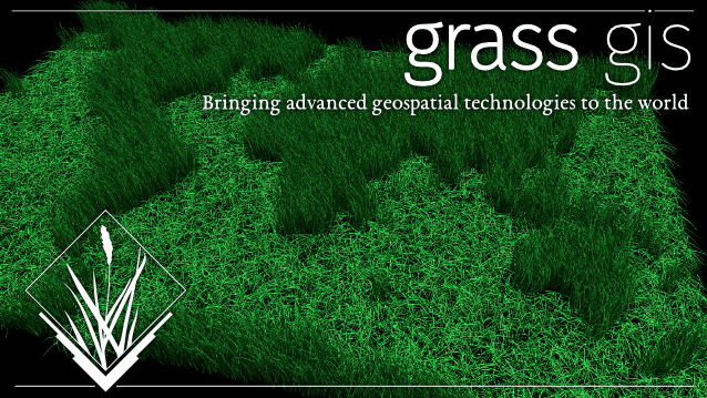
splash_screen.png
(186.8 KB
) - added by 9 years ago.
GRASS 7 splash screen
-
d_shade.jpg
(77.5 KB
) - added by 9 years ago.
Screenshot d.shade
-
i_col_enh_corr.jpg
(53.1 KB
) - added by 9 years ago.
Screenshot i.landsat.toar
-
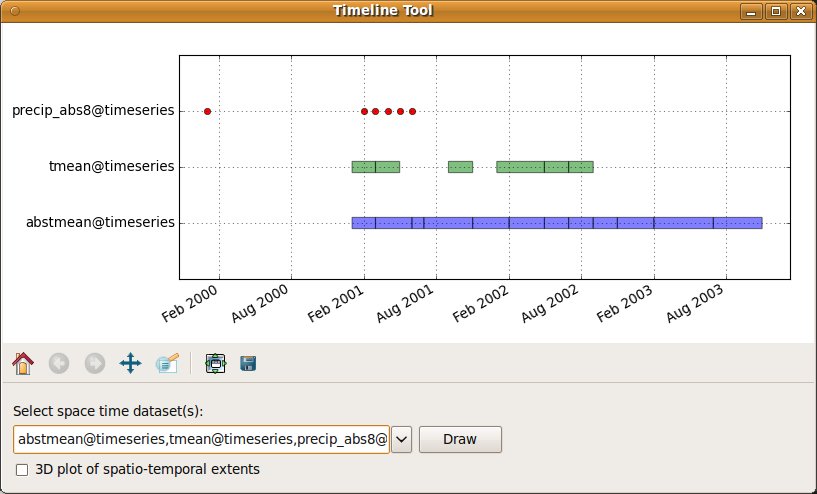
temporal_timeline_2D.jpg
(54.2 KB
) - added by 9 years ago.
Screenshot temporal framework t.*
-
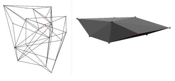
v_hull_3d.png
(47.9 KB
) - added by 9 years ago.
Screenshot v.hull 3D map
-
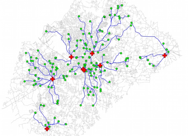
v_net_distance.jpg
(84.0 KB
) - added by 9 years ago.
Screenshot v.net.distance
-
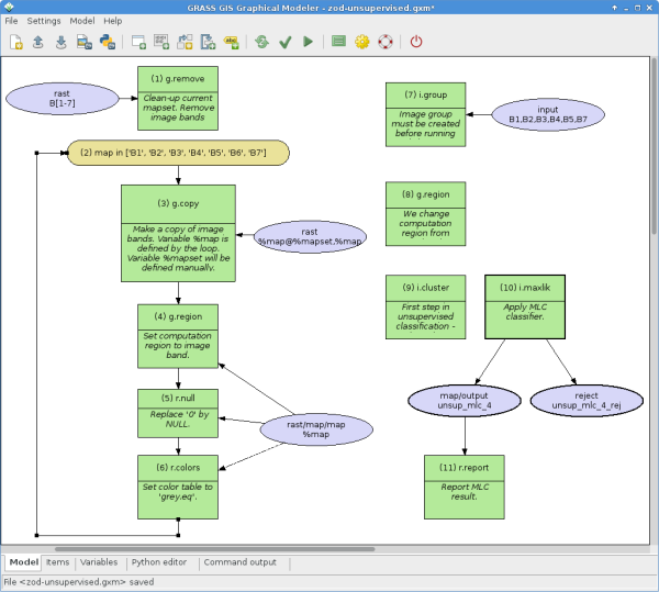
wxGUI_gmodeler.png
(65.6 KB
) - added by 9 years ago.
Screenshot wxGUI graphical modeler
-
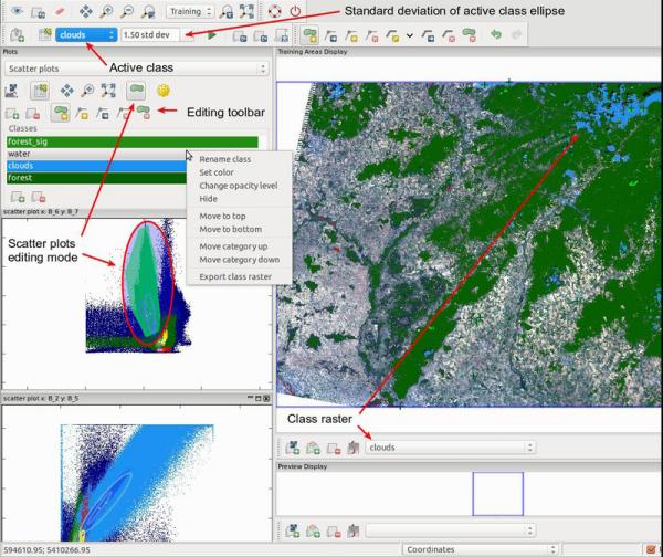
wxGUI_iscatt.jpg
(73.5 KB
) - added by 9 years ago.
Screenshot wxGUI scatterplot tool
-
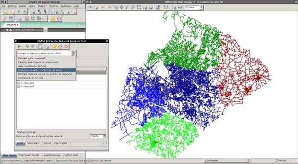
wxGUI_vnet.jpg
(43.6 KB
) - added by 9 years ago.
Screenshot wxGUI vector network analyst
Download all attachments as: .zip
Note:
See TracWiki
for help on using the wiki.