
Opened 10 years ago
Closed 10 years ago
#2279 closed defect (fixed)
wingrass71: rendering problems with raster layers automatically added by finished modules
| Reported by: | hellik | Owned by: | |
|---|---|---|---|
| Priority: | critical | Milestone: | 7.0.0 |
| Component: | wxGUI | Version: | svn-trunk |
| Keywords: | wingrass, rendering | Cc: | |
| CPU: | x86-64 | Platform: | MSWindows 7 |
Description
taken from the dev-ML
http://lists.osgeo.org/pipermail/grass-dev/2014-May/068633.html
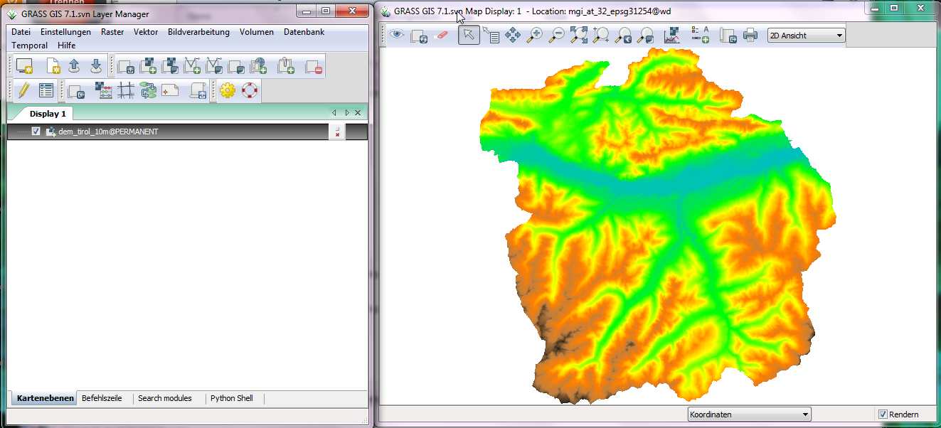
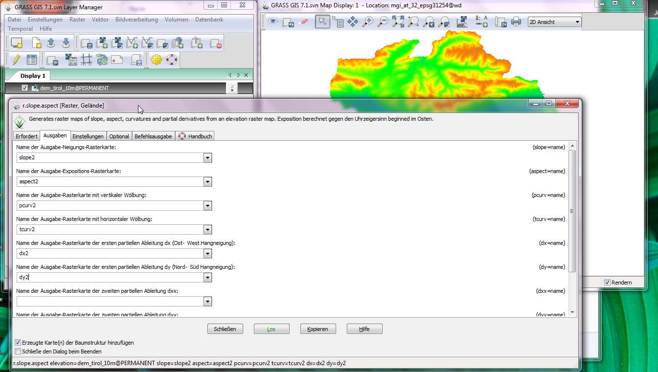
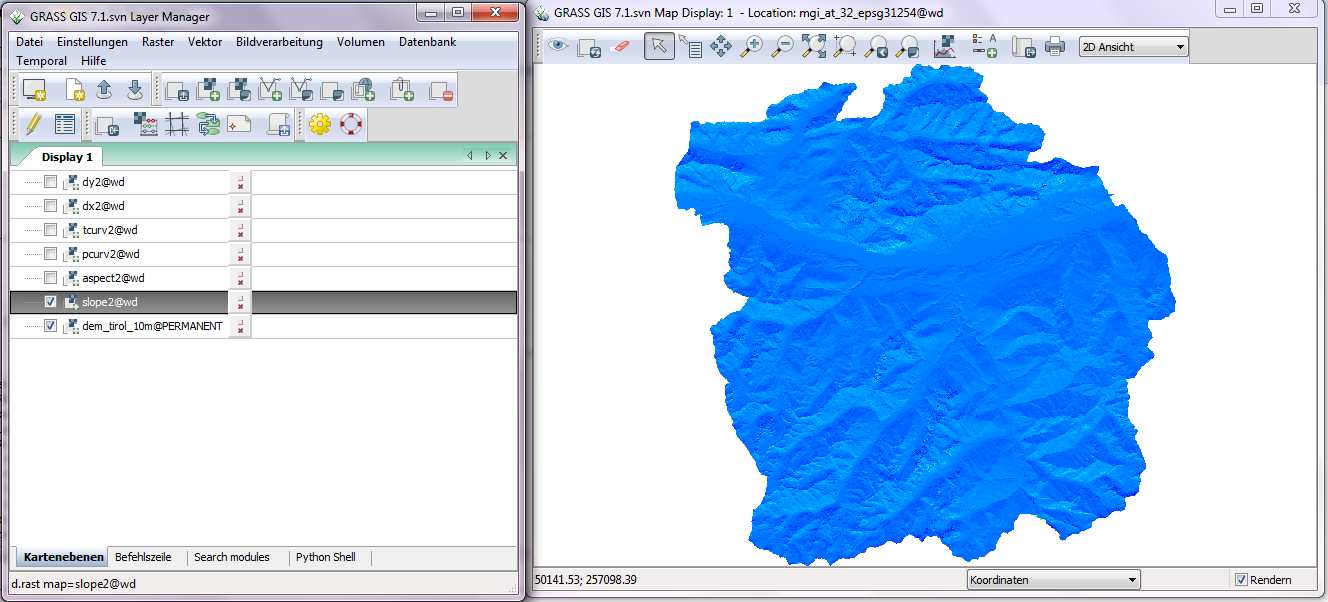
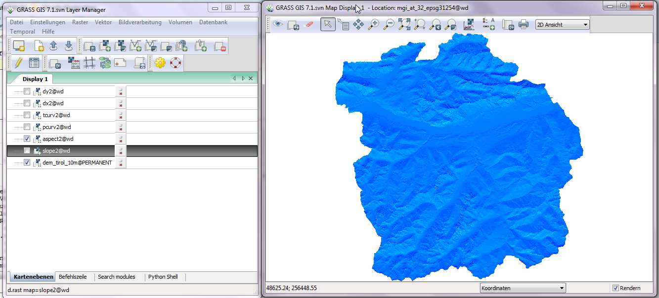
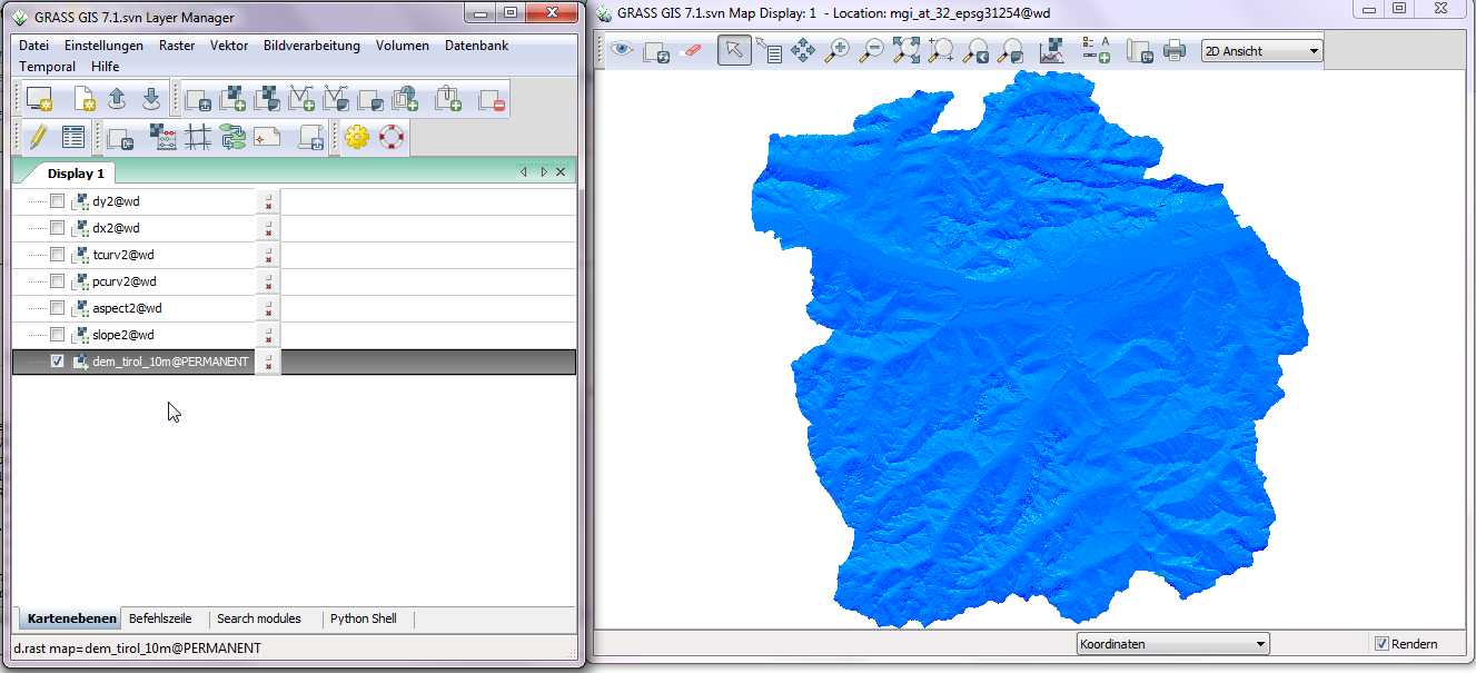
Hi,

tested with winGRASS71 by osgeo4w from today.

Rendering is activated in map display.

start e.g. r.slope.aspect in the wxgui, define more than one outputs.

Automatically adding the results to map display is activated.

run r.slope.aspect, after the output results are added to map display,
rendering has problems.

-erase map display erases display, but rendering again raster artefacts are
displayed
- change raster color, raster artefacts are displayed
-only after deleting from and readding result raster in map display,
rendering is correct.

anyone confirms this behavior?
Attachments (6)
Change History (18)
comment:1 by , 10 years ago
by , 10 years ago
| Attachment: | step1_elevetationraster_in_mapdisplay_trac.jpg added |
|---|
screenshot_step1
by , 10 years ago
| Attachment: | step2_runmodule_with_more_than_one_output_trac.jpg added |
|---|
screenshot_step2
by , 10 years ago
| Attachment: | step5_elevetationraster_in_mapdisplay_again_trac.jpg added |
|---|
screenshot_step5
by , 10 years ago
| Attachment: | step6display_resultraster1_after_new_load_in_mapdisplay_trac.jpg added |
|---|
screenshot_step6
comment:3 by , 10 years ago
| Summary: | wingrass71: rendering problems with raster layers automatically added by finished → wingrass71: rendering problems with raster layers automatically added by finished modules |
|---|
follow-up: 5 comment:4 by , 10 years ago
By artifacts you mean that you see different layers in map display and in the layer manager? I had no problems with this on Ubuntu, I will try it on Windows tomorrow.
follow-up: 6 comment:5 by , 10 years ago
Replying to annakrat:
By artifacts you mean that you see different layers in map display and in the layer manager? I had no problems with this on Ubuntu, I will try it on Windows tomorrow.
have a look at the screenshots. this blue raster layer is the artefact.
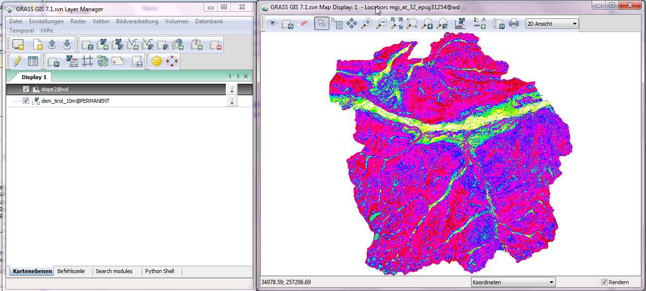
this remains/persists although you toggle on/ off the several resultat output maps automatically added to the map display by a finished module like r.slope.aspect. it remains also if you zoom in/out.
only manually removing and adding again to map display helps.
comment:6 by , 10 years ago
Replying to hellik:
Replying to annakrat:
By artifacts you mean that you see different layers in map display and in the layer manager? I had no problems with this on Ubuntu, I will try it on Windows tomorrow.
have a look at the screenshots. this blue raster layer is the artefact.
this remains/persists although you toggle on/ off the several resultat output maps automatically added to the map display by a finished module like r.slope.aspect. it remains also if you zoom in/out.
no, toggle no/off worked for me, otherwise I can confirm it. It basically doesn't show that the layer is checked when it is checked. I will try to look at it this week.
follow-up: 9 comment:8 by , 10 years ago
| Resolution: | → fixed |
|---|---|
| Status: | new → closed |
Replying to annakrat:
tested with
GRASS Version: 7.1.svn
GRASS SVN Revision: 60138
Erstellungsdatum: 2014-05-07
Build Platform: i686-pc-mingw32
GDAL/OGR: 1.11.0
PROJ.4: 4.8.0
GEOS: 3.4.2
SQLite: 3.7.17
Python: 2.7.4
wxPython: 2.8.12.1
Platform: Windows-7-6.1.7601-SP1 (OSGeo4W)
it works now, closing ticket.
thanks.
follow-up: 10 comment:9 by , 10 years ago
comment:10 by , 10 years ago
comment:11 by , 10 years ago
| Resolution: | fixed |
|---|---|
| Status: | closed → reopened |
tested with