
Opened 16 years ago
Closed 16 years ago
#157 closed enhancement (fixed)
Wxgrass: Set computational region to the minimum necessary to enclose map data extent
| Reported by: | epatton | Owned by: | martinl |
|---|---|---|---|
| Priority: | minor | Milestone: | 6.4.0 |
| Component: | wxGUI | Version: | svn-trunk |
| Keywords: | map display, region, zoom | Cc: | grass-dev@… |
| CPU: | Unspecified | Platform: | Unspecified |
Description
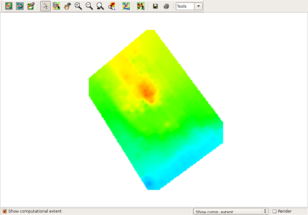
As far as I'm aware, this functionality doesn't yet exist in wxgrass: Set the computational region to that of the smallest possible box which will completely enclose all non-null cells in the selected raster map.
The reason for this request is that sometimes setting the computational region to that of a selected raster doesn't crop the region bounds to the edges of raster cells; it seems to depend on the display window geometry. See the attached screenshot - the computational region has been set to the shown raster, but the region bounds seem to conform to the display window bounds rather than the edge to existing data.
Attachments (1)
Change History (4)
by , 16 years ago
| Attachment: | Computational_Region.png added |
|---|
comment:1 by , 16 years ago
| Component: | Python → wxGUI |
|---|
comment:2 by , 16 years ago
| Cc: | added |
|---|---|
| CPU: | → Unspecified |
| Owner: | changed from to |
| Platform: | → Unspecified |
| Status: | new → assigned |
comment:3 by , 16 years ago
| Resolution: | → fixed |
|---|---|
| Status: | assigned → closed |
Note:
See TracTickets
for help on using tickets.
The computational regiion extents do not crop to the data limits