
#1174 closed defect (invalid)
Set zoom to/from computational region in display map does not work
| Reported by: | frankie | Owned by: | |
|---|---|---|---|
| Priority: | major | Milestone: | 6.4.1 |
| Component: | Tcl/Tk | Version: | 6.4.0 |
| Keywords: | Cc: | ||
| CPU: | All | Platform: | Linux |
Description
It is quite easy to check. Simply change resolution and try to zoom at the new level. It is ignored.
Attachments (2)
Change History (6)
comment:1 by , 14 years ago
follow-up: 4 comment:2 by , 14 years ago
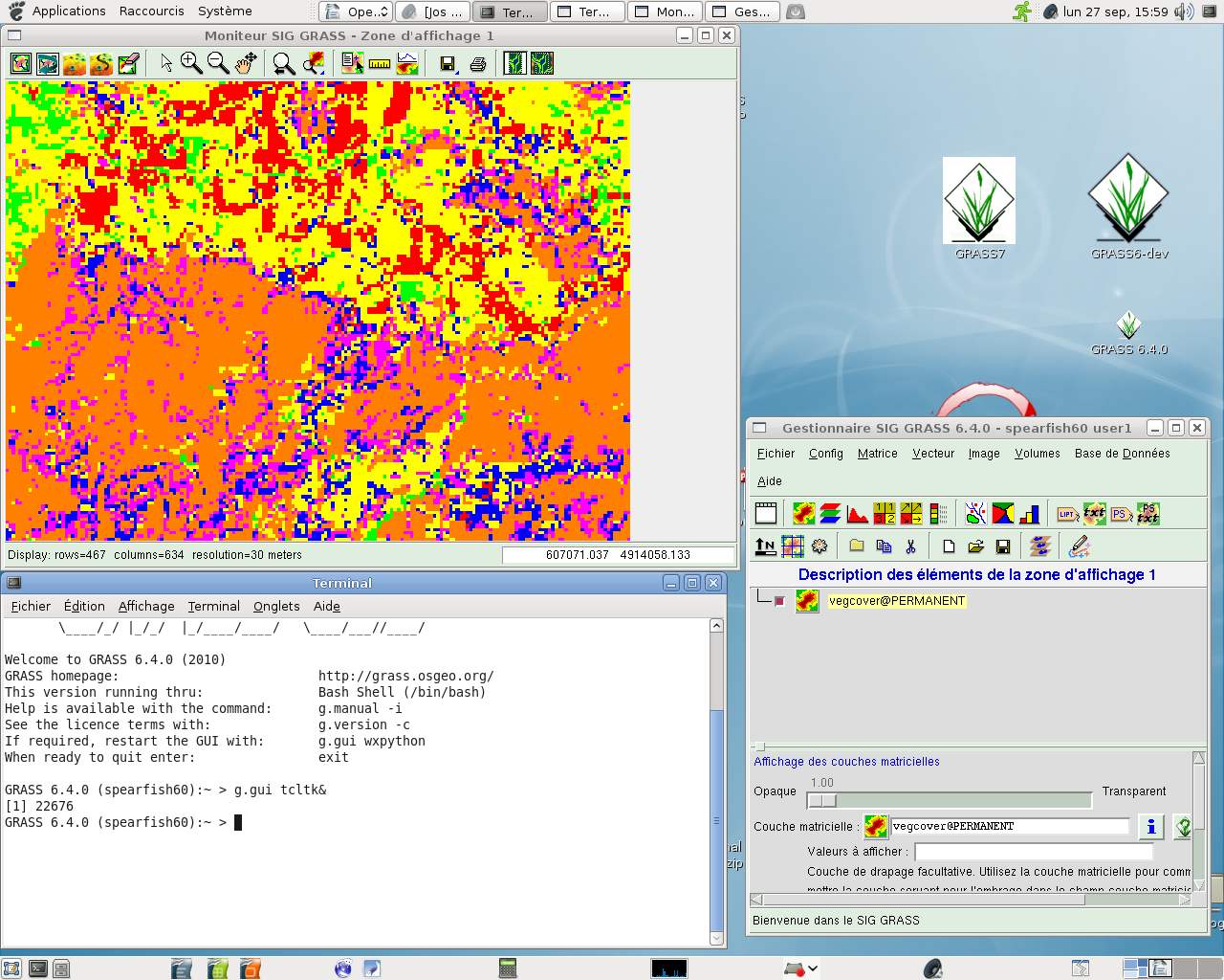
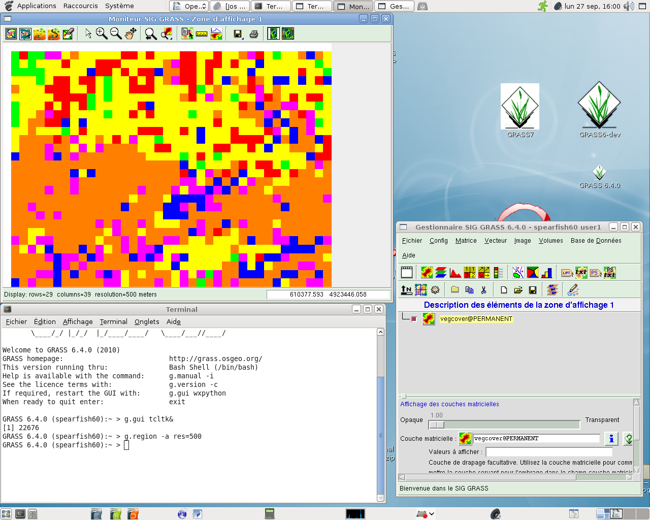
It is an error in gis.m. Let do what follows in spearfish:
- Load vegcover in layer tree.
- View it in display map at default res (30m)
- Change resolution to 500m by g.region (menu or command line)
- Then -> Zoom display to computational region. It does not change resolution in the display map. Up to 6.2 that was working.
I do not see any reason because one has to set computational region to match display, as you suggest, before that. Also note I'm using Tcl/Tk 8.4 which is the default in Debian sid/squeeze and 6.4.0 final.
comment:3 by , 14 years ago
| Resolution: | → invalid |
|---|---|
| Status: | new → closed |
By default gis.m is not affected by raster resolution in "explore" mode. Switdh gis.m to "strict" (Constrain map to region geometry) and it will use current computational resolution also for displaying data.
See gis.m help for more: http://grass.osgeo.org/grass64/manuals/html64_user/gis.m.html
In explore mode the region from the last zoom is expanded to fill the entire screen. The resolution is adjusted to match the screen resolution. Explore mode shows as much as possible.
comment:4 by , 14 years ago
Replying to frankie:
It is an error in gis.m. Let do what follows in spearfish:
- Load vegcover in layer tree.
- View it in display map at default res (30m)
- Change resolution to 500m by g.region (menu or command line)
- Then -> Zoom display to computational region. It does not change resolution in the display map. Up to 6.2 that was working.
I do not see any reason because one has to set computational region to match display, as you suggest, before that.
That was just for convenience to better see the difference... (having zoomed into the map).
Also note I'm using Tcl/Tk 8.4 which is the default in Debian sid/squeeze and 6.4.0 final.
Just to reinforce Maris' message: it works perfectly here (Debian lenny+lenny-backports, with tcl 8.4) when using the "Strict draw mode".
Screenshots attached to show it works. IMHO, this report can be closed, but I'll let Frankie do it if he agrees.
Moritz
Replying to frankie:
Doing
works for me. Are you sure you are using the constrained display mode ?
(Just to confirm: This is in the old tcltk GUI, or ?).
Moritz