| Version 5 (modified by , 12 years ago) ( diff ) |
|---|
WFS Data downloader
| Date | 2012/09/17 |
| Contact(s) | François Prunayre |
| Last edited | |
| Status | OnGoing |
| Assigned to release | 2.x |
| Resources | Available |
| Ticket # | #1072 |
| Github source | https://github.com/fxprunayre/core-geonetwork/tree/feature/download-wfs |
Proposal
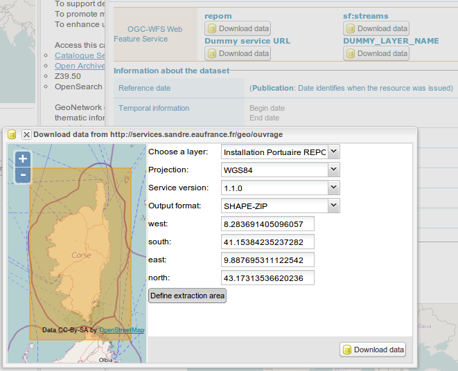
The WFS data downloader component is a simple widget which helps user downloading data from a WFS service. A form is displayed in order to select:
- a service (usually referenced in a metadata record)
- a layer (aka. feature type) (which may be referenced in a metadata record)
- an output format
- a projection
- an area of interest (a bounding box)

The service and layer can be use to initialize the component.
If the service is not available, a warning is displayed. If the layer is not published in the service, a warning is displayed.
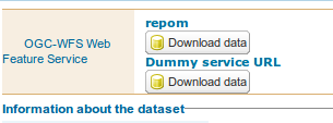
A "download data" button is added to the view mode of the metadata when a WFS is registered in the current record.

The area of interest could be the linked map extent or a map control added to draw the extraction area.
Proposal Type
- Type: Widget
- App: GeoNetwork
- Module: Client app
Voting history
Vote proposed by Francois on 2012/MM/DD, result was
- ?
Risks
- None.
Participants
- Francois Prunayre
Attachments (2)
- geonetwork-wfs-download.png (8.9 KB ) - added by 12 years ago.
- geonetwork-wfs-download-form.png (92.1 KB ) - added by 12 years ago.
Download all attachments as: .zip
Note:
See TracWiki
for help on using the wiki.