| Version 4 (modified by , 14 years ago) ( diff ) |
|---|
Add gco:CharacterString substitution group support and filter substitution element list
| Date | 2010/03/09 |
| Contact(s) | Francois |
| Last edited | Timestamp |
| Status | Draft |
| Assigned to release | 2.5 |
| Resources | GéoSource [BRGM] |
| Ticket |
Overview
Actually, GeoNetwork ignore all gco:CharacterString substitutes due to the following lines in schema-substitutes.xml :
<!-- override all the schema substitutes for gco:CharacterString
	- we don't want any-->
	<field name="gco:CharacterString">
	</field>
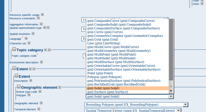
It also provide by default all substitutes of an element (see below). The proposal allows to filter these substitution lists.

The idea of the proposal is to be able for some elements to be able to use one or more substitutes of gco:CharacterString. Indeed, some substitute like gmx:FileName or gmx:Anchor could be useful in some situation.
The proposal enhancements are :
- Add configuration of allowed substitutes for an element
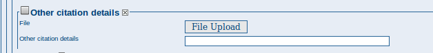
- Add support for gmx:FileName to be used to store a document in the catalogue (added by default to otherCitationDetails)
- Suggest only gml:Polygon for bounding polygon element.
Proposal Type
- Type: Editor
- App: GeoNetwork
- Module: Editor
Links
- Email discussions:
- IRC discussions:
Voting History
- Vote not yet proposed
Proposal details
Configuration
The file schema-substitutes.xml is modified to load gco:CharacterString on startup. GMX schema is imported in schema.xsd.
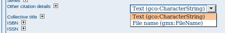
Configuration for gmd:otherCitationDetails
In the schema-suggestion.xml, otherCitationDetails allows use of CharacterString or FileName
<field name="gmd:otherCitationDetails">
  <suggest name="gco:CharacterString"/>
  <suggest name="gmx:FileName"/>
</field>
This will trigger the following in the editor :

Using the gmx:FileName, editors could upload document for the element using the upload panel :

Configuration for gmd:polygon
<field name="gmd:polygon">
  <suggest name="gml:Polygon"/>
</field>
will only suggest gmd:Polygon to editors. Furthermore, the bounding polygon extent map drawing tools only allows to draw polygons. This will make the editor more consistent.
Risks
Participants
- Francois
Attachments (4)
- substition-group-all.png (50.4 KB ) - added by 14 years ago.
- substition-group-otherCitationDetails.png (8.7 KB ) - added by 14 years ago.
- substition-group-otherCitationDetails-upload.png (5.3 KB ) - added by 14 years ago.
- substitute.patch (20.8 KB ) - added by 14 years ago.
Download all attachments as: .zip