Opened 11 years ago
Last modified 11 years ago
#1250 closed task
ISO19139 / Improve support for making metadata on maps — at Version 3
| Reported by: | fxp | Owned by: | |
|---|---|---|---|
| Priority: | minor | Milestone: | v2.10.0 RC0 |
| Component: | General | Version: | v2.9.0 |
| Keywords: | GEOPICARDIE | Cc: |
Description (last modified by )
The goal is to help user describing maps using ISO19139 providing:
- a template
- a quick search for maps using resource type criteria
- minor changes to the editor for maps (eg. suggestion for formats)
Changes:
- Index ISO19139 record describing maps with field "type" equal "map" when:
- gmd:hierarchyLevel/gmd:MD_ScopeCode/@codeListValue='dataset'
- gmd:identificationInfo/*/gmd:citation/gmd:CI_Citation/gmd:presentationForm/gmd:CI_PresentationFormCode/@codeListValue = 'mapDigital'
- gmd:distributionInfo/gmd:MD_Distribution/gmd:distributionFormat/gmd:MD_Format/gmd:name/gco:CharacterString[contains(., 'PDF') or contains(., 'PNG') or contains(., 'JPEG') or contains(., 'OGC:WMC') or contains(., 'OGC:OWS')])
- if distribution format is PDF : "type"="staticMap" is also added to the index
- if distribution format is OGC:WMC or OGC:OWS : "type"="interactiveMap" is added to the index
- Search form / Add search for map in resource type - based on autocompletion
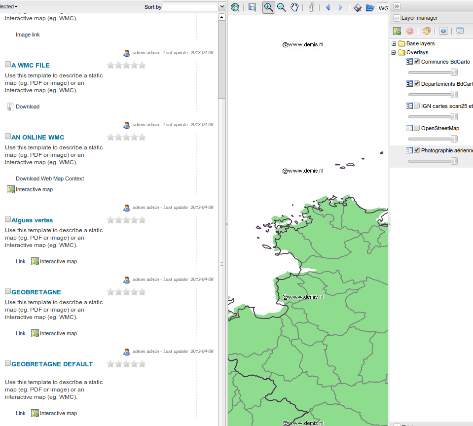
- Search results : For WMC, add "add to map" action to load the context in the mapviewer
- Templates:
- Add an ISO19139 template for maps
- Remove presentationForm from default raster and vector templates
- Editor / Add values for format suggestion
- PNG
- JPEG
- OGC:WMC
- OGC:OWS Context
Change History (4)
comment:1 by , 11 years ago
comment:2 by , 11 years ago
TIFF is already here (used for RASTER layer too). Why not for GIF and BMP.
The list of suggestion is simply defined in localization files and could be customized easily. It's sometimes better to not to have too many options (in case you use radio mode for suggestion for example - see http://trac.osgeo.org/geonetwork/ticket/1211).
comment:3 by , 11 years ago
| Description: | modified (diff) |
|---|
by , 11 years ago
| Attachment: | wmc-add-to-map.png added |
|---|
Note:
See TracTickets
for help on using tickets.
I guess I would add 'GIF', 'BMP' and 'TIFF' as well for the format values, even if they are not the most common types.