Opened 12 years ago
Closed 12 years ago
#4489 closed defect (invalid)
GRIB Origin/Coordinates wrong
| Reported by: | bcrosby | Owned by: | warmerdam |
|---|---|---|---|
| Priority: | normal | Milestone: | |
| Component: | default | Version: | 1.9.0 |
| Severity: | normal | Keywords: | grib |
| Cc: |
Description (last modified by )
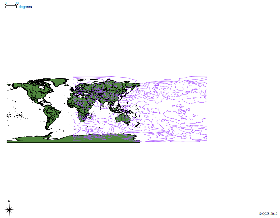
I'm not sure if this is the exact same problem as bug #2550, but I thought I would flag it regardless.
Using version 1.9 and processing a GRIB file results in the output being wrong in the sense that values >180 degrees should actually be <0 degrees.
The attached screenshot might illustrate this better. Generating she shapefile using the following command:
gdal_contour -b 25 -a temp -f "ESRI Shapefile" 2012020218-09.grib contours2.shp -i 5
So longitude values >180 should actually be on the "other side" of the map (I think, by subtracting 360 degrees).
Attachments (1)
Change History (3)
by , 12 years ago
| Attachment: | output.png added |
|---|
comment:1 by , 12 years ago
| Description: | modified (diff) |
|---|
you can download the grib file here.. http://www.blakecrosby.com/bug.grib
comment:2 by , 12 years ago
| Resolution: | → invalid |
|---|---|
| Status: | new → closed |
Blake,
I don't really agree. The file is georeferenced from longitude 0 to 360. I don't see any reason we ought to be arbitrarily rewrapping that to -180 to 180. It has not been our practice to do in GDAL/OGR except in very particular cases.
I think there is some facility in ogr2ogr to rewrap longitudes relative to the dateline. The -wrapdateline option of that utility might be of interest. Traditionally given rasters of this form I would cut them in two, fix the 180 to 360 to be -180 to 0 and then remosaic them to give me a raster in the -180 to 180 range.
screenshot