Opened 13 years ago
Last modified 11 years ago
#4254 closed defect
SOME USRP DATA ARE NOT DECODED CORRECTLY — at Version 4
| Reported by: | flovinopi | Owned by: | warmerdam |
|---|---|---|---|
| Priority: | highest | Milestone: | |
| Component: | GDAL_Raster | Version: | 1.8.1 |
| Severity: | blocker | Keywords: | |
| Cc: |
Description (last modified by )
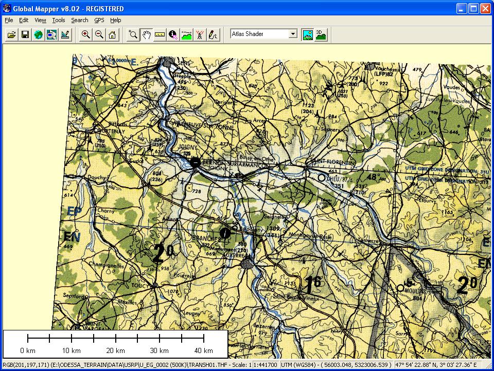
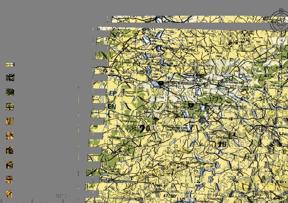
I use GDAL to read and display data in various formats (DTED, USRP, CADRG, USRP, GEOTIFF, …). It’s working fine but some USRP DATA cannot be decoded correctly. On attached files you can see a USRP data decoded with GDAL and Global mapper. There is a problem with the tiles !!!. If somebody can help me, I can send the USRP DATA on a http site (It’s about 130 MB) Philippe and you can join me with my mail : mauge.philippe.at.free.fr
Change History (6)
by , 13 years ago
| Attachment: | global_mapper.jpg added |
|---|
by , 13 years ago
| Attachment: | AC_with_gdal.jpg added |
|---|
comment:1 by , 13 years ago
| Description: | modified (diff) |
|---|
comment:2 by , 13 years ago
| Description: | modified (diff) |
|---|
comment:3 by , 13 years ago
| Description: | modified (diff) |
|---|
comment:4 by , 13 years ago
| Description: | modified (diff) |
|---|
Note:
See TracTickets
for help on using tickets.